Category:Maps of census statistical areas in Idaho
Jump to navigation
Jump to search
States of the United States: Alabama · Alaska · Arizona · Arkansas · California · Colorado · Connecticut · Delaware · Florida · Georgia · Idaho · Illinois · Indiana · Iowa · Kansas · Kentucky · Louisiana · Maine · Maryland · Massachusetts · Michigan · Minnesota · Mississippi · Missouri · Montana · Nebraska · Nevada · New Hampshire · New Jersey · New Mexico · New York · North Carolina · North Dakota · Ohio · Oklahoma · Oregon · Pennsylvania · Rhode Island · South Carolina · South Dakota · Tennessee · Texas · Utah · Vermont · Virginia · Washington · West Virginia · Wisconsin
Puerto Rico
Puerto Rico
Media in category "Maps of census statistical areas in Idaho"
The following 10 files are in this category, out of 10 total.
-
 Boise City-Nampa Metropolitan Area.png 335 × 503; 19 KB
-
 Burley Micropolitan Area.png 335 × 503; 19 KB
-
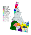 Idaho CBSAs 2020.png 3,648 × 4,131; 785 KB
-
 Idaho Falls Metropolitan Area and Idaho Falls-Blackfoot CSA.png 335 × 503; 19 KB
-
 Lewiston-Clarkston metropolitan area.svg 3,228 × 2,416; 498 KB
-
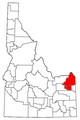
 Pocatello Metropolitan Area.png 335 × 503; 19 KB
-
 Pullman-Moscow Combined Statistical Area.svg 3,228 × 2,416; 498 KB
-
 Rexburg Micropolitan Area.png 335 × 503; 19 KB
-
 Spokane-Coeur d'Alene Combined Statistical Area.svg 3,228 × 2,416; 498 KB
-
 Twin Falls Micropolitan Area.png 335 × 503; 19 KB


