Category:Maps of Westchester County, New York
Jump to navigation
Jump to search
Counties of New York (state): Albany · Allegany · Bronx · Broome · Cattaraugus · Cayuga · Chautauqua · Chemung · Chenango · Clinton · Columbia · Cortland · Delaware · Dutchess · Erie · Essex · Franklin · Fulton · Genesee · Greene · Hamilton · Herkimer · Jefferson · Kings · Lewis · Livingston · Madison · Monroe · Montgomery · Nassau · New York · Niagara · Oneida · Onondaga · Ontario · Orange · Orleans · Oswego · Otsego · Putnam · Queens · Rensselaer · Richmond · Rockland · Saratoga · Schenectady · Schoharie · Schuyler · Seneca · St. Lawrence · Steuben · Suffolk · Sullivan · Tioga · Tompkins · Ulster · Warren · Washington · Wayne · Westchester · Wyoming · Yates
Wikimedia category | |||||
| Upload media | |||||
| Instance of | |||||
|---|---|---|---|---|---|
| Category combines topics | |||||
| Westchester County | |||||
county in New York, United States. Connector between New York City/Long Island and the rest of New York    | |||||
| Instance of | |||||
| Named after | |||||
| Location | New York | ||||
| Capital | |||||
| Head of government |
| ||||
| Inception |
| ||||
| Population |
| ||||
| Area |
| ||||
| Elevation above sea level |
| ||||
| Different from | |||||
| official website | |||||
 | |||||
Subcategories
This category has the following 6 subcategories, out of 6 total.
1
N
- Maps of New Rochelle, New York (32 F)
Media in category "Maps of Westchester County, New York"
The following 165 files are in this category, out of 165 total.
-

-
 1813 Yonkers, NY, map.jpg 708 × 418; 119 KB
-
 1867 Beers Map of Peekskill, Westchester, New York - Geographicus - Peekskill-beers-1867.jpg 5,000 × 3,720; 4.73 MB
-

-

-
 1867 Beers Map of Yonkers - Tibbetts Brook 01.jpg 3,000 × 3,703; 2.71 MB
-
 1867 Beers Map of Yonkers - Tibbetts Brook 02.jpg 1,701 × 2,575; 1.3 MB
-
 1867 Beers Map of Yonkers - Tibbetts Brook 03.jpg 1,701 × 2,575; 1.29 MB
-
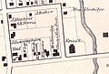 1867 Beers North Castle map Armonk closeup.jpg 516 × 349; 205 KB
-

-

-

-
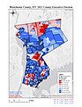 2021 Westchester County Executive Results - Map.jpg 1,275 × 1,650; 1.2 MB
-
 8 Rockland, Westchester counties.jpg 11,031 × 6,873; 13.42 MB
-
 Area code 914.png 400 × 465; 33 KB
-

-

-
 Bedford Road Historic District map.svg 749 × 361; 64 KB
-

-

-
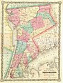 Colton-westchester-map.jpg 850 × 1,115; 297 KB
-
 Cropped Westchester map from March 18, 1928 N. Y. Times.png 2,714 × 3,279; 580 KB
-
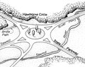 Hawthorne Circle.tif 2,998 × 2,361; 6.75 MB
-
 Hydrography of East Chester Creek, New York near Lockwood's - NARA - 122668536.jpg 12,975 × 6,900; 9.71 MB
-
 Index NYPL2055645.tiff 5,381 × 7,175, 2 pages; 110.73 MB
-
 Index NYPL2055949.tiff 5,394 × 7,192, 2 pages; 111.25 MB
-
 Map of New Rochelle, New York communities.png 942 × 1,789; 173 KB
-
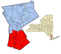
 Map of New York highlighting Westchester County.svg 6,599 × 5,030; 112 KB
-

-
 Map of Yonkers in 1813.png 862 × 644; 975 KB
-
 Map of Yonkers, 1868, Showing Lay-Out of Streets.png 700 × 407; 662 KB
-
 MountVernonNeighborhood.PNG 323 × 382; 18 KB
-
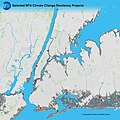 MTA Resiliency Projects Map (33441628404).jpg 1,910 × 1,910; 2.16 MB
-
 New Rochelle Containment Area March 2020.svg 835 × 741; 189 KB
-
 New York to Stratford page 2.jpg 954 × 1,453; 310 KB
-
 New York's 16th congressional district (new version) (since 2025).svg 1,600 × 1,069; 1.54 MB
-
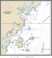
 NOAA Chart 12366 (2008).jpg 9,398 × 8,843; 12.63 MB
-
 Northern & Southern Westchester map.svg 512 × 454; 111 KB
-
 Northern-southern Westchester proposed boundary for NRHP lists.PNG 884 × 1,031; 198 KB
-
 NRHA 1.png 2,202 × 2,478; 2.02 MB
-
 NYStateMap.PNG 426 × 333; 23 KB
-
 NYStateMap2.PNG 422 × 332; 11 KB
-

-
 Parks and parkways in the Borough of the Bronx, New York City (1914) (14585419257).jpg 2,256 × 2,994; 1.17 MB
-
 Parks and parkways in the Borough of the Bronx, New York City (1914) (14771565552).jpg 2,216 × 2,970; 1.21 MB
-
 Peekskill NY.png 422 × 359; 6 KB
-
 Philipsburg Manor - Westchester and Bronx Counties 1778 edit.jpg 4,920 × 7,280; 25.28 MB
-
 Philipsburg Manor - Westchester and Bronx Counties 1778.jpg 4,920 × 7,280; 29.77 MB
-
 Philipsburg manor map.png 1,000 × 1,392; 525 KB
-

-

-

-
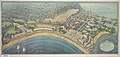 Playland and Rye Beach, New York in 1927.jpg 6,954 × 3,318; 6.11 MB
-
 Port Chester, New York (2675043207).jpg 2,000 × 1,576; 2.94 MB
-
 PoughkeepsieMap.tif 921 × 708; 2.49 MB
-
 Rockwood Hall map 01.jpg 1,922 × 1,539; 1.5 MB
-
 Rockwood Hall map 02.jpg 5,057 × 4,190; 9.75 MB
-

-
 New York State Senate District 34 (2012).png 2,740 × 2,480; 547 KB
-
 New York State Senate District 35 (2012).png 3,259 × 2,492; 398 KB
-
 New York State Senate District 36 (2012).png 2,740 × 2,480; 537 KB
-
 New York State Senate District 37 (2012).png 3,259 × 2,492; 399 KB
-
 New York State Senate District 38 (2012).png 3,259 × 2,492; 398 KB
-
 New York State Senate District 40 (2012).png 3,259 × 2,492; 400 KB
-
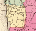 Sparta-Ossining-New-York-1868.png 971 × 830; 1.37 MB
-

-
 T21-2.jpg 12,902 × 8,476; 6.44 MB
-
 T47-2.jpg 13,142 × 9,371; 9.15 MB
-
 T48-2-li.jpg 11,417 × 8,548; 5.98 MB
-
 Town Hall, Salem Center, Westchester County, NY HABS NY,60-SAL,1- (sheet 0 of 7).tif 9,312 × 7,584; 191 KB
-

-
 Westchester County map.jpg 542 × 619; 215 KB
-
 Westchester County.) NYPL433697.tiff 3,985 × 5,010; 57.13 MB
-
 Westchester EmploymentSites.PNG 884 × 1,074; 182 KB
-
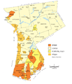
 Westchester Income Map2.PNG 3,307 × 3,659; 947 KB
-
 Westchester Minority Map.PNG 1,066 × 1,188; 140 KB
-
 Westchester Municipalities (updated).png 884 × 1,031; 208 KB
-
 Westchester Municipalities.PNG 884 × 1,031; 160 KB
-
 Westchester Parks.PNG 884 × 1,080; 258 KB
-
 Westchester Population.PNG 884 × 1,031; 236 KB
-
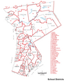 Westchester School Districts.PNG 884 × 1,074; 196 KB
-

-

-
 Westchester, V. 1, Double Page Plate No. 11 (Map bounded by New Rochelle, City of Mount Vernon, City of Yonkers) NYPL2055658.tiff 7,083 × 5,313, 2 pages; 107.93 MB
-

-

-

-

-
-

-

-

-

-
 Westchester, V. 1, Double Page Plate No. 20 (Map bounded by Main St., Davenports Neck, Meadow Lane, Woodlane Ave.) NYPL2055667.tiff 7,150 × 5,362, 2 pages; 109.95 MB
-

-
 Westchester, V. 1, Double Page Plate No. 22 (Map bounded by Mayflower Ave., Orchard Pl., Lockwood Ave., Pelham) NYPL2055669.tiff 7,063 × 5,297, 2 pages; 107.3 MB
-
 Westchester, V. 1, Double Page Plate No. 23 (Map bounded by Broadview Ave., Montgomery Pl., Mayflower Ave., Pelham) NYPL2055670.tiff 7,133 × 5,350, 2 pages; 109.45 MB
-
 Westchester, V. 1, Double Page Plate No. 24 (Map bounded by Titus Mill Pond, Long Island Sound, New Rochelle Creek) NYPL2055671.tiff 7,171 × 5,378, 2 pages; 110.6 MB
-

-

-
 Westchester, V. 1, Double Page Plate No. 27 (Map bounded by Mamaroneck, Overlook Circle, East Chester) NYPL2055674.tiff 7,099 × 5,324, 2 pages; 108.4 MB
-

-
 Westchester, V. 1, Double Page Plate No. 29 (Map bounded by Weaver St., Long Island Sound, City of New Rochelle) NYPL2055676.tiff 7,125 × 5,344, 2 pages; 109.2 MB
-

-

-

-

-
 Westchester, V. 1, Double Page Plate No. 33 (Map bounded by Long Island Sound, Milton Harbor, Oakhurst Ave.) NYPL2055680.tiff 7,163 × 5,372, 2 pages; 110.36 MB
-

-

-
 Westchester, V. 1, Double Page Plate No. 36 (Map bounded by Ridge St., Indian Rd., Byram River) NYPL2055683.tiff 7,159 × 5,369, 2 pages; 110.23 MB
-

-
 Westchester, V. 1, Double Page Plate No. 38 (Map bounded by State of Connecticut, White Plains, North Castle) NYPL2055685.tiff 7,062 × 5,296, 2 pages; 107.27 MB
-

-

-

-

-

-

-

-
 Westchester, V. 2, Double Page Plate No. 10 (Map bounded by Western Ave., Hastings, Hudson River, Irvington) NYPL2055961.tiff 7,111 × 5,334, 2 pages; 108.78 MB
-
 Westchester, V. 2, Double Page Plate No. 11 (Map bounded by Midland Ave., Dobbs Ferry, Hudson River, Tarry town) NYPL2055962.tiff 7,028 × 5,271, 2 pages; 106.25 MB
-
 Westchester, V. 2, Double Page Plate No. 12 (Map bounded by W. Sunnyside Ave., Hudson River, Benedfct Ave.) NYPL2055963.tiff 7,111 × 5,334, 2 pages; 108.78 MB
-

-
 Westchester, V. 2, Double Page Plate No. 14 (Map bounded by New Sprain Rd., Scarsdale, City of Yonkers) NYPL2055965.tiff 7,126 × 5,344, 2 pages; 109.22 MB
-
 Westchester, V. 2, Double Page Plate No. 15 (Map bounded by Secor Rd., Walworth Ave., Old Sprain Rd.) NYPL2055966.tiff 7,162 × 5,371, 2 pages; 110.32 MB
-
 Westchester, V. 2, Double Page Plate No. 16 (Map bounded by Village of Irvington, Landers Rd., Ashford Ave.) NYPL2055967.tiff 7,126 × 5,344, 2 pages; 109.22 MB
-
 Westchester, V. 2, Double Page Plate No. 17 (Map bounded by Arlington Ave., Village of White Plains) NYPL2055968.tiff 7,159 × 5,370, 2 pages; 110.25 MB
-
 Westchester, V. 2, Double Page Plate No. 18 (Map bounded by White Plains Rd., Landers Rd.) NYPL2055969.tiff 7,126 × 5,344, 2 pages; 109.22 MB
-

-

-

-

-
 Westchester, V. 2, Double Page Plate No. 22 (Map bounded by Highland Rd., Hudson River) NYPL2055973.tiff 7,121 × 5,341, 2 pages; 109.08 MB
-
 Westchester, V. 2, Double Page Plate No. 23 (Map bounded by Sleepy Hollow Rd., Hudson River, Long Hill Rd.) NYPL2055974.tiff 7,106 × 5,330, 2 pages; 108.63 MB
-
 Westchester, V. 2, Double Page Plate No. 24 (Map bounded by New Castle, Bronx River, Green Burg) NYPL2055975.tiff 7,131 × 5,349, 2 pages; 109.39 MB
-

-

-

-
 Westchester, V. 2, Double Page Plate No. 28 (Map bounded by Gates Ave., Lincoln Pl., Broad Ave., Hudson River) NYPL2055979.tiff 7,126 × 5,344, 2 pages; 109.22 MB
-
 Westchester, V. 2, Double Page Plate No. 29 (Map bounded by Town of New Castle, Hardscrable Rd., Hudson River) NYPL2055980.tiff 7,126 × 5,344, 2 pages; 109.22 MB
-
 Westchester, V. 2, Double Page Plate No. 3 (Map bounded by Nepperhan Ave., High St., Hudson River) NYPL2055954.tiff 7,197 × 5,398, 2 pages; 111.41 MB
-

-
 Westchester, V. 2, Double Page Plate No. 31 (Map bounded by Hudson River, Yorktown Rd., Croton River) NYPL2055982.tiff 7,126 × 5,344, 2 pages; 109.22 MB
-
 Westchester, V. 2, Double Page Plate No. 32 (Map bounded by Hudosn River, York Town, New Castle, Haverstraw Bay) NYPL2055983.tiff 7,011 × 5,258, 2 pages; 105.73 MB
-
 Westchester, V. 2, Double Page Plate No. 33 (Map bounded by Hudson River, Husted Ave., Boulevard, Maple Ave.) NYPL2055984.tiff 7,011 × 5,258, 2 pages; 105.73 MB
-
 Westchester, V. 2, Double Page Plate No. 34 (Map bounded by Putnam County, York Town, Hudson River) NYPL2055985.tiff 7,013 × 5,260, 2 pages; 105.8 MB
-

-
 Westchester, V. 2, Double Page Plate No. 36 (Map bounded by Part of the town of York Town, Sommers) NYPL2055987.tiff 7,142 × 5,356, 2 pages; 109.71 MB
-

-
 Westchester, V. 2, Double Page Plate No. 38 (Map bounded by Part of the Towns of North Castle, Bedford, New Castle) NYPL2055989.tiff 7,126 × 5,344, 2 pages; 109.22 MB
-
 Westchester, V. 2, Double Page Plate No. 39 (Map bounded by Village of Mt. Kisco) NYPL2055990.tiff 7,126 × 5,344, 2 pages; 109.22 MB
-
 Westchester, V. 2, Double Page Plate No. 4 (Map bounded by Nepperhan Ave., 7th St., Grassy Spran Rd., Square Rd.) NYPL2055955.tiff 7,208 × 5,406, 2 pages; 111.75 MB
-
 Westchester, V. 2, Double Page Plate No. 40 (Map bounded by Part of the Towns of Poundridge, Bedford, North Castle) NYPL2055991.tiff 7,126 × 5,344, 2 pages; 109.22 MB
-
 Westchester, V. 2, Double Page Plate No. 41 (Map bounded by Part of the towns of Somers, Lewisboro, Bedford) NYPL2055992.tiff 7,126 × 5,344, 2 pages; 109.22 MB
-
 Westchester, V. 2, Double Page Plate No. 42 (Map bounded by Putnam County, North Salem) NYPL2055993.tiff 7,109 × 5,332, 2 pages; 108.71 MB
-
 Westchester, V. 2, Double Page Plate No. 43 (Map bounded by Putnam County, State of Connecticut, Lewisboto, Somers) NYPL2055994.tiff 7,165 × 5,373, 2 pages; 110.41 MB
-
 Westchester, V. 2, Double Page Plate No. 44 (Map bounded by State of Connecticut, Poundridge, Bedford) NYPL2055995.tiff 7,208 × 5,406, 2 pages; 111.75 MB
-
 Westchester, V. 2, Double Page Plate No. 45 (Map bounded by State of Connecticut, Bedford) NYPL2055996.tiff 7,183 × 5,387, 2 pages; 110.97 MB
-

-
 Westchester, V. 2, Double Page Plate No. 6 (Map bounded by Midland Ave., New York Mount Vernon, City of New York) NYPL2055957.tiff 7,206 × 5,404, 2 pages; 111.68 MB
-

-

-

-
 WestchesterCountyNY1839.jpg 518 × 760; 67 KB
.jpg)


,_New_York_-_Geographicus_-_Greenburgh-beers-1867.jpg)
,_New_York_-_Geographicus_-_Yonkers-beers-1867.jpg)


,_New_York_-_Geographicus_-_Tarrytown-beers-1868.jpg)


.webp)


.jpg)


_(since_2025).svg)
.jpg)


_(14585419257).jpg)
_(14771565552).jpg)


.jpg)


.png)
.png)
.png)
.png)
.png)
.png)


.png)


