Category:Maps of Erie County, New York
Jump to navigation
Jump to search
Counties of New York (state): Albany · Allegany · Bronx · Broome · Cattaraugus · Cayuga · Chautauqua · Chemung · Chenango · Clinton · Columbia · Cortland · Delaware · Dutchess · Erie · Essex · Franklin · Fulton · Genesee · Greene · Hamilton · Herkimer · Jefferson · Kings · Lewis · Livingston · Madison · Monroe · Montgomery · Nassau · New York · Niagara · Oneida · Onondaga · Ontario · Orange · Orleans · Oswego · Otsego · Putnam · Queens · Rensselaer · Richmond · Rockland · Saratoga · Schenectady · Schoharie · Schuyler · Seneca · St. Lawrence · Steuben · Suffolk · Sullivan · Tioga · Tompkins · Ulster · Warren · Washington · Wayne · Westchester · Wyoming · Yates
Wikimedia category | |||||
| Upload media | |||||
| Instance of | |||||
|---|---|---|---|---|---|
| Category combines topics | |||||
| Erie County | |||||
county in New York, United States   | |||||
| Instance of | |||||
| Named after | |||||
| Location | New York | ||||
| Capital | |||||
| Headquarters location | |||||
| Inception |
| ||||
| Population |
| ||||
| Area |
| ||||
| Different from | |||||
| official website | |||||
 | |||||
Subcategories
This category has the following 14 subcategories, out of 14 total.
Media in category "Maps of Erie County, New York"
The following 100 files are in this category, out of 100 total.
-
 Annual report of the Regents - New York State Museum. (1896) (19360065752).jpg 3,455 × 2,743; 1.27 MB
-
 Beaver Island Parkway map.png 2,255 × 1,286; 122 KB
-
 BowmansvillerelativetoBuffalo1855.jpg 3,396 × 1,276; 1.31 MB
-
 Buffalo Creek Reservation in 1841 map.tif 2,289 × 1,495; 146 KB
-
 Buffalo Creek Reservation.png 1,300 × 740; 160 KB
-
 Buffalo, New York 1955 Yellow Book.jpg 800 × 1,111; 294 KB
-
 County Route 574 (NY) map.png 2,255 × 1,286; 131 KB
-
 Erie Constituency.png 757 × 946; 143 KB
-
 Erie County New York incorporated and unincorporated areas Akron highlighted.svg 1,300 × 740; 2.74 MB
-
-
 Erie County New York incorporated and unincorporated areas Alden highlighted.svg 1,300 × 740; 2.74 MB
-
 Erie County New York incorporated and unincorporated areas Amherst highlighted.svg 1,300 × 740; 2.74 MB
-
 Erie County New York incorporated and unincorporated areas Angola highlighted.svg 1,300 × 740; 2.74 MB
-

-
 Erie County New York incorporated and unincorporated areas Aurora highlighted.svg 1,300 × 740; 2.74 MB
-

-
 Erie County New York incorporated and unincorporated areas Blasdell highlighted.svg 1,300 × 740; 2.74 MB
-
 Erie County New York incorporated and unincorporated areas Boston highlighted.svg 1,300 × 740; 2.74 MB
-
 Erie County New York incorporated and unincorporated areas Brant highlighted.svg 1,300 × 740; 2.74 MB
-
 Erie County New York incorporated and unincorporated areas Buffalo highlighted.svg 1,300 × 740; 2.74 MB
-

-

-
-

-

-
 Erie County New York incorporated and unincorporated areas Clarence highlighted.svg 1,300 × 740; 2.74 MB
-
 Erie County New York incorporated and unincorporated areas Colden highlighted.svg 1,300 × 740; 2.74 MB
-
 Erie County New York incorporated and unincorporated areas Collins highlighted.svg 1,300 × 740; 2.74 MB
-
 Erie County New York incorporated and unincorporated areas Concord highlighted.svg 1,300 × 740; 2.74 MB
-
 Erie County New York incorporated and unincorporated areas Depew highlighted.svg 1,300 × 740; 2.74 MB
-

-

-
 Erie County New York incorporated and unincorporated areas Eden highlighted.svg 1,300 × 740; 2.74 MB
-
-

-
 Erie County New York incorporated and unincorporated areas Elma highlighted.svg 1,300 × 740; 2.74 MB
-
 Erie County New York incorporated and unincorporated areas Evans highlighted.svg 1,300 × 740; 2.74 MB
-
 Erie County New York incorporated and unincorporated areas Farnham highlighted.svg 1,300 × 740; 2.74 MB
-
 Erie County New York incorporated and unincorporated areas Gowanda highlighted.svg 1,300 × 740; 2.74 MB
-

-

-

-
 Erie County New York incorporated and unincorporated areas Hamburg highlighted.svg 1,300 × 740; 2.74 MB
-

-

-
 Erie County New York incorporated and unincorporated areas Holland highlighted.svg 1,300 × 740; 2.74 MB
-
 Erie County New York incorporated and unincorporated areas Kenmore highlighted.svg 1,300 × 740; 2.74 MB
-
-

-
-
 Erie County New York incorporated and unincorporated areas Lancaster highlighted.svg 1,300 × 740; 2.74 MB
-
 Erie County New York incorporated and unincorporated areas Marilla highlighted.svg 1,300 × 740; 2.74 MB
-
 Erie County New York incorporated and unincorporated areas Newstead highlighted.svg 1,300 × 740; 2.74 MB
-

-
-

-

-

-
 Erie County New York incorporated and unincorporated areas Sardinia highlighted.svg 1,300 × 740; 2.74 MB
-
 Erie County New York incorporated and unincorporated areas Sloan highlighted.svg 1,300 × 740; 2.74 MB
-

-
-

-

-
-
-
 Erie County New York incorporated and unincorporated areas Town Line highlighted.svg 1,300 × 740; 2.74 MB
-

-
 Erie County New York incorporated and unincorporated areas Wales highlighted.svg 1,300 × 740; 2.74 MB
-
 Erie County New York incorporated and unincorporated areas Wanakah highlighted.svg 1,300 × 740; 2.74 MB
-

-

-

-
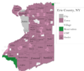
 Erie County New York incorporated and unincorporated areas.svg 1,300 × 740; 2.74 MB
-
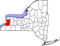
 Erie County NY.jpg 563 × 669; 312 KB
-
 Erie-Buffalo.png 500 × 650; 22 KB
-
 Erie-Lancaster (village).png 500 × 650; 22 KB
-
 ForksNY.jpg 622 × 362; 277 KB
-
 Grand Island (Township); South Buffalo (Village); Buffalo Plains (Village) NYPL1584513.tiff 7,230 × 4,780; 98.88 MB
-
-
 Lancaster, N.Y. LOC 79695013.jpg 9,552 × 6,240; 13.38 MB
-
 Map - Clarence NY.png 3,000 × 4,017; 2.06 MB
-
 Map - Clarence NY.svg 1,235 × 1,653; 2.64 MB
-
 Map of East Amherst, New York.png 1,834 × 2,176; 59 KB
-
 Map of Erie County New York NYPL1584503.tiff 4,780 × 7,230; 98.88 MB
-
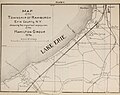
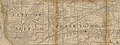
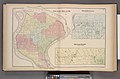
 Map of Erie County, New York - from actual surveys LOC 2012593658.jpg 16,869 × 16,960; 45.1 MB
-
 Map of Erie County, New York - from actual surveys LOC 2012593658.tif 16,869 × 16,960; 818.53 MB
-
 Map of Erie County, New York.png 4,800 × 4,107; 1.06 MB
-
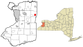
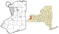
 Map of New York highlighting Erie County.svg 6,599 × 5,030; 112 KB
-
 Map of the Cattaraugus Indian Reservation, New York. LOC 81692883.tif 4,298 × 3,299; 40.57 MB
-
 NY323 route map.jpg 575 × 421; 310 KB
-
 Plan for the Depew Improvement Company, Depew, NY.jpg 669 × 505; 75 KB
-
 New York State Senate District 59 (2012).png 3,259 × 2,492; 400 KB
-
 New York State Senate District 60 (2012).png 3,259 × 2,492; 399 KB
-
 New York State Senate District 61 (2012).png 3,259 × 2,492; 399 KB
-
 New York State Senate District 63 (2012).png 3,259 × 2,492; 397 KB
-
 Snyder, New York National Register of Historic Places Entranceways.png 1,274 × 898; 275 KB
-

-

-
_(19360065752).jpg)


_map.png)


_highlighted.svg)


_highlighted.svg)
_highlighted.svg)
_highlighted.svg)


_highlighted.svg)


_highlighted.svg)


_highlighted.svg)


_highlighted.svg)


_highlighted.svg)

_highlighted.svg)
_highlighted.svg)


_highlighted.svg)
_highlighted.svg)
_highlighted.svg)


_highlighted.svg)


.png)


.png)
.png)
.png)
.png)

