Category:Maps of Santa Cruz County, California
Jump to navigation
Jump to search
English: Maps of Santa Cruz County, California
Counties of California: Alameda · Alpine · Amador · Butte · Calaveras · Colusa · Contra Costa · Del Norte · El Dorado · Fresno · Glenn · Humboldt · Imperial · Inyo · Kern · Kings · Lake · Lassen · Los Angeles · Madera · Marin · Mariposa · Mendocino · Merced · Modoc · Mono · Monterey · Napa · Nevada · Orange · Placer · Plumas · Riverside · Sacramento · San Benito · San Bernardino · San Diego · San Joaquin · San Luis Obispo · San Mateo · Santa Barbara · Santa Clara · Santa Cruz · Shasta · Sierra · Siskiyou · Solano · Sonoma · Stanislaus ·Sutter · Tehama · Trinity · Tulare · Tuolumne · Ventura · Yolo · Yuba – Consolidated city-county: San Francisco
Wikimedia category | |||||
| Upload media | |||||
| Instance of | |||||
|---|---|---|---|---|---|
| Category combines topics | |||||
| Santa Cruz County | |||||
county in California, United States     | |||||
| Instance of | |||||
| Named after | |||||
| Location | California, Pacific States Region | ||||
| Located in or next to body of water | |||||
| Capital | |||||
| Inception |
| ||||
| Population |
| ||||
| Area |
| ||||
| Different from | |||||
| official website | |||||
 | |||||
- See also wikipedia article (English text): Santa Cruz County, California.
Subcategories
This category has the following 2 subcategories, out of 2 total.
Media in category "Maps of Santa Cruz County, California"
The following 45 files are in this category, out of 45 total.
-
 1889 hatch map.png 1,072 × 1,440; 449 KB
-
 BonnyDmap.jpg 619 × 604; 54 KB
-
 CA 20 certified.pdf 1,275 × 1,650; 999 KB
-
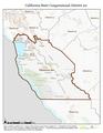
 CA-14th.png 745 × 399; 47 KB
-
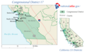 CA-17th.png 658 × 399; 37 KB
-

-
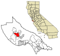
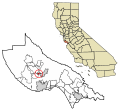
 California map showing Santa Cruz County.png 200 × 231; 22 KB
-
 California US Congressional District 18 (since 2013).tif 2,016 × 998; 2.83 MB
-
 California US Congressional District 20 (since 2013).tif 2,016 × 998; 2.67 MB
-
 Costa Central de Califòrnia.png 2,000 × 2,361; 305 KB
-
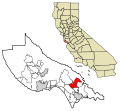
 Map of California highlighting Santa Cruz County.svg 1,022 × 1,171; 504 KB
-
 San Jose-San Francisco-Oakland CSA.png 421 × 489; 24 KB
-
 San Jose-San Francisco-Oakland CSA.svg 621 × 733; 255 KB
-
 Santa Cruz County adjacents.svg 9,164 × 10,536; 181 KB
-

-

-

-
-

-

-

-

-
-

-

-

-

-

-

-

-

-
-

-

-

-

-

-

-

-

-

-

-
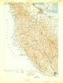 Santa-Cruz-Quadrangle-1902.png 6,623 × 8,747; 60.94 MB
-
 California SD-17 (2011).svg 1,450 × 1,680; 55 KB
-


_(14801578453).jpg)


.svg)
_(14586554670).jpg)