Category:Maps of Alameda County, California
Jump to navigation
Jump to search
Counties of California: Alameda · Alpine · Amador · Butte · Calaveras · Colusa · Contra Costa · Del Norte · El Dorado · Fresno · Glenn · Humboldt · Imperial · Inyo · Kern · Kings · Lake · Lassen · Los Angeles · Madera · Marin · Mariposa · Mendocino · Merced · Modoc · Mono · Monterey · Napa · Nevada · Orange · Placer · Plumas · Riverside · Sacramento · San Benito · San Bernardino · San Diego · San Joaquin · San Luis Obispo · San Mateo · Santa Barbara · Santa Clara · Santa Cruz · Shasta · Sierra · Siskiyou · Solano · Sonoma · Stanislaus ·Sutter · Tehama · Trinity · Tulare · Tuolumne · Ventura · Yolo · Yuba – Consolidated city-county: San Francisco
Wikimedia category | |||||
| Upload media | |||||
| Instance of | |||||
|---|---|---|---|---|---|
| Category combines topics | |||||
| Alameda County | |||||
county in California, United States       | |||||
| Instance of | |||||
| Part of |
| ||||
| Named after |
| ||||
| Location | California, Pacific States Region | ||||
| Capital | |||||
| Inception |
| ||||
| Population |
| ||||
| Area |
| ||||
| official website | |||||
 | |||||

Subcategories
This category has the following 6 subcategories, out of 6 total.
A
B
O
Media in category "Maps of Alameda County, California"
The following 56 files are in this category, out of 56 total.
-
 1878 Washington Corners T&W p129 e.jpg 1,414 × 1,230; 961 KB
-

-

-

-

-
-

-

-

-

-

-

-

-
-

-

-

-

-

-

-
 Alameda County California Incorporated and Unincorporated areas.svg 372 × 251; 61 KB
-
 Alameda County.png 811 × 607; 13 KB
-
 Alameda Neighborhoods.jpg 960 × 720; 74 KB
-
 CA 13 certified.pdf 1,275 × 1,650; 690 KB
-
 CA 15 certified.pdf 1,275 × 1,650; 1,019 KB
-
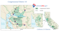
 CA-13th.png 746 × 399; 50 KB
-
 Ca10 109.png 763 × 401; 55 KB
-
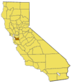
 California county map (Alameda County highlighted).svg 621 × 733; 503 KB
-
 California County of Alameda.png 891 × 615; 3 KB
-
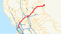 California Interstate 80.svg 1,152 × 640; 631 KB
-
 California Interstate and State Route 238.svg 1,152 × 640; 395 KB
-
 California map showing Alameda County.png 200 × 231; 22 KB
-
 California State Route 123.svg 1,152 × 640; 394 KB
-
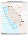
 California US Congressional District 13 (since 2013).tif 2,016 × 998; 2.98 MB
-
 California US Congressional District 15 (since 2013).tif 2,016 × 998; 3.09 MB
-
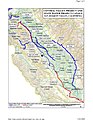 CVPSouthernCanalsUSBR.jpg 1,224 × 1,584; 1.58 MB
-
 District 4 Map -1.jpg 4,032 × 3,024; 2.51 MB
-
 District 4 Map.jpg 4,032 × 3,024; 2.51 MB
-
 District Alameda Country Map.jpg 4,032 × 3,024; 3.26 MB
-
 District Alameda County Map.jpg 4,032 × 3,024; 3.25 MB
-
 East Bay California Incorporated and Unincorporated areas.svg 950 × 550; 185 KB
-
 EastshoreSPmap.png 672 × 1,508; 196 KB
-
 Historic Mountain Home, Alameda County and Mountain House Creek 1916.png 1,198 × 1,340; 3.12 MB
-
 LivermoreAirport1953.jpg 452 × 402; 29 KB
-
 Map of Alameda County 1878 LARGE.jpg 960 × 611; 496 KB
-
 Map of California highlighting Alameda County.svg 1,022 × 1,171; 497 KB
-
 NorthHaywardShake.gif 640 × 440; 21 KB
-
 Plat of Northern Part of Rancho San Antonio.jpg 6,564 × 8,349; 12.97 MB
-
 RogersCrkNorthHayward.gif 640 × 440; 23 KB
-
 San Jose-San Francisco-Oakland CSA.png 421 × 489; 24 KB
-
 San Jose-San Francisco-Oakland CSA.svg 621 × 733; 255 KB
-
 SouthHaywardShake.gif 640 × 440; 22 KB
-

-

-

-
 Ca09 109.png 785 × 400; 46 KB

.jpg)


.svg)


_(14586446720).jpg)
_(14586493690).jpg)
_(14586543799).jpg)
