Category:Maps of Pickens County, South Carolina
Jump to navigation
Jump to search
Counties of South Carolina: Abbeville · Aiken · Allendale · Anderson · Bamberg · Barnwell · Beaufort · Berkeley · Calhoun · Charleston · Cherokee · Chester · Chesterfield · Clarendon · Colleton · Darlington · Dillon · Dorchester · Edgefield · Fairfield · Florence · Georgetown · Greenville · Greenwood · Hampton · Horry · Jasper · Kershaw · Lancaster · Laurens · Lee · Lexington · Marion · Marlboro · McCormick · Newberry · Oconee · Orangeburg · Pickens · Richland · Saluda · Spartanburg · Sumter · Union · Williamsburg · York
Wikimedia category | |||||
| Upload media | |||||
| Instance of | |||||
|---|---|---|---|---|---|
| Category combines topics | |||||
| Pickens County | |||||
county in South Carolina, United States   | |||||
| Instance of | |||||
| Named after | |||||
| Location | South Carolina | ||||
| Capital | |||||
| Inception |
| ||||
| Population |
| ||||
| Area |
| ||||
| Different from | |||||
| official website | |||||
 | |||||
Media in category "Maps of Pickens County, South Carolina"
The following 7 files are in this category, out of 7 total.
-
 Greenville-Mauldin-Easley Metropolitan Area.png 541 × 437; 30 KB
-
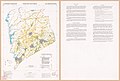 Important farmlands map, Pickens County, South Carolina LOC 95686002.jpg 12,047 × 8,114; 8.96 MB
-
 Map of South Carolina highlighting Pickens County.svg 4,419 × 3,522; 103 KB
-
 SC State Senate District 2 Pickens County.jpg 10,800 × 10,800; 18.69 MB
-
 Senate District 01 0.jpg 10,800 × 10,800; 16.41 MB
-
 Upstate South Carolina.png 590 × 440; 10 KB
-
 UpstateSC CBSAs.png 300 × 210; 32 KB


