Category:Maps of Dillon County, South Carolina
Jump to navigation
Jump to search
Counties of South Carolina: Abbeville · Aiken · Allendale · Anderson · Bamberg · Barnwell · Beaufort · Berkeley · Calhoun · Charleston · Cherokee · Chester · Chesterfield · Clarendon · Colleton · Darlington · Dillon · Dorchester · Edgefield · Fairfield · Florence · Georgetown · Greenville · Greenwood · Hampton · Horry · Jasper · Kershaw · Lancaster · Laurens · Lee · Lexington · Marion · Marlboro · McCormick · Newberry · Oconee · Orangeburg · Pickens · Richland · Saluda · Spartanburg · Sumter · Union · Williamsburg · York
| NO WIKIDATA ID FOUND! Search for Maps of Dillon County, South Carolina on Wikidata | |
| Upload media |
Media in category "Maps of Dillon County, South Carolina"
The following 2 files are in this category, out of 2 total.
-
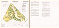 Important farmlands map, Dillon County, South Carolina LOC 95682945.jpg 14,676 × 7,064; 8.34 MB
-
 Map of South Carolina highlighting Dillon County.svg 4,419 × 3,522; 103 KB

