Category:Maps of Page County, Virginia
Jump to navigation
Jump to search
Counties of Virginia: Accomack · Albemarle · Alleghany · Amelia · Amherst · Appomattox · Arlington · Augusta · Bath · Bedford · Bland · Botetourt · Brunswick · Buchanan · Buckingham · Campbell · Caroline · Carroll · Charles City · Charlotte · Chesterfield · Clarke · Craig · Culpeper · Cumberland · Dickenson · Dinwiddie · Essex · Fairfax · Fauquier · Floyd · Fluvanna · Franklin · Frederick · Giles · Gloucester · Goochland · Grayson · Greene · Greensville · Halifax · Hanover · Henrico · Henry · Highland · Isle of Wight · James City · King and Queen · King George · King William · Lancaster · Lee · Loudoun · Louisa · Lunenburg · Madison · Mathews · Mecklenburg · Middlesex · Montgomery · Nelson · New Kent · Northampton · Northumberland · Nottoway · Orange · Page · Patrick · Pittsylvania · Powhatan · Prince Edward · Prince George · Prince William · Pulaski · Rappahannock · Richmond · Roanoke · Rockbridge · Rockingham · Russell · Scott · Shenandoah · Smyth · Southampton · Spotsylvania · Stafford · Surry · Sussex · Tazewell · Warren · Washington · Westmoreland · Wise · Wythe · York
Wikimedia category | |||||
| Upload media | |||||
| Instance of | |||||
|---|---|---|---|---|---|
| Category combines topics | |||||
| Page County | |||||
county in Virginia, United States   | |||||
| Instance of | |||||
| Named after | |||||
| Location | Virginia | ||||
| Capital | |||||
| Inception |
| ||||
| Highest point | |||||
| Population |
| ||||
| Area |
| ||||
| Different from | |||||
| official website | |||||
 | |||||
Media in category "Maps of Page County, Virginia"
The following 11 files are in this category, out of 11 total.
-
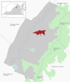 Luray in Page County.svg 512 × 601; 1.87 MB
-
 Map of Virginia highlighting Page County.svg 7,486 × 3,247; 223 KB
-
 Map showing Page County, Virginia.png 750 × 485; 31 KB
-
 Municipalities in Page County, VA.svg 512 × 601; 1.88 MB
-
 Page County VA location map.svg 512 × 601; 1.87 MB
-
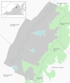
 Shenandoah in Page County, VA.svg 512 × 601; 1.87 MB
-
 Stanley in Page County.svg 512 × 601; 1.87 MB
-
 VAMap-doton-Luray.PNG 300 × 134; 9 KB
-
 VAMap-doton-Shenandoah.PNG 300 × 134; 9 KB
-
 VAMap-doton-Stanley.PNG 300 × 134; 9 KB
-
 Virginia Senate District 26 (2011).png 3,503 × 1,529; 688 KB


.png)