Category:Maps of Chesterfield County, Virginia
Jump to navigation
Jump to search
Counties of Virginia: Accomack · Albemarle · Alleghany · Amelia · Amherst · Appomattox · Arlington · Augusta · Bath · Bedford · Bland · Botetourt · Brunswick · Buchanan · Buckingham · Campbell · Caroline · Carroll · Charles City · Charlotte · Chesterfield · Clarke · Craig · Culpeper · Cumberland · Dickenson · Dinwiddie · Essex · Fairfax · Fauquier · Floyd · Fluvanna · Franklin · Frederick · Giles · Gloucester · Goochland · Grayson · Greene · Greensville · Halifax · Hanover · Henrico · Henry · Highland · Isle of Wight · James City · King and Queen · King George · King William · Lancaster · Lee · Loudoun · Louisa · Lunenburg · Madison · Mathews · Mecklenburg · Middlesex · Montgomery · Nelson · New Kent · Northampton · Northumberland · Nottoway · Orange · Page · Patrick · Pittsylvania · Powhatan · Prince Edward · Prince George · Prince William · Pulaski · Rappahannock · Richmond · Roanoke · Rockbridge · Rockingham · Russell · Scott · Shenandoah · Smyth · Southampton · Spotsylvania · Stafford · Surry · Sussex · Tazewell · Warren · Washington · Westmoreland · Wise · Wythe · York
Wikimedia category | |||||
| Upload media | |||||
| Instance of | |||||
|---|---|---|---|---|---|
| Category combines topics | |||||
| Chesterfield County | |||||
county in Virginia, United States   | |||||
| Instance of | |||||
| Named after | |||||
| Location | Virginia | ||||
| Capital | |||||
| Inception |
| ||||
| Population |
| ||||
| Area |
| ||||
| Different from | |||||
| official website | |||||
 | |||||
Media in category "Maps of Chesterfield County, Virginia"
The following 36 files are in this category, out of 36 total.
-
 (Map of Drewry's Bluff, Chesterfield Co., Va.) LOC gvhs01.vhs00321.jpg 10,217 × 6,768; 7.59 MB
-
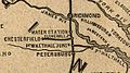
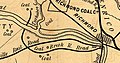 1856 Chesterfield RR.jpg 1,094 × 574; 210 KB
-

-
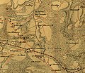
 Eppington and surrounding plantations and traffic routes on Chesterfield 1888 Map.jpg 1,090 × 1,325; 310 KB
-
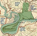
 Farrar's Island, Dutch Gap & Landing.jpg 1,700 × 2,200; 321 KB
-

-
 La Prade Map 1888 of Chesterfield County (zoom on Black Heath Mines).jpg 960 × 720; 151 KB
-
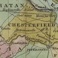
 La Prade Map 1888 of Chesterfield County (zoom on Manchester and Southside).jpg 1,901 × 913; 426 KB
-
 La Prade Map 1888 of Chesterfield County (zoom on Manchester to Drewrys Bluff).jpg 1,059 × 1,760; 330 KB
-
 La Prade Map 1888 of Chesterfield County (zoom on Midlothian Mines).jpg 1,843 × 913; 330 KB
-
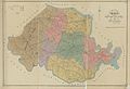 La Prade Map 1888 of Chesterfield County.jpg 1,968 × 1,339; 422 KB
-
 Map of Drewry's Bluff, Chesterfield Co., Va. (cropped).jpg 6,560 × 5,248; 4.35 MB
-
-
 Map of Virginia highlighting Chesterfield County.svg 7,486 × 3,247; 223 KB
-
 Map of William Farrar's Patent for Farrar's Island and Environs.jpg 903 × 889; 1,008 KB
-
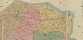
 Map showing Chesterfield County, Virginia.png 750 × 485; 31 KB
-
-
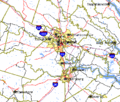
 Richmond Metropolitan Area.png 638 × 293; 33 KB
-
 Richmond-Petersburg TIGER MAP.gif 422 × 359; 18 KB
-
 Simcoe, John Graves - Sketch of the Action at Osburns April 27th 1781.jpg 5,304 × 4,152; 19.47 MB
-
 Summerville Plantation in Chesterfield County map, 1888.jpg 1,681 × 1,431; 603 KB
-
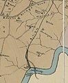
 Summerville Plantation on Chesterfield County map, 1864.jpg 1,722 × 1,499; 898 KB
-
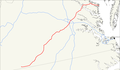 US 360 map.png 1,688 × 984; 61 KB
-
 VAMap-doton-Bellwood.png 300 × 134; 9 KB
-
 VAMap-doton-Bensley.png 300 × 134; 9 KB
-
 VAMap-doton-BonAir.PNG 300 × 134; 9 KB
-
 VAMap-doton-Chester.PNG 300 × 134; 9 KB
-
 VAMap-doton-ChesterfieldCourHouse.PNG 300 × 134; 9 KB
-
 VAMap-doton-Ettrick.PNG 300 × 134; 9 KB
-
 VAMap-doton-Matoaca.PNG 300 × 134; 9 KB
-
 VAMap-doton-Midlothian.PNG 300 × 134; 9 KB
-
 Virginia Senate District 10 (2011).png 3,505 × 1,532; 685 KB
-
 Virginia Senate District 11 (2011).png 3,507 × 1,532; 686 KB
-
 Virginia Senate District 16 (2011).png 3,507 × 1,526; 684 KB
-
 Virginia Under the Stuarts - Dale's Settlements.png 1,040 × 779; 169 KB
-
 Western Chesterfield County, Va. – 1864.jpg 3,150 × 2,035; 1.23 MB
_LOC_gvhs01.vhs00321.jpg)


.jpg)
.jpg)
.jpg)
.jpg)

.jpg)
_(Cropped_for_Richmond_Petersburg_Railroad).jpg)


.png)
.png)
.png)

