Category:Maps of New England
Jump to navigation
Jump to search
Wikimedia category | |||||
| Upload media | |||||
| Instance of | |||||
|---|---|---|---|---|---|
| Category combines topics | |||||
| New England | |||||
region of the northeasternmost United States  .svg)   | |||||
| Instance of |
| ||||
| Named after |
| ||||
| Location |
| ||||
| Located in or next to body of water | |||||
| Has part(s) | |||||
| Highest point | |||||
| Population |
| ||||
| Area |
| ||||
| Different from | |||||
 | |||||
Subcategories
This category has the following 4 subcategories, out of 4 total.
Media in category "Maps of New England"
The following 200 files are in this category, out of 202 total.
(previous page) (next page)-
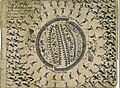
 10 of 'History of New England. vol. 1-4' (11054440816).jpg 2,672 × 1,545; 1.05 MB
-
 11 of 'History of New England. vol. 1-4' (11053875073).jpg 2,672 × 1,535; 1.01 MB
-
-
 120px-US map-New England.png 120 × 78; 10 KB
-
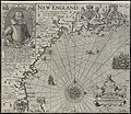
 1664AmeriqueNord.jpg 1,280 × 1,040; 495 KB
-
-

-

-
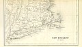
 1848 U.S. Coast Survey Map of New England - Geographicus - NewEngland-uscs-1848.jpg 3,000 × 4,552; 2.15 MB
-
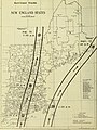
 1854 Rail Road Map of the New England States.jpg 10,752 × 9,328; 29.53 MB
-

-
 1909 streetcar map of New England.jpg 2,653 × 4,000; 1.66 MB
-
 1922 New England road map 1.jpg 792 × 781; 207 KB
-
 1922 New England road map 2.jpg 1,311 × 839; 387 KB
-
 1922 New England routes.jpg 255 × 580; 65 KB
-

-
-
 527 of 'History of New England. vol. 1-4' (11054930193).jpg 1,815 × 1,440; 727 KB
-
-
 A chart of the coast of America from New found Land to Cape Cod (2675728104).jpg 2,000 × 1,611; 3.23 MB
-

-

-

-
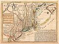
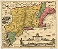
 A map of New England and New York (2674918949).jpg 2,000 × 1,517; 2.98 MB
-
 A map of New England and New York (8347484880).jpg 800 × 636; 138 KB
-

-
 A map of New England, being the first that ever was here cut ... places (2675732378).jpg 2,000 × 1,574; 3.04 MB
-

-
 A map of the most inhabited part of New England (2674889207).jpg 1,942 × 2,000; 3.57 MB
-

-
 A mapp of New England (2675735796).jpg 2,000 × 1,665; 2.83 MB
-

-

-
 ABC pathfinder railway guide map eastern division (9138718144).jpg 722 × 800; 159 KB
-
 AMH-8632-NA Map of Nieuw Nederland featuring an inset showing Nieuw Amsterdam.jpg 2,400 × 2,028; 839 KB
-
 Anglo American War 1812 Locations map-ar.svg 1,052 × 744; 1.02 MB
-
 Anglo American War 1812 Locations map-en he.svg 1,503 × 836; 439 KB
-
 Anglo American War 1812 Locations map-en.svg 1,052 × 744; 136 KB
-
 Anglo American War 1812 Locations map-es.svg 1,494 × 830; 127 KB
-
 Anglo American War 1812 Locations map-fr.svg 1,494 × 830; 206 KB
-
-
 Archdiocese of Boston.png 828 × 1,088; 49 KB
-
 At The Heart of Industrial New England (Holyoke, Mass.).jpg 1,386 × 1,993; 1.2 MB
-
 Atlas Maior - Novi Belgii - four colors.jpg 6,912 × 5,824; 11.21 MB
-

-
 BayOfMaine1713.jpg 2,761 × 1,958; 2.23 MB
-
 Belgii novi, angliae novae, et partis Virginiae - novissima delineatio. NYPL433965.tiff 4,975 × 4,262; 60.67 MB
-
 Boston Fed map.png 188 × 259; 5 KB
-
 Boston Post Road map.png 4,020 × 2,658; 3.56 MB
-
-
 Boylston prize dissertations for the years 1836 and 1837 (1838) (14783653512).jpg 2,416 × 3,202; 1.22 MB
-
 Bulletin (1907) (20240407058).jpg 3,112 × 2,268; 1.27 MB
-
 Bulletin (1910) (19804130004).jpg 2,864 × 3,092; 2.91 MB
-
 Bulletin (1911) (20239137088).jpg 3,120 × 3,368; 3.26 MB
-
 Bulletin of the U.S. Department of Agriculture (1913-1923.) (19877574223).jpg 2,896 × 2,040; 721 KB
-
 Bulletin of the U.S. Department of Agriculture (1913-1923.) (20312538139).jpg 3,260 × 4,928; 3.95 MB
-
 By trolley through eastern New England (1904) (14776558855).jpg 2,656 × 3,872; 855 KB
-
 Carta particolare della Nuoua Belgia è parte della Nuoua Anglia (2675720272).jpg 1,511 × 2,000; 2.23 MB
-
 Climatological data, New England (1953) (14576969678).jpg 2,472 × 3,384; 1.32 MB
-
 Climatological data, New England (1953) (14577114067).jpg 2,502 × 3,390; 1.58 MB
-
 Climatological data, New England (1953) (14577164947).jpg 2,492 × 3,392; 1.51 MB
-
 Climatological data, New England (1953) (14740635126).jpg 2,452 × 3,280; 1.51 MB
-
 Climatological data, New England (1953) (14760409081).jpg 2,504 × 3,504; 1.53 MB
-
 Climatological data, New England (1953) (14761212554).jpg 2,476 × 3,384; 1.5 MB
-
 Climatological data, New England (1953) (14761247114).jpg 2,516 × 3,420; 1.47 MB
-
 Climatological data, New England (1953) (14761279574).jpg 1,428 × 3,362; 665 KB
-
 Climatological data, New England (1953) (14763284552).jpg 2,522 × 3,380; 1.51 MB
-
 Climatological data, New England (1953) (14783459263).jpg 2,470 × 3,380; 1.24 MB
-
 Connecticut 1660.jpg 1,873 × 1,751; 766 KB
-
 Ctfish.png 464 × 605; 38 KB
-
 Description of New England - Smith (1616) - map.png 5,247 × 4,347; 7.96 MB
-
 Description of the Coasts, Points, Harbours and Islands of New France WDL280.png 9,652 × 6,783; 94.71 MB
-

-
 Dirk Jansz van Santen - map finish comparison.jpg 640 × 815; 115 KB
-
 Dominion-of-new-england no-border.png 408 × 473; 85 KB
-
 EB9 New Hampshire - New England rock distribution.jpg 1,187 × 1,393; 372 KB
-
 Electric railway journal (1909) (14738514656).jpg 2,430 × 2,740; 931 KB
-
 Europe and other continents (1901) (14783791903).jpg 1,650 × 2,392; 949 KB
-
 Four-State Tornado Swarm.PNG 414 × 348; 9 KB
-
 GJohnsonMap Burnetts.jpg 1,024 × 768; 287 KB
-
 Glacial Lakes Albany, Champlain, Hitchcock, Winsooski, & Merrimack.jpg 918 × 1,188; 116 KB
-
 GulfofMaine2.jpg 523 × 544; 160 KB
-

-
 HaverhillRaid1708.png 948 × 1,152; 2.21 MB
-
 Hurricane warning breakpoints (Northeastern US).gif 895 × 692; 149 KB
-
 Jansson-Visscher map.jpg 1,728 × 1,456; 2.67 MB
-
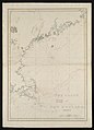
 JTA map of New England Coast, 1607.jpg 1,434 × 1,052; 548 KB
-
 JTA New England Map.jpg 660 × 980; 157 KB
-
 King williams war-ar.svg 638 × 455; 1.75 MB
-
 King williams war.svg 638 × 455; 1.71 MB
-
 LLWS New England.svg 959 × 593; 94 KB
-
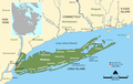 Longisland1.png 1,276 × 811; 523 KB
-
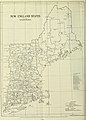
 Map of New England (1960).png 1,374 × 1,102; 128 KB
-
 Map of New England (2675036886).jpg 1,524 × 2,000; 3.04 MB
-
 Map Of New England Counties.svg 1,200 × 1,956; 59 KB
-
 Map of New England in 1624.jpg 1,536 × 1,334; 531 KB
-
 Map of New England, 31st (2673765403).jpg 2,000 × 1,493; 2.74 MB
-
 Map of New Netherland (Novi Belgii Novaeque Angliae) by Justus Danckerts c1673.jpg 8,908 × 7,481; 9.59 MB
-
 Map of New Netherland, Virginia, and New England WDL10083.png 1,461 × 1,024; 3.16 MB
-
 Map of USA highlighting OCA New England Diocese.svg 959 × 593; 78 KB
-
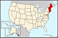
 Map of USA New England.svg 286 × 186; 167 KB
-

-
 Map underhill mason1.jpg 4,365 × 3,197; 14.03 MB
-
 Map-USA-New England01.png 1,563 × 2,209; 352 KB
-
 Map-USA-New England01.svg 744 × 1,052; 263 KB
-
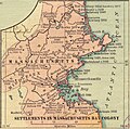 Massachusetts 1660.jpg 1,649 × 1,633; 591 KB
-
 Maury Geography 047A New England.jpg 1,956 × 2,506; 817 KB
-
 NE Dominion.png 1,355 × 963; 213 KB
-
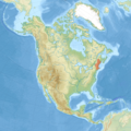 NE NA relief.png 1,058 × 1,062; 1.91 MB
-
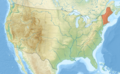 NE US relief.png 1,181 × 731; 1.7 MB
-
 NECTA Divisions.png 1,056 × 816; 68 KB
-
 New England (1).jpg 2,000 × 1,735; 3.5 MB
-
 New England 1660.jpg 6,439 × 8,263; 7.8 MB
-
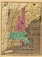 New England 1836.jpg 2,860 × 3,880; 1.84 MB
-
 New England 2016 election results.png 1,071 × 1,381; 112 KB
-
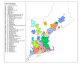
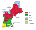
 New England ancestry by county - updated.png 1,481 × 1,234; 88 KB
-
 New England ancestry by county.png 1,481 × 1,234; 95 KB
-
 New England and South-East of Canada topographic map-blank.svg 1,455 × 1,040; 528 KB
-
 New England Cities Where Rev. Elhanan Winchester Preached.png 3,712 × 2,456; 408 KB
-
 New England Conference-USA-states.png 841 × 580; 29 KB
-
 New England District of the Lutheran Church-Missouri Synod.jpg 302 × 354; 37 KB
-
 New England English map.jpg 383 × 457; 59 KB
-
 New England Governors and Eastern Canadian Premiers Conference members.svg 1,712 × 1,750; 242 KB
-
 New England in 2017.png 1,209 × 917; 32 KB
-
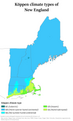 New England Köppen.png 6,000 × 9,900; 509 KB
-
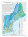 New England Level IV ecoregions.pdf 2,850 × 3,750; 1.94 MB
-
 New England Minor Civil Divisions.png 718 × 945; 325 KB
-
 New England Physiographic Province.jpg 900 × 665; 198 KB
-
 New england ref 2001.jpg 900 × 1,361; 385 KB
-
 New England Road System.svg 1,007 × 1,340; 835 KB
-
 New England tornado paths.png 564 × 668; 37 KB
-
 New England Town Lines and Borders in 1700.png 716 × 719; 21 KB
-
 New England Town Lines and Borders in the Six New England States.png 1,180 × 1,500; 134 KB
-
 New England USA closeup.svg 400 × 600; 9 KB
-
 New England USA.svg 1,000 × 600; 95 KB
-
 New England, New York, New Jersey, and Pensilvania etc NYPL435000.tiff 4,662 × 4,976; 66.38 MB
-
 Flag map of New England (Revolutionary Flag).png 2,000 × 3,000; 97 KB
-
 US Census Division - New England.svg 98 × 158; 5 KB
-
 New England; a human interest geographical reader (1917) (14580792969).jpg 2,800 × 1,920; 532 KB
-
 New England; a human interest geographical reader (1917) (14598394129).jpg 2,768 × 1,632; 488 KB
-
 New France, New Englande, New Scotlande, and New Foundlande (2675734090).jpg 2,000 × 1,696; 2.69 MB
-
 New Hampshire 1660.jpg 1,554 × 1,235; 687 KB
-
 New-england-colonies-in-1677.jpg 1,522 × 1,650; 591 KB
-
 Newengland and New York. NYPL433720.tiff 2,068 × 2,320; 13.73 MB
-
 NewEnglandEnglish.jpg 188 × 252; 24 KB
-
 NewEnglandIndyRef2018.png 512 × 835; 129 KB
-
 Nova Anglia Novum Belgium et Virginia (8431021382).jpg 800 × 689; 113 KB
-
 Nova Belgica Et Anglia Nova (New Netherland and New England) Blaeu Map c1634.jpg 9,000 × 7,644; 25.45 MB
-
 Nova Belgica et Anglia nova - CBT 6620962.jpg 5,888 × 4,542; 5.78 MB
-

-

-

-
 Novi Belgii Novaeque Angliae nec non partis Virginiae tabula (8249621137).jpg 2,000 × 1,550; 2.52 MB
-

-

-
-
 NoviBelgii.jpg 1,607 × 1,375; 915 KB
-

-
 Novi Belgii Novaeque Angliae nec non partis Virginiae tabula (NYPL b14946244-434503).jpg 5,259 × 4,736; 5.38 MB
-
 Novi Belgii Novaeque Angliae nec non partis Virginiae tabula (NYPL b14946244-434503).tiff 5,259 × 4,744; 71.39 MB
-
 An exact mapp of New England and New York (NYPL b15079225-434822).jpg 5,290 × 4,768; 4.85 MB
-

-
 Newengland and New York (NYPL b15102843-433720).jpg 2,068 × 2,320; 1.35 MB
-
 Tierra nveva (NYPL b15307938-434490)(c).jpg 4,160 × 2,912; 1.93 MB
-
 Pascatway River New England.jpg 3,440 × 2,448; 749 KB
-
 PAT - New England.gif 1,600 × 2,000; 1.05 MB
-
-
 Plymouth Colony 1660.jpg 1,693 × 1,243; 481 KB
-
 Population speaking French at home in New England, percent by county.svg 487 × 467; 1.74 MB
-
 Population speaking French at home in New England, sum by county.svg 487 × 467; 1.78 MB
-

-
-
 Purchas Map of New England.jpg 609 × 463; 182 KB
-
-
 Regions of NE cropped.png 1,140 × 1,480; 151 KB
-
 Rhode Island 1660.jpg 1,405 × 1,701; 512 KB
-
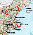 Roundtrip New England.jpg 701 × 746; 612 KB
-
 Sewall's Map of York, Maine, 1794.png 1,719 × 2,488; 1.27 MB
-
 Southern New England 1620-22.jpg 8,959 × 9,705; 7.44 MB
-
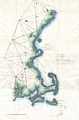
 Southern New England, 1 Arc Second (5030496075).png 4,092 × 1,988; 2.74 MB
-
 Storm Total Snow Accumulation during the February 08-09, 2013 Blizzard.gif 938 × 1,039; 43 KB
-
 Taconic Subdivision of New England Province.jpg 827 × 611; 168 KB
-

-

-
 The coast of New England (10295685495).jpg 576 × 800; 74 KB
-
 The coast of New England (2674898811).jpg 1,412 × 2,000; 1.77 MB
-
 The Founding of New England - p40.jpg 2,409 × 1,643; 2.46 MB
-
 The New England Colonies, physical, local jurisdictions, oceans.gif 808 × 900; 63 KB
-

-

-
 Tierra nveva (NYPL b15307937-434500)(c).jpg 4,416 × 3,320; 2.62 MB
-

-
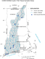
 Tribal Territories Southern New England.png 1,701 × 1,169; 490 KB
-
 US regions-New England.jpg 572 × 371; 107 KB
-
 USA-New-England.png 689 × 280; 42 KB
-
 Valentines Day Blizzard SNE snow totals.png 920 × 800; 281 KB
-
 VKF1 článek.gif 1,616 × 1,200; 67 KB
-
 Wikivoyage US regions - New England states.jpg 572 × 371; 106 KB
-

-

.jpg)
.jpg)
.jpg)


_-_Geographicus_-_NewEnglandNewYork-moll-1729.jpg)


%27_(11232022065).jpg)
%27_(11233183135).jpg)
.jpg)
.jpg)
.jpg)

.jpg)
.jpg)
.jpg)
.jpg)
.jpg)
.jpg)
.jpg)
.jpg)

.jpg)

.jpg)
.jpg)


_(19173685358).jpg)

.jpg)

.jpg)


.jpg)
_(14783653512).jpg)
_(20240407058).jpg)
_(19804130004).jpg)
_(20239137088).jpg)
_(19877574223).jpg)
_(20312538139).jpg)
_(14776558855).jpg)
.jpg)
_(14576969678).jpg)
_(14577114067).jpg)
_(14577164947).jpg)
_(14740635126).jpg)
_(14760409081).jpg)
_(14761212554).jpg)
_(14761247114).jpg)
_(14761279574).jpg)
_(14763284552).jpg)
_(14783459263).jpg)


_-_map.png)

_(20703996239).jpg)


_(14738514656).jpg)
_(14783791903).jpg)


.gif)


.png)
.jpg)


.jpg)
_by_Justus_Danckerts_c1673.jpg)


.jpg)


.jpg)


.png)

_(14580792969).jpg)
_(14598394129).jpg)
.jpg)


.jpg)
_Blaeu_Map_c1634.jpg)


.jpg)


.jpg)
.jpg)
.jpg)
_(cropped).jpg)
.jpg)
(c).jpg)


.jpg)


.jpg)
.jpg)

.jpg)


.png)


_(19888603914).jpg)
_(20485044126).jpg)
.jpg)
.jpg)


.jpg)
(c).jpg)
.svg)


_(14596053739).jpg)
.jpg)
.jpg)