Category:Maps of Clackmannanshire
Jump to navigation
Jump to search
Traditional counties (shires) of Scotland: Aberdeenshire · Angus · Argyll ≈ Argyllshire · Ayrshire · Banffshire · Berwickshire · Buteshire · Caithness · Clackmannanshire · Cromartyshire · Dumbartonshire · Dumfriesshire · East Lothian · Fife · Inverness-shire · Kincardineshire · Kinross-shire · Kirkcudbrightshire · Lanarkshire · Midlothian · Moray · Nairnshire · the Orkney Islands ≈ Orkney Islands · Peeblesshire · Perthshire · Renfrewshire · Ross-shire · Roxburghshire · Selkirkshire · the Shetland Islands ≈ Shetland Islands · Stirlingshire · Sutherland · West Lothian · Wigtownshire
Council areas (municipalities) of Scotland: Aberdeen · Aberdeenshire · Angus · Argyll and Bute · Clackmannanshire · Dumfries and Galloway · Dundee · East Ayrshire · East Dunbartonshire · East Lothian · East Renfrewshire · Edinburgh · Falkirk · Fife · Glasgow · Highland · Inverclyde · Midlothian · Moray · North Ayrshire · North Lanarkshire · Outer Hebrides · Orkney Islands · Perth and Kinross · Renfrewshire · Scottish Borders · Shetland Islands · South Ayrshire · South Lanarkshire · Stirling · West Dunbartonshire · West Lothian
Wikimedia category | |||||
| Upload media | |||||
| Instance of | |||||
|---|---|---|---|---|---|
| Category combines topics | |||||
| Clackmannanshire | |||||
Scottish council area    | |||||
| Instance of | |||||
| Location |
| ||||
| Capital | |||||
| Population |
| ||||
| Area |
| ||||
| official website | |||||
 | |||||
Subcategories
This category has the following 3 subcategories, out of 3 total.
W
- Wards of Clackmannanshire (7 F)
Media in category "Maps of Clackmannanshire"
The following 16 files are in this category, out of 16 total.
-
 Clackmannanshire - British Isles.svg 1,250 × 1,835; 1,002 KB
-
 Clackmannanshire Brit Isles Sect 2.svg 915 × 841; 1,004 KB
-
 Clackmannanshire Brit Isles Sect 3.svg 939 × 677; 940 KB
-
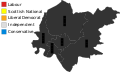 Clackmannanshire Council election 2017.svg 866 × 516; 22 KB
-
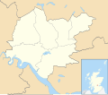
 Clackmannanshire UK blank map.svg 1,425 × 1,248; 698 KB
-
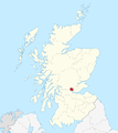
 Clackmannanshire UK location map.svg 1,425 × 1,248; 811 KB
-
 Clackmannanshire UK parish map (blank).svg 1,425 × 1,248; 797 KB
-
 Clackmannanshire UK relief location map.jpg 2,002 × 1,753; 315 KB
-
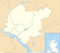
 Clackmannanshire UK ward map (blank).svg 1,425 × 1,248; 827 KB
-
 Clackmannanshire UK ward map 2017 (blank).svg 1,425 × 1,248; 815 KB
-
 ClackmannanshireBrit2.PNG 608 × 604; 20 KB
-
 ClackmannanshireBrit2.png 608 × 604; 15 KB
-
 ClackmannanshireTraditional.png 2,096 × 2,348; 173 KB
-

-
 Scot1975Clackmannan.png 200 × 229; 30 KB
-
 Scotland Clackmannanshire map.png 511 × 730; 11 KB


.svg)
.svg)
.svg)