Category:Locator maps of North Carolina
Jump to navigation
Jump to search
States of the United States: Alabama · Alaska · Arizona · Arkansas · California · Colorado · Connecticut · Delaware · Florida · Georgia · Hawaii · Idaho · Illinois · Indiana · Iowa · Kansas · Kentucky · Louisiana · Maine · Maryland · Massachusetts · Michigan · Minnesota · Mississippi · Missouri · Montana · Nebraska · Nevada · New Hampshire · New Jersey · New Mexico · New York · North Carolina · North Dakota · Ohio · Oklahoma · Oregon · Pennsylvania · Rhode Island · South Carolina · South Dakota · Tennessee · Texas · Utah · Vermont · Virginia · Washington · West Virginia · Wisconsin · Wyoming – Washington, D.C.
insular area of the United States: American Samoa · Guam · Northern Mariana Islands · Puerto Rico · United States Virgin Islands – Baker Island · Howland Island · Jarvis Island · Johnston Atoll · Kingman Reef · Midway Atoll · Navassa Island · Palmyra Atoll · Wake Island
insular area of the United States: American Samoa · Guam · Northern Mariana Islands · Puerto Rico · United States Virgin Islands – Baker Island · Howland Island · Jarvis Island · Johnston Atoll · Kingman Reef · Midway Atoll · Navassa Island · Palmyra Atoll · Wake Island
Subcategories
This category has the following 3 subcategories, out of 3 total.
Media in category "Locator maps of North Carolina"
The following 49 files are in this category, out of 49 total.
-
 Colonial NC.png 1,000 × 1,000; 220 KB
-
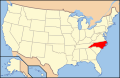
 Map of USA highlighting North Carolina.png 280 × 183; 35 KB
-
 Map of USA NC.svg 286 × 186; 167 KB
-
 NCMap dot on Maple.png 300 × 117; 19 KB
-
 NCMap-doton-Avon.PNG 300 × 117; 9 KB
-
 NCMap-doton-Bynum.PNG 300 × 117; 9 KB
-
 NCMap-doton-CaswellBeach.PNG 300 × 117; 9 KB
-
 NCMap-doton-Corolla.PNG 300 × 117; 11 KB
-
 NCMap-doton-DeepGap.PNG 300 × 117; 9 KB
-
 NCMap-doton-Duck.PNG 300 × 117; 11 KB
-
 NCMap-doton-Fairview.PNG 300 × 117; 9 KB
-
 NCMap-doton-ForestCity.PNG 300 × 117; 9 KB
-
 NCMap-doton-Foxfire.PNG 300 × 117; 9 KB
-
 NCMap-doton-Greensboro.svg 300 × 120; 43 KB
-
 NCMap-doton-KureBeach.PNG 300 × 117; 9 KB
-
 NCMap-doton-NagsHead.PNG 300 × 117; 9 KB
-
 NCMap-doton-NorthTopsailBeach.PNG 300 × 117; 9 KB
-
 NCMap-doton-OakIsland.PNG 300 × 117; 9 KB
-
 NCMap-doton-Rodanthe.PNG 300 × 117; 11 KB
-
 NCMap-doton-Salvo.PNG 300 × 117; 11 KB
-
 NCMap-doton-SouthernShores.PNG 300 × 117; 9 KB
-
 NCMap-doton-SugarGrove.PNG 300 × 117; 9 KB
-
 NCMap-doton-SurfCity.PNG 300 × 117; 9 KB
-
 NCMap-doton-TopsailBeach.PNG 300 × 117; 9 KB
-
 NCMap-doton-Warrenton.PNG 300 × 117; 9 KB
-
 NCMap-doton-Waves.PNG 300 × 117; 11 KB
-
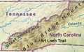 North Carolina (location of Art Loeb Trail).jpg 621 × 387; 104 KB
-
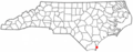
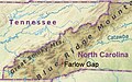 North Carolina (location of Farlow Gap).jpg 621 × 390; 105 KB
-
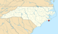
 North Carolina Locator Map.PNG 531 × 201; 15 KB
-
 Ubicación de Queen Anne´s Revenge.png 1,025 × 609; 522 KB
-
 USA Names North Carolina.png 5,895 × 4,049; 1.51 MB
-
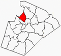
 WakeCountyNC-BuckhornTownship.PNG 303 × 279; 43 KB
-
 WakeCountyNC-CedarForkTownship.PNG 303 × 279; 43 KB
-
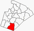
 WakeCountyNC-HollySpringsTownship.PNG 303 × 279; 43 KB
-
 WakeCountyNC-HouseCreekTownship.PNG 303 × 279; 43 KB
-
 WakeCountyNC-LeesvilleTownship.PNG 303 × 279; 44 KB
-
 WakeCountyNC-LittleRiverTownship.PNG 303 × 279; 43 KB
-
 WakeCountyNC-MarksCreekTownship.PNG 303 × 279; 43 KB
-
 WakeCountyNC-MeredithTownship.PNG 303 × 279; 44 KB
-
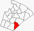
 WakeCountyNC-MiddleCreekTownship.PNG 303 × 279; 43 KB
-
 WakeCountyNC-NeuseTownship.PNG 303 × 279; 44 KB
-
 WakeCountyNC-NewLightTownship.PNG 303 × 279; 43 KB
-
 WakeCountyNC-PantherBranchTownship.PNG 303 × 279; 43 KB
-
 WakeCountyNC-RaleighTownship.PNG 303 × 279; 43 KB
-
 WakeCountyNC-SaintMarysTownship.PNG 303 × 279; 43 KB
-
 WakeCountyNC-SaintMatthewsTownship.PNG 303 × 279; 43 KB
-
 WakeCountyNC-SwiftCreekTownship.PNG 303 × 279; 43 KB
-
 WakeCountyNC-WakeForestTownship.PNG 303 × 279; 43 KB
-
 WakeCountyNC-WhiteOakTownship.PNG 303 × 279; 43 KB


.jpg)
.jpg)


