Category:Geology of Aberdeenshire
Jump to navigation
Jump to search
Council areas (municipalities) of Scotland: Aberdeen · Aberdeenshire · Angus · Argyll and Bute · Clackmannanshire · Dumfries and Galloway · Dundee · East Ayrshire · East Dunbartonshire · East Lothian · East Renfrewshire · Edinburgh · Falkirk · Fife · Highland · Inverclyde · Midlothian · Moray · North Ayrshire · North Lanarkshire · Outer Hebrides · Orkney Islands · Perth and Kinross · Renfrewshire · Scottish Borders · Shetland Islands · South Ayrshire · South Lanarkshire · Stirling · West Dunbartonshire · West Lothian
Subcategories
This category has the following 3 subcategories, out of 3 total.
C
R
- Rocks in Aberdeenshire (12 F)
Media in category "Geology of Aberdeenshire"
The following 27 files are in this category, out of 27 total.
-
 Andalusite Crystals Whitehills Scotland.jpg 640 × 427; 309 KB
-
 Anthophyllite - geograph.org.uk - 4175108.jpg 640 × 444; 470 KB
-
 Axial Planar Cleavage - geograph.org.uk - 1945635.jpg 640 × 395; 105 KB
-
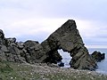
 Conglomerate at Todhead Point - geograph.org.uk - 800887.jpg 640 × 427; 258 KB
-
 Dyke in Conglomerate - geograph.org.uk - 800907.jpg 427 × 640; 325 KB
-
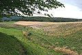
 Flooded fields - geograph.org.uk - 1132118.jpg 640 × 480; 86 KB
-
 Floodwater lake near 'Stirling' - geograph.org.uk - 1132200.jpg 640 × 480; 51 KB
-
 Folded Limestone at Boyne Bay in Scotland 1.jpg 1,704 × 3,000; 983 KB
-
 Folded Limestone at Boyne Bay in Scotland 2.jpg 3,000 × 1,704; 743 KB
-
 Folded Limestone at Boyne Bay in Scotland 3.jpg 3,000 × 1,704; 990 KB
-
 Folded Limestone at Boyne Bay in Scotland 4.jpg 3,000 × 1,704; 623 KB
-
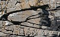
 Folded Rocks - geograph.org.uk - 224051.jpg 569 × 640; 341 KB
-
 Folded Rocks - geograph.org.uk - 746521.jpg 640 × 586; 395 KB
-
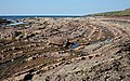
 Folded rocks near Collieston - geograph.org.uk - 6084.jpg 640 × 448; 254 KB
-
 FOS039.jpg 6,720 × 4,572; 17.76 MB
-
 Glacial deposit, Glen Ey - geograph.org.uk - 917983.jpg 640 × 480; 126 KB
-

-
 Glacial Meltwater Channel - geograph.org.uk - 550794.jpg 640 × 427; 262 KB
-

-
 Kame on the banks of the Ythan Estuary - geograph.org.uk - 421560.jpg 640 × 342; 338 KB
-
 Minor Folds - geograph.org.uk - 846194.jpg 640 × 383; 287 KB
-

-
 Rocks by Tarlair Swimming Pool - geograph.org.uk - 764832.jpg 640 × 480; 69 KB
-
 Symmetrical Minor Folds - geograph.org.uk - 846208.jpg 427 × 640; 311 KB
-
 Syncline - geograph.org.uk - 1383096.jpg 640 × 402; 273 KB
-
 Burn o' Vat. - geograph.org.uk - 67764.jpg 419 × 640; 135 KB
-
 Entrance to the Vat - geograph.org.uk - 236691.jpg 427 × 640; 306 KB


