Category:Geological maps of Virginia
Jump to navigation
Jump to search
States of the United States: Alabama · Alaska · Arizona · Arkansas · California · Colorado · Connecticut · Delaware · Florida · Georgia · Hawaii · Idaho · Illinois · Indiana · Iowa · Kansas · Kentucky · Louisiana · Maine · Maryland · Massachusetts · Michigan · Minnesota · Mississippi · Missouri · Montana · Nebraska · Nevada · New Hampshire · New Jersey · New Mexico · New York · North Carolina · North Dakota · Ohio · Oklahoma · Oregon · Pennsylvania · Rhode Island · South Carolina · South Dakota · Tennessee · Texas · Utah · Vermont · Virginia · Washington · West Virginia · Wisconsin · Wyoming
Puerto Rico
Puerto Rico
Subcategories
This category has the following 3 subcategories, out of 3 total.
Media in category "Geological maps of Virginia"
The following 18 files are in this category, out of 18 total.
-

-
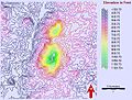 Battle Mountain countour map based on NASA ASTER data.jpg 520 × 393; 150 KB
-
 Bedrock Map Culpeper Basin (Leavy, Froelich, Abram) 1983.png 1,218 × 1,820; 1.93 MB
-
 CatoctinFormationMap2.pdf 1,275 × 1,208; 406 KB
-
 DC-DE-MD-PA-VA-WV Level IV ecoregions.pdf 5,100 × 6,300; 2.34 MB
-
 Farmington Gabbro Map Unit.jpg 480 × 492; 53 KB
-
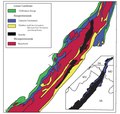
 Farmville Basin Diagram from Virginia DMME.jpg 1,048 × 1,479; 326 KB
-
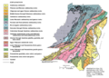
 GeologicalMapRappahannockCountyVA.jpg 1,057 × 1,633; 177 KB
-
 Geology of the Richmond Basin 1899 Plate XXVI.jpg 2,310 × 3,642; 1.93 MB
-
 Marcellus Bedrock.svg 540 × 540; 1.21 MB
-
 Marcellus Shale USGS.png 300 × 350; 78 KB
-
 Mid-Atlantic Appalachian rock types.gif 858 × 614; 66 KB
-
 Mid-Atlantic Appalachian rock types.png 858 × 614; 52 KB
-
 NPS assateague-island-geologic-map.jpg 4,126 × 5,762; 5.69 MB
-
 NPS cumberland-gap-geologic-map-east.jpg 2,183 × 1,512; 1.11 MB
-
 NPS cumberland-gap-geologic-map-west.jpg 2,188 × 1,511; 887 KB
-
 NPS shenandoah-geologic-map.jpg 3,600 × 5,156; 5.35 MB
-
 NPS shenandoah-surficial-geology-map.jpg 3,578 × 5,060; 6.55 MB
_(14781337351).jpg)

_1983.png)


