Category:Environs of Caistor St. Edmund
Jump to navigation
Jump to search
Media in category "Environs of Caistor St. Edmund"
The following 20 files are in this category, out of 20 total.
-
-
 Flood meadow beside Stoke Road - geograph.org.uk - 1670220.jpg 640 × 480; 103 KB
-
 Flood on the River Tas - geograph.org.uk - 1670224.jpg 640 × 480; 130 KB
-
 Flooded meadow beside Stoke Road - geograph.org.uk - 1670235.jpg 640 × 575; 133 KB
-
 Flooded pasture beside Stoke Road - geograph.org.uk - 1670215.jpg 640 × 502; 153 KB
-
 Flooded pastures by the River Tas - geograph.org.uk - 1670228.jpg 640 × 501; 124 KB
-
 Flooded pastures north of the A47 road - geograph.org.uk - 1670184.jpg 640 × 481; 108 KB
-
 Gate by farm track - geograph.org.uk - 1772172.jpg 640 × 480; 137 KB
-
 Old Hall Farm - geograph.org.uk - 1352712.jpg 640 × 480; 80 KB
-
 Pasture east of the River Tas - geograph.org.uk - 1541745.jpg 640 × 449; 92 KB
-
 Rabbit tracks in the snow - geograph.org.uk - 1656927.jpg 640 × 584; 162 KB
-

-

-
 Train on the London to Norwich line - geograph.org.uk - 1352749.jpg 640 × 409; 81 KB
-
 Train on the London to Norwich line - geograph.org.uk - 1352824.jpg 640 × 541; 82 KB
-
 Trees growing alongside a field boundary - geograph.org.uk - 1378705.jpg 640 × 480; 120 KB
-
 Trees growing on field boundary - geograph.org.uk - 1656873.jpg 640 × 510; 93 KB
-
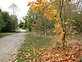
 View to Broken Back Plantation - geograph.org.uk - 1656848.jpg 640 × 480; 96 KB
-
 View towards Broken Back Plantation - geograph.org.uk - 1539767.jpg 640 × 480; 83 KB
-


