Category:Election maps of Portugal
Jump to navigation
Jump to search
Countries of Europe: Albania · Andorra · Armenia‡ · Austria · Azerbaijan‡ · Belarus · Belgium · Bosnia and Herzegovina · Bulgaria · Croatia · Cyprus‡ · Czech Republic · Denmark · Estonia · Finland · France‡ · Georgia‡ · Germany · Greece · Hungary · Iceland · Republic of Ireland · Italy · Kazakhstan‡ · Latvia · Liechtenstein · Lithuania · Luxembourg · Malta · Moldova · Montenegro · Netherlands‡ · North Macedonia · Norway · Poland · Portugal‡ · Romania · Russia‡ · San Marino · Serbia · Slovakia · Slovenia · Spain‡ · Sweden · Switzerland · Turkey‡ · Ukraine · United Kingdom
Specific status: Faroe Islands · Gibraltar · Isle of Man · Jersey – Limited recognition: Kosovo · Northern Cyprus‡
‡: partly located in Europe
Specific status: Faroe Islands · Gibraltar · Isle of Man · Jersey – Limited recognition: Kosovo · Northern Cyprus‡
‡: partly located in Europe
Administrative districts of Portugal:
Aveiro ≈ Aveiro · Beja ≈ Beja · Braga ≈ Braga · Bragança ≈ Bragança · Castelo Branco ≈ Castelo Branco · Coimbra ≈ Coimbra · Évora ≈ Évora · Faro ≈ Faro · Guarda ≈ Guarda · Leiria ≈ Leiria · Lisbon ≈ Lisbon · Portalegre ≈ Portalegre · Porto ≈ Porto · Santarém ≈ Santarém · Setúbal ≈ Setúbal · Viana do Castelo ≈ Viana do Castelo · Vila Real ≈ Vila Real · Viseu ≈ Viseu
Subcategories
This category has the following 8 subcategories, out of 8 total.
+
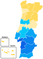
- Election maps of the Azores (18 F)
- Election maps of Madeira (16 F)
G
- Election maps of Guimarães (12 F)
L
- Local elections maps of Portugal (47 F)
P
Media in category "Election maps of Portugal"
The following 31 files are in this category, out of 31 total.
-
 1998 Portuguse Abortion Referendum results.svg 1,200 × 1,623; 3.63 MB
-
 2007 Portuguese abortion referendum results by municipality.svg 1,200 × 1,623; 16.23 MB
-
 2007 Portuguese abortion referendum results.svg 1,200 × 1,623; 3.63 MB
-

-
 2015 portuguese legislative election map.svg 840 × 1,100; 426 KB
-
 Mapa dos Resultados das Eleições Autárquicas de 2013.jpg 834 × 1,029; 98 KB
-
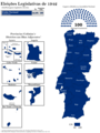
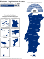
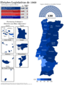
 Mapa Eleições Legislativas Portuguesas de 1934.png 1,540 × 2,048; 321 KB
-
 Mapa Eleições Legislativas Portuguesas de 1938.png 1,540 × 2,048; 322 KB
-
 Mapa Eleições Legislativas Portuguesas de 1942.png 1,540 × 2,048; 322 KB
-
 Mapa Eleições Legislativas Portuguesas de 1945.png 1,540 × 2,048; 328 KB
-
 Mapa Eleições Legislativas Portuguesas de 1949.png 1,540 × 2,048; 330 KB
-
 Mapa Eleições Legislativas Portuguesas de 1953.png 1,540 × 2,048; 333 KB
-
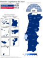 Mapa Eleições Legislativas Portuguesas de 1957.png 1,540 × 2,048; 337 KB
-
 Mapa Eleições Legislativas Portuguesas de 1961.png 1,540 × 2,048; 329 KB
-
 Mapa Eleições Legislativas Portuguesas de 1965.png 1,540 × 2,048; 331 KB
-
 Mapa Eleições Legislativas Portuguesas de 1969.png 1,540 × 2,048; 356 KB
-
 Mapa Eleições Legislativas Portuguesas de 1973.png 1,540 × 2,048; 323 KB
-
 Portuguese 2019 election by constituency.svg 840 × 1,180; 441 KB
-
 Portuguese Electoral Districts 2019 redistribution.svg 775 × 1,000; 399 KB
-
 Pt euelection 1989.PNG 214 × 346; 5 KB
-
 Pt euelection 1994.PNG 214 × 346; 5 KB
-
 Pt euelection 2005.PNG 214 × 346; 5 KB
-
 Pt ploelection ma1985.PNG 391 × 346; 10 KB
-
 Pt ploelection pa1982.PNG 385 × 346; 9 KB
-
 Pt ploelection pa1985.PNG 391 × 346; 10 KB
-
 Pt ploelection pa2005.PNG 385 × 346; 9 KB
-
 Pt ploelection ta2005.PNG 385 × 346; 9 KB
-
 Pt ploelection tc1976.PNG 385 × 346; 9 KB
-
 Pt ploelection tc1979.PNG 385 × 346; 9 KB
-
 Pt ploelection tc1982.PNG 385 × 346; 9 KB
-
 Pt ploelection tc1985.PNG 391 × 346; 10 KB


