Category:Drainage basin maps of the United States
Jump to navigation
Jump to search
English: Maps of drainage basins predominantly within the territory of the United States
Subcategories
This category has only the following subcategory.
G
Media in category "Drainage basin maps of the United States"
The following 106 files are in this category, out of 106 total.
-
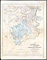 1863 map of Stony Brook drainage basin.jpg 6,384 × 8,098; 10.94 MB
-
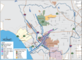
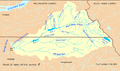
 Anchorage Watersheds.jpg 770 × 606; 304 KB
-

-
 Applegate River Watershed.png 1,188 × 949; 2.07 MB
-
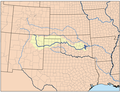
 Arkansasrivermap.jpg 771 × 533; 259 KB
-

-
 Bad River South Dakota Map 1.jpg 580 × 402; 102 KB
-
 Ballona watershed.png 839 × 616; 299 KB
-
 Belle Fourche map 1.jpg 633 × 473; 105 KB
-
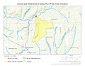
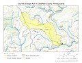
 Big Butte Creek Watershed.png 1,162 × 975; 1.64 MB
-
 Big Darby watershed -- Ohio.gif 460 × 577; 35 KB
-
 BigHoleRiverWatershedFWS.jpg 625 × 447; 42 KB
-
 Bighornrivermap.jpg 493 × 599; 302 KB
-
 Black-river-boundary.pdf 1,275 × 1,650; 73 KB
-
 Blueearthrivermap.png 500 × 500; 101 KB
-
 Bull run river oregon watershed map.png 710 × 420; 64 KB
-
 Cache River Watershed.jpg 600 × 574; 43 KB
-
 Cacherivermap.png 500 × 500; 145 KB
-
 Canadianrivermap.png 500 × 385; 204 KB
-
 Carsonrivermap.png 500 × 500; 335 KB
-
 Catskillcreekmap.png 1,000 × 1,000; 303 KB
-
 Chesapeake Bay watershed map - EPA.gif 245 × 350; 37 KB
-
 Chesapeakewatershedmap.png 1,500 × 1,656; 2.79 MB
-
 CheyenneCourseWatershed1.png 814 × 567; 43 KB
-
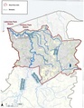
 Watershed of Michigan's Clinton River - final state approved.pdf 2,550 × 1,650; 881 KB
-
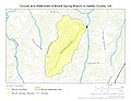 Course and Watershed of Bowle Spring Branch in Halifax County, Virginia, USA.jpg 1,056 × 816; 135 KB
-
 Course and Watershed of Brannon Run (Allegheny River tributary).jpg 1,056 × 816; 193 KB
-
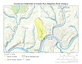 Course and Watershed of Charley Run (Allegheny River tributary).jpg 1,056 × 816; 166 KB
-
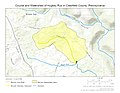
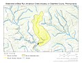
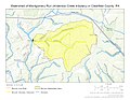
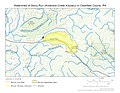
 Course and Watershed of Fenton Run in Clearfield County, Pennsylvania.jpg 1,056 × 816; 130 KB
-
 Course and Watershed of Golby Run (Pine Creek tributary).jpg 1,056 × 816; 148 KB
-
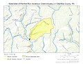
 Course and Watershed of Henderson Run (Pine Creek tributary).jpg 1,056 × 816; 159 KB
-
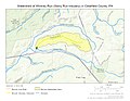
 Course and Watershed of Hughey Run in Clearfield County, Pennsylvania.jpg 1,056 × 816; 129 KB
-
 Course and Watershed of Husband Run.jpg 1,056 × 816; 147 KB
-
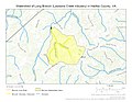
 Course and Watershed of Jerimy Creek in Halifax County, Virginia, USA.jpg 1,056 × 816; 166 KB
-

-
 Course of Bilger Run in Clearfield County, Pennsylvania.jpg 1,056 × 816; 164 KB
-
 Course of Butrum Creek in Halifax County, Virginia, USA.jpg 1,056 × 816; 158 KB
-
 Course of Caldwell Creek (Pine Creek tributary).jpg 1,056 × 816; 131 KB
-

-

-
 Course of Hummer Creek (Thompson Creek tributary).jpg 1,056 × 816; 201 KB
-
 Course of Kratzer Run in Clearfield County, Pennsylvania.jpg 1,056 × 816; 167 KB
-

-

-
 Course of Marsh Run (Oil Creek tributary).jpg 1,056 × 816; 169 KB
-

-

-

-
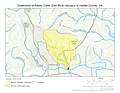
 Course of Pine Log Creek (Richardson Creek tributary).jpg 1,056 × 816; 196 KB
-

-
 Course of Reedy Creek (Dan River tributary) in Halifax County, Virginia, USA.jpg 1,056 × 816; 180 KB
-

-

-
 Crooked River Map.png 821 × 609; 90 KB
-
 Cuyahoga River - final state approved-201007.pdf 2,550 × 1,650; 482 KB
-
 Cuyahogarivermap.png 1,252 × 1,000; 392 KB
-
 Delaware river watershed.png 600 × 836; 33 KB
-
 Desmoinesrivermap.png 500 × 500; 116 KB
-
 Granderonderivermap.jpg 700 × 710; 249 KB
-
 Johndayrivermap.png 561 × 500; 396 KB
-
 KlamathRiver watershed.png 469 × 445; 54 KB
-
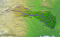
 Klamath Basin map.png 1,179 × 1,121; 1.92 MB
-
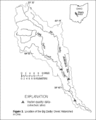
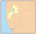
 KlamathBasin-location.jpg 768 × 1,000; 261 KB
-
 KlamathRiver watershed (cropped).png 316 × 316; 45 KB
-
 Littlemissouririvermap.png 836 × 878; 1,019 KB
-
 McKenzie River watershed (9357445131).jpg 2,413 × 1,580; 2.64 MB
-
 Mckenzierivermap.png 2,917 × 3,333; 3.14 MB
-
 Middle Fork Salmon River Watershed.png 1,169 × 826; 1.53 MB
-
 Minnesota Watersheds.png 522 × 589; 40 KB
-
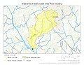
 Mississippi river map.png 1,326 × 838; 2.05 MB
-
 Mohican River watershed.jpg 1,245 × 865; 359 KB
-
 Owyhee river basin map.png 1,000 × 1,372; 2.39 MB
-
 Palo duro province.png 1,181 × 731; 254 KB
-
 Redrivermap.jpg 856 × 532; 262 KB
-
 Scioto River Watershed.jpg 1,056 × 841; 248 KB
-
 SnakeRiverNicerMap.jpg 1,130 × 976; 1 MB
-
 Washington. Irrigation by drainage basins. 1939 - btv1b53189470g.jpg 9,176 × 5,530; 4.65 MB
-
-
 Watershed of Bilger Run in Clearfield County, Pennsylvania.jpg 1,056 × 816; 161 KB
-

-

-
 Watershed of Butrum Creek in Halifax County, Virginia, USA.jpg 1,056 × 816; 158 KB
-
 Watershed of Caldwell Creek (Pine Creek tributary).jpg 1,056 × 816; 133 KB
-
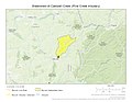
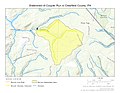 Watershed of Coupler Run in Clearfield County, Pennsylvania.jpg 1,056 × 816; 148 KB
-
 Watershed of Dressler Run in Clearfield County, Pennsylvania.jpg 1,056 × 816; 120 KB
-

-
 Watershed of Hummer Creek (Thompson Creek tributary).jpg 1,056 × 816; 202 KB
-

-
 Watershed of Kratzer Run in Clearfield County, Pennsylvania.jpg 1,056 × 816; 212 KB
-

-
-
 Watershed of Marsh Run (Oil Creek tributary).jpg 1,056 × 816; 203 KB
-
 Watershed of Marys Creek (Haw River tributary).jpg 1,056 × 816; 174 KB
-
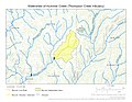
 Watershed of McLaughlin Creek (Thompson Creek tributary).jpg 1,056 × 816; 282 KB
-
-
 Watershed of Motes Creek (Haw River tributary).jpg 1,056 × 816; 183 KB
-
-

-

-
-

-
-
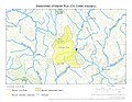
 Watershed of Warden Run (Sugar Creek tributary).jpg 1,056 × 816; 204 KB
-
-
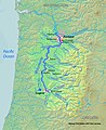 Willametterivermap.jpg 562 × 689; 297 KB
-
 Willamette river map new.png 2,917 × 3,333; 3.28 MB


_(14566027347).jpg)


.jpg)
.jpg)
.jpg)
.jpg)


.jpg)
_in_Halifax_County,_Virginia,_USA.jpg)
.jpg)
_in_Halifax_County,_Virginia,_USA.jpg)
_in_Halifax_County,_Virginia,_USA.jpg)
.jpg)
_in_Halifax_County,_Virginia,_USA.jpg)
.jpg)
_in_Halifax_County,_Virginia,_USA.jpg)
_in_Halifax_County,_Virginia,_USA.jpg)
_in_Halifax_County,_Virginia,_USA.jpg)


.png)

.jpg)


.jpg)
_in_Halifax_County,_Virginia,_USA.jpg)
.jpg)
_in_Halifax_County,_Virginia,_USA.jpg)
_in_Halifax_County,_Virginia,_USA.jpg)
.jpg)
.jpg)
.jpg)
.jpg)
_in_Halifax_County,_Virginia,_USA.jpg)
_in_Halifax_County,_Virginia,_USA.jpg)
_in_Halifax_County,_Virginia,_USA.jpg)
_in_Halifax_County,_Virginia,_USA.jpg)
.jpg)


_in_Clearfield_County,_Pennsylvania.jpg)
_in_Clearfield_County,_Pennsylvania.jpg)
_in_Clearfield_County,_Pennsylvania.jpg)
_in_Clearfield_County,_Pennsylvania.jpg)
_in_Clearfield_County,_Pennsylvania.jpg)
_in_Clearfield_County,_Pennsylvania.jpg)
_in_Clearfield_County,_Pennsylvania.jpg)
_in_Clearfield_County,_Pennsylvania.jpg)
_in_Clearfield_County,_Pennsylvania.jpg)
_in_Clearfield_County,_Pennsylvania.jpg)
_in_Clearfield_County,_Pennsylvania.jpg)
_in_Clearfield_County,_Pennsylvania.jpg)
_in_Clearfield_County,_Pennsylvania.jpg)