Category:December 2008 in North Yorkshire
Jump to navigation
Jump to search
Deutsch: Bilder, die im Dezember 2008 in North Yorkshire aufgenommen worden sind. Bitte beachten Sie, dass dies weder das Datum des Uploads noch das Datum des Scannens eines Fotos ist.
English: Images/pictures taken in North Yorkshire during December 2008. Note this is not the date of the upload, nor the date a photo was scanned.
Español: Fotografías o imágenes tomadas en North Yorkshire durante diciembre 2008. No es la fecha de subida ni escaneo, sino la fecha en que las fotografías o imágenes se crearon.
Esperanto: Bildoj faritaj en North Yorkshire en decembro 2008. Tio ne estas la dato, kiam la bildoj estis alŝutitaj aŭ skanitaj.
Français : Photographies ou images prises en North Yorkshire durant décembre 2008. Ce n'est pas la date du téléchargement ou du scan.
Galego: Fotografías ou imaxes tomadas en North Yorkshire durante decembro 2008. Non é a data de subida nin escaneamento, senón a data na que se crearon as fotografías ou imaxes.
Italiano: Fotografie o immagini scattate a North Yorkshire nel dicembre 2008. Nota bene: la data non si riferisce né a quella di upload né a quella in cui la foto è stata digitalizzata.
Norsk bokmål: Bilder tatt i North Yorkshire i løpet av desember 2008. Merk at dette ikke er datoen for opplasting, eller når et bilde har blitt skannet.
Norsk nynorsk: Bilete teke i North Yorkshire i løpet av desember 2008. Merk at dette ikkje er datoen for opplasting, eller når eit bilete har vorte skanna.
Русский: Изображения, сделанные в North Yorkshire в течение декабрь 2008 (не дата загрузки изображения).
Українська: Зображення, зроблені в North Yorkshire протягом грудень 2008. Зауважте, що це не дата завантаження чи дата сканування фотографії.
| December 2007 | ← | December 2008 | → | December 2009 | |||||||
| Jan | Feb | Mar | Apr | May | Jun | Jul | Aug | Sep | Oct | Nov | Dec |
| 132 | 133 | 124 | 106 | 169 | 192 | 124 | 157 | 83 | 58 | 93 | 52 |
|---|---|---|---|---|---|---|---|---|---|---|---|
Subcategories
This category has only the following subcategory.
Y
Media in category "December 2008 in North Yorkshire"
The following 51 files are in this category, out of 51 total.
-
 Spa Cliff Railway winter position - geograph.org.uk - 1081030.jpg 480 × 640; 133 KB
-
 Steppey Hill Farm - geograph.org.uk - 1081062.jpg 640 × 480; 75 KB
-

-

-
 Approaching the 19th - geograph.org.uk - 1089093.jpg 640 × 349; 43 KB
-
 Barclay's Bank, Stokesley - geograph.org.uk - 1087082.jpg 466 × 640; 94 KB
-

-
 Byland Abbey - panoramio - Keith Ruffles (1).jpg 1,224 × 1,632; 333 KB
-
 Byland Abbey - panoramio - Keith Ruffles (2).jpg 1,507 × 1,061; 971 KB
-
 Byland Abbey - panoramio - Keith Ruffles.jpg 1,544 × 1,186; 1.23 MB
-
 Byland Abbey - panoramio.jpg 1,420 × 1,090; 1.06 MB
-
 Byland Abbey Arch - panoramio.jpg 1,632 × 1,224; 308 KB
-
 Catterick Racecourse - geograph.org.uk - 1082452.jpg 640 × 480; 92 KB
-
 Christmas lights on Skipton High Street.JPG 3,456 × 2,592; 1.88 MB
-
 Cottages at Ingleby Cross - geograph.org.uk - 1090106.jpg 640 × 318; 58 KB
-
 Cottages in High Dales - geograph.org.uk - 1104815.jpg 640 × 480; 93 KB
-
 Crabdale Beck - geograph.org.uk - 1093203.jpg 640 × 480; 120 KB
-
 Crabdale Beck from Pamperdale Ridge - geograph.org.uk - 1093251.jpg 640 × 451; 103 KB
-
 Descending to Tang Beck - geograph.org.uk - 1082460.jpg 640 × 480; 95 KB
-
 Disused quarry above Ellerton Scar - geograph.org.uk - 1089135.jpg 640 × 480; 91 KB
-
 Drax Power Station from Gowdall - geograph.org.uk - 1094326.jpg 640 × 480; 58 KB
-
 East from Hood Hill summit - geograph.org.uk - 1096573.jpg 481 × 640; 103 KB
-
 Field near Hampsthwaite - geograph.org.uk - 1082977.jpg 640 × 480; 149 KB
-
 Field near Hew Green - geograph.org.uk - 1082408.jpg 640 × 480; 124 KB
-
 Fields in Swarcliffe - geograph.org.uk - 1082395.jpg 640 × 480; 72 KB
-
 Flood defence - geograph.org.uk - 1094350.jpg 480 × 640; 58 KB
-
 Footbridge over Ormesby Road, Normanby - geograph.org.uk - 1075772.jpg 640 × 480; 191 KB
-
 Footpath to Gormire Lake - geograph.org.uk - 1081445.jpg 640 × 427; 80 KB
-
 Gateway to Hackness Hall - geograph.org.uk - 1104745.jpg 640 × 480; 93 KB
-
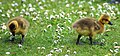
 Goslings (3546551599).jpg 2,460 × 1,268; 2.71 MB
-
 Goslings (3546553609).jpg 2,604 × 1,220; 2.95 MB
-
 Goslings (3547352792).jpg 2,000 × 3,008; 3.63 MB
-
 Goslings (3547354220).jpg 2,380 × 848; 1.87 MB
-
 Goslings (3547355834).jpg 3,008 × 736; 1.96 MB
-
 Goslings (3547357592).jpg 2,368 × 1,096; 2.47 MB
-
 Hide on shores of Malham tarn - geograph.org.uk - 1095758.jpg 640 × 414; 128 KB
-

-
 Malham Tarn and information board - geograph.org.uk - 1095779.jpg 425 × 640; 73 KB
-
 On the slopes of Hood Hill - geograph.org.uk - 1095277.jpg 640 × 480; 81 KB
-
 Otley Street Skipton.JPG 2,592 × 3,456; 1.68 MB
-
 Pasture by Hollins Hall - geograph.org.uk - 1082990.jpg 640 × 480; 122 KB
-
 Remains of Railway Bridge in Burdale - geograph.org.uk - 1401110.jpg 640 × 482; 128 KB
-
 River Derwent in Flood - geograph.org.uk - 1205138.jpg 480 × 640; 76 KB
-
 Road Bridge A171 Scalby - geograph.org.uk - 1082030.jpg 640 × 480; 90 KB
-
 Sherburn Street, Cawood - geograph.org.uk - 1079663.jpg 640 × 480; 70 KB
-
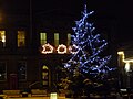 Skipton Town Hall Christmas.JPG 3,456 × 2,592; 1.68 MB
-
 Staithes and Staithes Beck - geograph.org.uk - 1093026.jpg 640 × 420; 110 KB
-
 Tight Alley - geograph.org.uk - 1081056.jpg 427 × 640; 49 KB
-

-
-
 Texaco filling station - geograph.org.uk - 298463.jpg 640 × 403; 36 KB


.jpg)
.jpg)


.jpg)
.jpg)
.jpg)
.jpg)


.jpg)
.jpg)