Category:December 2006 in County Antrim
Jump to navigation
Jump to search
English: Images taken in County Antrim, Northern Ireland in this month of 2006 (not the date of the upload).
| Jan | Feb | Mar | Apr | May | Jun | Jul | Aug | Sep | Oct | Nov | Dec | ||
| ← | 38 | 48 | 10 | 35 | 37 | 24 | 53 | 216 | 56 | 18 | 18 | 25 | → |
|---|
Media in category "December 2006 in County Antrim"
The following 25 files are in this category, out of 25 total.
-
 Ballasting the track at the Maze Station - geograph.org.uk - 334822.jpg 640 × 426; 148 KB
-
 Cairn Hill near Carrickfergus - geograph.org.uk - 296554.jpg 640 × 426; 156 KB
-
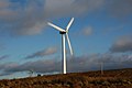 Corkey wind farm near Clogh Mills - geograph.org.uk - 301378.jpg 640 × 426; 97 KB
-
 Farmland at Carneal near Carrickfergus - geograph.org.uk - 294224.jpg 640 × 426; 167 KB
-
 Footbridge Steps - geograph.org.uk - 313080.jpg 640 × 426; 156 KB
-
 Giants Causeway 1a.JPG 2,560 × 1,920; 880 KB
-
 Glarryford level crossing - geograph.org.uk - 290723.jpg 640 × 426; 129 KB
-
 Gobbins Brae, Islandmagee (2) - geograph.org.uk - 292898.jpg 640 × 426; 122 KB
-
 Portrush lifeboat station - geograph.org.uk - 290715.jpg 640 × 426; 136 KB
-
 Raloo parish church, Glenoe - geograph.org.uk - 297076.jpg 640 × 426; 145 KB
-
 Road and railway near Glynn - geograph.org.uk - 294244.jpg 640 × 426; 153 KB
-
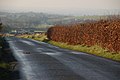
 The Antrim-Ballymena road - geograph.org.uk - 290729.jpg 640 × 426; 86 KB
-
 The Ballypollard Road near Magheramorne - geograph.org.uk - 294238.jpg 640 × 426; 148 KB
-
 The Irish Hill Road near Straid - geograph.org.uk - 296559.jpg 640 × 426; 161 KB
-
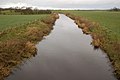 The Killagan Water at Glarryford - geograph.org.uk - 290720.jpg 640 × 426; 120 KB
-
 The Knockagh Road near Carrickfergus (1) - geograph.org.uk - 296527.jpg 640 × 426; 154 KB
-
 The Knockagh Road, Carrickfergus (2) - geograph.org.uk - 296534.jpg 640 × 426; 171 KB
-
 The Knockagh Road, Carrickfergus (3) - geograph.org.uk - 296539.jpg 640 × 426; 137 KB
-
 The Larne line near Ballyhenry - geograph.org.uk - 296578.jpg 640 × 426; 136 KB
-
 The Lisglass Road near Straid - geograph.org.uk - 296565.jpg 640 × 426; 129 KB
-
 The Shore Road, Glynn (2) - geograph.org.uk - 294247.jpg 640 × 426; 164 KB
-
 The Slievetrue Road, Knockagh - geograph.org.uk - 296543.jpg 640 × 426; 121 KB
-
 The Slievetrue Road, Woodburn - geograph.org.uk - 296547.jpg 640 × 426; 129 KB
-
 Whiteabbey Station (2006) - geograph.org.uk - 369121.jpg 640 × 426; 141 KB
-
 Whitehouse Lagoon - geograph.org.uk - 304785.jpg 640 × 426; 75 KB


_-_geograph.org.uk_-_292898.jpg)


_-_geograph.org.uk_-_296527.jpg)
_-_geograph.org.uk_-_296534.jpg)
_-_geograph.org.uk_-_296539.jpg)


_-_geograph.org.uk_-_294247.jpg)


_-_geograph.org.uk_-_369121.jpg)
