Category:Datia district
Jump to navigation
Jump to search
Districts of Madhya Pradesh: Agar Malwa · Alirajpur · Anuppur · Ashoknagar · Balaghat · Barwani · Betul · Bhind · Bhopal · Burhanpur · Chhatarpur · Chhindwara · Damoh · Datia · Dewas · Dhar · Dindori · Guna · Gwalior · Harda · Indore · Jabalpur · Jhabua · Katni · Khandwa · Khargone · Maihar · Mandla · Mandsaur · Mauganj · Morena · Narmadapuram · Narsinghpur · Neemuch · Niwari · Pandhurna · Panna · Raisen · Rajgarh · Ratlam · Rewa · Sagar · Satna · Sehore · Seoni · Shahdol · Shajapur · Sheopur · Shivpuri · Sidhi · Singrauli · Tikamgarh · Ujjain · Umaria · Vidisha
district of Madhya Pradesh, India  | |||||
| Upload media | |||||
| Instance of | |||||
|---|---|---|---|---|---|
| Location |
| ||||
| Capital | |||||
| Population |
| ||||
| Area |
| ||||
| official website | |||||
 | |||||

Subcategories
This category has the following 6 subcategories, out of 6 total.
Media in category "Datia district"
The following 5 files are in this category, out of 5 total.
-
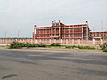 Datia District Court.jpg 3,264 × 2,448; 3.88 MB
-
 Madhya Pradesh Datia location map.svg 669 × 486; 149 KB
-
 Madhya Pradesh district location map Datia.svg 1,639 × 1,852; 744 KB
-
 Magnificent dome of a chhatri of the Maharaja Bhawani Singh.jpg 5,400 × 3,600; 9.18 MB
-
 Map of Datia.png 800 × 563; 108 KB


