Category:Balaghat district
Jump to navigation
Jump to search
district of Madhya Pradesh, India  | |||||
| Upload media | |||||
| Audio | |||||
|---|---|---|---|---|---|
| Instance of | |||||
| Location | Jabalpur division, Madhya Pradesh, India | ||||
| Capital |
| ||||
| Inception |
| ||||
| Population |
| ||||
| Area |
| ||||
| official website | |||||
 | |||||
Districts of Madhya Pradesh: Agar Malwa · Alirajpur · Anuppur · Ashoknagar · Balaghat · Barwani · Betul · Bhind · Bhopal · Burhanpur · Chhatarpur · Chhindwara · Damoh · Datia · Dewas · Dhar · Dindori · Guna · Gwalior · Harda · Indore · Jabalpur · Jhabua · Katni · Khandwa · Khargone · Maihar · Mandla · Mandsaur · Mauganj · Morena · Narmadapuram · Narsinghpur · Neemuch · Niwari · Pandhurna · Panna · Raisen · Rajgarh · Ratlam · Rewa · Sagar · Satna · Sehore · Seoni · Shahdol · Shajapur · Sheopur · Shivpuri · Sidhi · Singrauli · Tikamgarh · Ujjain · Umaria · Vidisha
English: Balaghat district is in the southeast corner of Madhya Pradesh, in the tristate area, sharing parts of its border with Maharashtra and Chhattisgarh states of India. It derives it name from Baraghat (twelve ghat-hills). The region has been home to some of earliest attestable history of tribal kingdoms that adopted Hinduism, including the Gonds, who built forts and temples with Hindu architecture between the 9th-century and 14th-century. They came under the hegemony of various Sultanates, then the Marathas, thereafter as a part of Nagpur Province under the colonial British. It is during the colonial era, Baraghat was phonetically misspelled as Balaghat and created as a district.
Balaghat district should not be confused with Balaghat range – a 300 km long range of hills in Maharashtra.
Balaghat district should not be confused with Balaghat range – a 300 km long range of hills in Maharashtra.

Subcategories
This category has the following 7 subcategories, out of 7 total.
G
- Garra, Madhya Pradesh (3 F)
J
- Joda Temple, Baihar (12 F)
K
L
M
- Moti Talab, Balaghat (4 F)
T
- Tirodi copper plates (7 F)
- Tirodi Mine (3 F)
Media in category "Balaghat district"
The following 19 files are in this category, out of 19 total.
-
 Agriculture lands.jpg 4,000 × 2,250; 2.99 MB
-
 Baiga tribe family.jpg 637 × 1,079; 504 KB
-
 BALAGHAT district MADHYA PRADESH.jpg 720 × 1,280; 324 KB
-
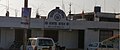
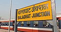 Balaghat junction .jpg 736 × 392; 24 KB
-
 Balaghat, Madhya Pradesh, India - panoramio.jpg 1,024 × 768; 207 KB
-
DIWALI.webm 43 s, 720 × 1,280; 18.11 MB
-
DUSSEHRA VIBES.webm 37 s, 720 × 1,280; 11.43 MB
-
GOD DURGA.webm 16 s, 720 × 1,280; 5.29 MB
-
 Kali Putli.png 161 × 174; 42 KB
-
 Karvy data pan card centre at budhee balaghat.jpg 2,624 × 1,808; 318 KB
-
 Madhya Pradesh district location map Balaghat.svg 1,639 × 1,852; 744 KB
-
MAHASHIVRATRI.webm 36 s, 720 × 1,280; 17.71 MB
-
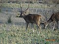 Male Barasingha.jpg 4,608 × 3,456; 3.42 MB
-
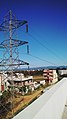
 Mountain View, BALAGHAT district MADHYA PRADESH.jpg 3,584 × 2,016; 2.91 MB
-
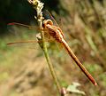 Neurothemis intermedia. male - Flickr - gailhampshire (2).jpg 2,604 × 2,344; 538 KB
-
 Potomarcha congener female - Flickr - gailhampshire (1).jpg 1,460 × 1,332; 261 KB
-
 Samta Bhawan Building in Budhee,Balaghat.jpg 3,312 × 1,384; 181 KB
-

-
 Statue of Rani Avanti Bai, in bus stand of Balaghat district , Madhya Pradesh.jpg 2,016 × 3,584; 2.66 MB


.jpg)
.jpg)

.jpg)
