Category:Black and white photographs of West Yorkshire
Jump to navigation
Jump to search
Ceremonial counties of England: Bedfordshire · Berkshire · Buckinghamshire · Cambridgeshire · Cheshire · Cornwall · Cumbria · Derbyshire · Devon · Dorset · Durham · East Riding of Yorkshire · East Sussex · Essex · Gloucestershire · Greater London · Greater Manchester · Hampshire · Herefordshire · Hertfordshire · Isle of Wight · Kent · Lancashire · Leicestershire · Lincolnshire · Merseyside · Norfolk · North Yorkshire · Northamptonshire · Northumberland · Nottinghamshire · Oxfordshire · Rutland · Shropshire · Somerset · South Yorkshire · Staffordshire · Suffolk · Surrey · Tyne and Wear · Warwickshire · West Midlands · West Sussex · West Yorkshire · Wiltshire · Worcestershire
City-counties: Bristol ·
Former historic counties:
Other former counties:
City-counties: Bristol ·
Former historic counties:
Other former counties:

Subcategories
This category has the following 5 subcategories, out of 5 total.
Media in category "Black and white photographs of West Yorkshire"
The following 200 files are in this category, out of 340 total.
(previous page) (next page)-
 "Beeline" at Ilkley - geograph.org.uk - 914856.jpg 440 × 640; 63 KB
-
 128 Bradford Road - geograph.org.uk - 462938.jpg 352 × 640; 64 KB
-
 1909 school feast Joshua Biltcliffe Upper Cumberworth West Yorkshire England.jpg 1,412 × 885; 863 KB
-
 A rainy day in Huddersfield (15834830078).jpg 2,650 × 3,583; 4.88 MB
-
 Addingham - 114a Main Street - geograph.org.uk - 369532.jpg 640 × 590; 172 KB
-
 Addingham - 144 Main Street - geograph.org.uk - 369538.jpg 640 × 635; 235 KB
-
 Addingham - 155 Main Street - geograph.org.uk - 369548.jpg 640 × 623; 250 KB
-
 Addingham - 32-34 Main Street - geograph.org.uk - 369492.jpg 638 × 609; 51 KB
-
 Addingham - 71 Main Street - geograph.org.uk - 369490.jpg 639 × 502; 53 KB
-
 Addingham - 72-74 Main Street - geograph.org.uk - 369503.jpg 639 × 640; 80 KB
-
 Addingham - 88-94 Main Street - geograph.org.uk - 369507.jpg 640 × 592; 218 KB
-
 Addingham - 99 Main Street - geograph.org.uk - 369517.jpg 640 × 615; 164 KB
-
 Addingham - Fir Cottage - geograph.org.uk - 369551.jpg 640 × 580; 182 KB
-
 Addingham - House off Main Street - geograph.org.uk - 369544.jpg 640 × 601; 98 KB
-
-
 Addingham - Hudson Yard off main Street - geograph.org.uk - 369529.jpg 640 × 615; 194 KB
-
 Addingham - Lyngfold - geograph.org.uk - 369514.jpg 640 × 629; 211 KB
-
 Addingham - Main Street at Hudson Yard - geograph.org.uk - 369524.jpg 640 × 628; 188 KB
-
 Albion Mills, Brook Lane, Golcar - geograph.org.uk - 486434.jpg 640 × 427; 75 KB
-
 Alderscholes Lane Rooftops, from the Thornton Viaduct (5505494909).jpg 2,432 × 4,320; 8.6 MB
-
 Amanda's (9159645519).jpg 1,680 × 1,621; 1.32 MB
-
 Any Old Iron^ at Haworth, Yorkshire - geograph.org.uk - 560748.jpg 640 × 530; 100 KB
-
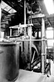
 Armitage Bridge Mills - steam engine - geograph.org.uk - 3337026.jpg 640 × 388; 71 KB
-
 Back from the dead - geograph.org.uk - 1344279.jpg 640 × 500; 56 KB
-
 Barker's Tannery, Otley - geograph.org.uk - 377368.jpg 431 × 640; 43 KB
-
 Barker's Tannery, Otley - geograph.org.uk - 659500.jpg 437 × 640; 43 KB
-
 Barn, Harp Lane, Queensbury (5596139274).jpg 3,862 × 2,688; 5.26 MB
-
 Batley Carr (GN) Station site of 1772328 a4783965.jpg 640 × 352; 95 KB
-
 Batley Cemetery (12662717423).jpg 3,370 × 4,213; 8.59 MB
-
 Batley Cemetery (12835427083).jpg 3,328 × 4,160; 7.49 MB
-
 Batley Cemetery (5547400534).jpg 3,000 × 3,858; 4.01 MB
-
 Batley Cemetery (5740641955).jpg 2,491 × 2,630; 2.49 MB
-
 Batley Cemetery (5740645753).jpg 2,251 × 3,782; 3.9 MB
-
 Batley Cemetery (5741193392).jpg 2,105 × 4,079; 3.17 MB
-
 Beam engine, Ledgard Bridge Mills - geograph.org.uk - 1112982.jpg 423 × 640; 65 KB
-
 Below Old Royd Lock, Rochdale Canal - geograph.org.uk - 398952.jpg 640 × 465; 101 KB
-

-
 Blackmoorfoot Reservoir 1960 - geograph.org.uk - 3014265.jpg 1,848 × 1,236; 564 KB
-
 Blackshaw Head, Yorkshire - geograph.org.uk - 648375.jpg 640 × 533; 80 KB
-
 Booth Wood Dam (B&W).jpg 1,024 × 773; 246 KB
-
 Bradford Exchange station, 1979 - geograph.org.uk - 560015.jpg 640 × 511; 111 KB
-
 Bradford Odeon 1938.jpg 299 × 284; 22 KB
-

-
 Bridge MDL 1-16 - George Street - geograph.org.uk - 903364.jpg 640 × 569; 229 KB
-
 Burgers, Curries; Cobblers (15236008917).jpg 3,282 × 2,626; 4.7 MB
-
 C and J Hirst, Sunnybank Mills - geograph.org.uk - 1046812.jpg 640 × 420; 73 KB
-
 Canal boating as a spectator-sport - geograph.org.uk - 1414589.jpg 640 × 572; 87 KB
-
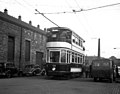
 Car No 180 at Golf House - geograph.org.uk - 1344326.jpg 640 × 465; 72 KB
-
 Car No 180 at Temple Newsam - geograph.org.uk - 1344305.jpg 518 × 640; 83 KB
-
 Cars do not stop by request - geograph.org.uk - 1336238.jpg 640 × 468; 29 KB
-
 Castleford Weir, River Aire - geograph.org.uk - 1637154.jpg 640 × 488; 68 KB
-
-
 Chapel, Batley Cemetery (12820460525).jpg 2,695 × 3,596; 4.27 MB
-
 Chapel, Warley Town (3307262726).jpg 1,920 × 2,280; 2.99 MB
-
-
 Churchyard Bottom, Heptonstall - geograph.org.uk - 512771.jpg 640 × 527; 101 KB
-
 City Square, Leeds - geograph.org.uk - 689696.jpg 640 × 558; 85 KB
-
-

-
 Clayton West station, Yorkshire - geograph.org.uk - 579819.jpg 640 × 533; 92 KB
-

-
 Corporation Mill, Sowerby Bridge - geograph.org.uk - 696116.jpg 640 × 622; 102 KB
-

-

-
 Cranberry Dam - geograph.org.uk - 1319713.jpg 640 × 502; 46 KB
-
 Cross Stone Church - geograph.org.uk - 668838.jpg 640 × 597; 67 KB
-
 Crossgates, Leeds - geograph.org.uk - 1325374.jpg 640 × 477; 54 KB
-
 Cullingworth - Baptist Sunday School 1898 - geograph.org.uk - 369373.jpg 640 × 621; 205 KB
-
 Cullingworth - small mill building - geograph.org.uk - 369352.jpg 560 × 640; 50 KB
-
 Cullingworth Mills - geograph.org.uk - 369394.jpg 635 × 589; 56 KB
-
 Cullingworth Mills - geograph.org.uk - 369397.jpg 636 × 610; 51 KB
-

-
 Dalton Mill (8172846582).jpg 2,873 × 2,611; 3.18 MB
-
 Dalton Mills (8183261188).jpg 2,321 × 2,321; 2.15 MB
-
 Denby Dale viaduct (explored) - Flickr - Shever ^ Kimmrs.jpg 5,184 × 3,456; 5.5 MB
-
 Denton Bridge, River Wharfe - geograph.org.uk - 579800.jpg 640 × 533; 160 KB
-

-
 Diesel railbus Oxenhope station Yorkshire.jpg 640 × 485; 112 KB
-

-

-
 Feltham car by the Corn Exchange - geograph.org.uk - 1330490.jpg 640 × 484; 62 KB
-

-
 Five Rise Locks, Bingley - geograph.org.uk - 721267.jpg 640 × 570; 114 KB
-

-
 Flints Reservoir - geograph.org.uk - 660916.jpg 640 × 544; 88 KB
-
 Former trolleybus turntable (2) - geograph.org.uk - 645435.jpg 640 × 544; 65 KB
-

-
 Forster Square station, Bradford - geograph.org.uk - 639184.jpg 640 × 558; 65 KB
-

-
 George Street Mills - geograph.org.uk - 402534.jpg 640 × 419; 52 KB
-
 Globe Mills, Slaithwaite - geograph.org.uk - 508253.jpg 640 × 369; 50 KB
-
 Goods Lane - Railway Street - geograph.org.uk - 1853884.jpg 640 × 480; 69 KB
-
 Halifax station - geograph.org.uk - 676080.jpg 640 × 564; 72 KB
-
 Halifax station - geograph.org.uk - 676087.jpg 640 × 518; 52 KB
-
 Halifax station - geograph.org.uk - 676091.jpg 640 × 546; 59 KB
-
 Halifax station, Up platform - geograph.org.uk - 676084.jpg 640 × 524; 66 KB
-
 Hall Green Chapel, Haworth (5482932832).jpg 2,757 × 2,763; 4.72 MB
-
 Hallas Hall Farm - geograph.org.uk - 372455.jpg 639 × 620; 62 KB
-
 Hanson House circa 1890 Normanton West Yorkshire.jpg 200 × 138; 9 KB
-
 Heath House Mill - geograph.org.uk - 403379.jpg 640 × 417; 33 KB
-
 Hebden Bridge, Yorkshire - geograph.org.uk - 465659.jpg 640 × 492; 91 KB
-
 Hebden Bridge, Yorkshire - geograph.org.uk - 466110.jpg 640 × 480; 87 KB
-
 Hebden Bridge, Yorkshire - geograph.org.uk - 466131.jpg 640 × 508; 126 KB
-
 Hebden Bridge, Yorkshire - geograph.org.uk - 627061.jpg 640 × 514; 95 KB
-
 Hebden Old Bridge - geograph.org.uk - 1507951.jpg 640 × 511; 71 KB
-
 Hebden Water below Gibson Mill - geograph.org.uk - 1395323.jpg 640 × 557; 116 KB
-
 Heckmondwyke, Yorkshire - geograph.org.uk - 645812.jpg 640 × 527; 73 KB
-
 Heptonstall bells 1912.jpg 720 × 480; 73 KB
-
 Heptonstall, Yorkshire - geograph.org.uk - 512739.jpg 640 × 521; 95 KB
-
 Hole Bottom Lane and 'The' chimney - geograph.org.uk - 656912.jpg 640 × 542; 71 KB
-
 Hollin Park near Denholme - geograph.org.uk - 372450.jpg 623 × 640; 114 KB
-
 Hollin Park near Denholme - geograph.org.uk - 372451.jpg 537 × 606; 67 KB
-

-
 Holme, West Yorkshire, Winter 1978.jpg 1,612 × 1,024; 1.29 MB
-
 Holmfirth, Yorkshire - geograph.org.uk - 411534.jpg 640 × 623; 102 KB
-
 Holmfirth, Yorkshire - geograph.org.uk - 620766.jpg 640 × 543; 73 KB
-
 Horsforth Mill and old corn mill - geograph.org.uk - 674245.jpg 640 × 538; 76 KB
-
 Horsforth station, looking north - geograph.org.uk - 671076.jpg 640 × 559; 59 KB
-
 Horsforth station, looking south - geograph.org.uk - 671079.jpg 640 × 548; 54 KB
-

-
 Huddersfield bus station - geograph.org.uk - 676062.jpg 640 × 490; 49 KB
-

-
 Huddersfield station - geograph.org.uk - 1588928.jpg 640 × 540; 89 KB
-
 Huddersfield station - geograph.org.uk - 1588934.jpg 640 × 533; 108 KB
-
 Huddersfield station - geograph.org.uk - 579815.jpg 640 × 478; 94 KB
-
 Huddersfield station - geograph.org.uk - 656745.jpg 640 × 537; 63 KB
-
 Huddersfield station - geograph.org.uk - 656761.jpg 640 × 534; 110 KB
-
 Huddersfield station - geograph.org.uk - 676040.jpg 640 × 509; 72 KB
-
 Huddersfield station - geograph.org.uk - 676050.jpg 640 × 507; 62 KB
-
 Huddersfield Station, eastward view with train, 1953 - geograph.org.uk - 4252683.jpg 2,334 × 1,552; 1.63 MB
-
 Huddersfield station, interior - geograph.org.uk - 579817.jpg 640 × 577; 136 KB
-
 Ilkley station - geograph.org.uk - 639169.jpg 640 × 527; 75 KB
-
 Joseph Hoyle, Prospect Mills - geograph.org.uk - 1046734.jpg 640 × 417; 71 KB
-

-

-

-

-
 Keighley station - geograph.org.uk - 636770.jpg 640 × 521; 70 KB
-
 Keighley station, Yorkshire - geograph.org.uk - 560775.jpg 640 × 511; 103 KB
-
 King Cross Street, Halifax (12193415855).jpg 2,390 × 1,593; 2.35 MB
-
 Kirkby Mill at South Kirkby, West Yorkshire, England.jpg 1,022 × 690; 686 KB
-
 Lad Stone Rock - geograph.org.uk - 1621478.jpg 640 × 513; 70 KB
-
 Lancashire and Yorkshire Railway Goods Shed, Halifax (8167790585).jpg 2,624 × 1,749; 2.26 MB
-

-
 Leeds (City) station in 1979 - geograph.org.uk - 560024.jpg 640 × 534; 101 KB
-

-

-

-
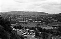
 Looking across to lidget green, Bradford West Yorkshire.jpg 2,520 × 1,680; 2.59 MB
-

-

-
 Looking west from Todmorden - geograph.org.uk - 689683.jpg 640 × 533; 65 KB
-
 Low Lane (7159921538).jpg 4,101 × 3,153; 5.66 MB
-

-
 Low Westwood Mills - geograph.org.uk - 508312.jpg 640 × 430; 50 KB
-
 Ludlam Street bus depot - geograph.org.uk - 657360.jpg 640 × 501; 59 KB
-
 Ludlam Street bus depot, Bradford - geograph.org.uk - 657351.jpg 640 × 537; 60 KB
-
 Ludlam Street bus depot, Bradford - geograph.org.uk - 657371.jpg 640 × 522; 59 KB
-
 Lumbutts village - geograph.org.uk - 661665.jpg 640 × 535; 63 KB
-

-

-
 Marsden station - geograph.org.uk - 641673.jpg 640 × 540; 70 KB
-
 Marsden station, Yorkshire - geograph.org.uk - 641670.jpg 640 × 522; 87 KB
-
 Michael Seatter.jpg 1,296 × 899; 202 KB
-
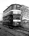
 Middleton Tram.jpg 640 × 489; 53 KB
-
 Middleton Woods (1) - geograph.org.uk - 1336282.jpg 640 × 467; 46 KB
-
 Middleton Woods (2) - geograph.org.uk - 1336294.jpg 640 × 482; 58 KB
-
 Middleton Woods (3) - geograph.org.uk - 1336322.jpg 640 × 524; 66 KB
-
 Middleton Woods (4) - geograph.org.uk - 1336349.jpg 640 × 477; 56 KB
-

-

-
 Mill, Cornholme (3360253117).jpg 2,443 × 1,803; 2.31 MB
-
 Mills to dust, Milnsbridge - geograph.org.uk - 1049429.jpg 640 × 423; 52 KB
-
 Milnsbridge - geograph.org.uk - 486378.jpg 414 × 640; 44 KB
-
 Milnsbridge - geograph.org.uk - 486388.jpg 640 × 432; 50 KB
-
 Milnsbridge from the "Pinfold" - geograph.org.uk - 486404.jpg 640 × 417; 57 KB
-
 Milnsbridge mills - geograph.org.uk - 402533.jpg 640 × 432; 61 KB
-
 Model engineers - geograph.org.uk - 719617.jpg 640 × 566; 86 KB
-

-
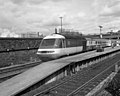
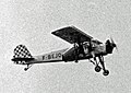 Morane MS.502 F-BEJQ YEA 30.05.55 edited-3.jpg 1,024 × 724; 632 KB
-
 Mytholmroyd station - geograph.org.uk - 660879.jpg 640 × 549; 79 KB
-
 National School, Haworth (5561729029).jpg 2,784 × 2,784; 5.59 MB
-
-
 Near Holme House - geograph.org.uk - 391300.jpg 640 × 588; 187 KB
-
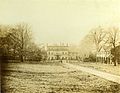 Newland Hall.jpeg 697 × 538; 78 KB
-
 No 602 at Thwaite Gate - geograph.org.uk - 1325129.jpg 640 × 504; 49 KB
-

-
-

-

-
 On the Briggate crossover - geograph.org.uk - 1330674.jpg 640 × 486; 90 KB
-
 On the street where I live (9248052807).jpg 2,242 × 2,242; 1.96 MB
-
 Otley bus station, Yorkshire - geograph.org.uk - 625415.jpg 640 × 538; 46 KB
-
 Over Wood, Hebden Dale, Yorkshire - geograph.org.uk - 321189.jpg 640 × 516; 125 KB
-
 Packhorse Bridge, Wakefield (3).jpg 3,024 × 4,032; 7.87 MB
-
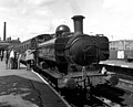 Pannier tank locomotive at Keighley - geograph.org.uk - 1544705.jpg 640 × 516; 67 KB
-
 Parkwood Mills - geograph.org.uk - 1046842.jpg 640 × 427; 48 KB
-
 Passing Parkside - geograph.org.uk - 1336207.jpg 640 × 469; 39 KB
-
 Pennine bus route - geograph.org.uk - 646706.jpg 640 × 536; 73 KB
-
 Preparing to leave Beza Road, Leeds - against the sunlight (29343290804).jpg 4,608 × 1,908; 3.23 MB


.jpg)


.jpg)
.jpg)


.jpg)
_Station_site_of_1772328_a4783965.jpg)
.jpg)
.jpg)
.jpg)
.jpg)
.jpg)
.jpg)


.jpg)


.jpg)


.jpg)
.jpg)


.jpg)
.jpg)
_-_Flickr_-_Shever_%5E_Kimmrs.jpg)


_-_geograph.org.uk_-_645435.jpg)


.jpg)


.jpg)


.jpg)

_station_in_1979_-_geograph.org.uk_-_560024.jpg)

_-_geograph.org.uk_-_660835.jpg)


.jpg)


_-_geograph.org.uk_-_1336282.jpg)
_-_geograph.org.uk_-_1336294.jpg)
_-_geograph.org.uk_-_1336322.jpg)
_-_geograph.org.uk_-_1336349.jpg)


.jpg)


.jpg)


.jpg)


.jpg)


.jpg)