Category:Aerial photographs of Utrecht (province)
Jump to navigation
Jump to search
Provinces of the Netherlands: Drenthe · Flevoland · Friesland · Gelderland · Groningen · Limburg · North Brabant · North Holland · Overijssel · South Holland · Utrecht · Zeeland
Subcategories
This category has the following 21 subcategories, out of 21 total.
A
- Aerial photographs of Amersfoort (72 F)
B
H
L
M
- Aerial photographs of Montfoort (21 F)
O
- Aerial photographs of Oudewater (17 F)
R
- Aerial photographs of Rhenen (61 F)
S
U
V
W
- Aerial photographs of Woerden (16 F)
Z
Media in category "Aerial photographs of Utrecht (province)"
The following 94 files are in this category, out of 94 total.
-
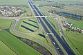 Aansluiting A2 Everdingen.jpg 3,888 × 2,592; 7.31 MB
-
 Aerial photograph of Winkeloord 7 FEB 2019 -1.jpg 5,472 × 3,080; 2.42 MB
-
 BaambrugseZuweSEP2017.jpg 3,535 × 2,435; 1.96 MB
-
 Luchtfoto - Botshol - 20038841 - RCE.jpg 3,072 × 3,072; 3.45 MB
-
 Luchtfoto - Botshol - 20038842 - RCE.jpg 1,197 × 1,200; 349 KB
-
 Luchtfoto - Botshol - 20038843 - RCE.jpg 1,195 × 1,200; 326 KB
-
 NIMH - 2011 - 0890 - Aerial photograph of Fort Botshol, The Netherlands - 1920 - 1940.jpg 3,500 × 2,551; 2.43 MB
-
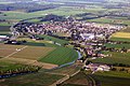 Cothen.air.jpg 2,766 × 1,845; 4.08 MB
-
 EembruggeJUL2017.jpg 5,095 × 2,787; 2.92 MB
-
 EemdijkJUL2017.jpg 4,676 × 2,689; 2.87 MB
-
 GooiseAtletiekClubJul2017.jpg 5,472 × 3,080; 3.9 MB
-
 T.goy.luchtfoto.jpg 3,072 × 2,304; 1.86 MB
-
 Boerderij - Helsdingen - 20498634 - RCE.jpg 1,200 × 900; 253 KB
-
 Hoograven Utrecht Netherlands RG373 AERIALFILM D6000 ON215228 US7GR 3283 4072 01.jpg 3,030 × 2,963; 3.5 MB
-
 Hydro power in the River Rhine in Holland (9659091328).jpg 2,657 × 3,986; 752 KB
-
 NIMH - 2011 - 0647 - Aerial photograph of IJsselstein, The Netherlands - 1920 - 1940.jpg 3,500 × 2,560; 1.9 MB
-
 NIMH - 2155 009756 - Aerial photograph of IJsselstein, The Netherlands.jpg 3,520 × 2,396; 1.77 MB
-
 NIMH - 2155 009757 - Aerial photograph of IJsselstein, The Netherlands.jpg 3,520 × 2,433; 2.27 MB
-
 NIMH - 2155 009758 - Aerial photograph of IJsselstein, The Netherlands.jpg 3,520 × 2,474; 1.92 MB
-
 Luchtfoto ID404594.jpg 3,646 × 2,505; 3.24 MB
-
 Luchtfoto's - Amstelhoek - 20010643 - RCE.jpg 1,197 × 1,200; 384 KB
-
 Luchtfoto's - Amstelhoek - 20010644 - RCE.jpg 1,195 × 1,200; 361 KB
-
 Luchtfoto's - Amstelhoek - 20010645 - RCE.jpg 1,200 × 1,200; 347 KB
-
 Aerial photo of De Meije.jpg 3,204 × 2,173; 2.04 MB
-
 Nieuwer-TerAa-SEP2017.jpg 2,141 × 1,645; 905 KB
-
 NIMH - 2011 - 0076 - Aerial photograph of Bunschoten, The Netherlands - 1920 - 1940.jpg 3,500 × 2,586; 1.46 MB
-
 NIMH - 2011 - 0489 - Aerial photograph of Spakenburg, The Netherlands - 1920 - 1940.jpg 3,500 × 2,543; 1.92 MB
-
 NIMH - 2011 - 0491 - Aerial photograph of Spakenburg, The Netherlands - 1920 - 1940.jpg 3,500 × 2,523; 2.07 MB
-
 NIMH - 2011 - 0576 - Aerial photograph of Vreeland, The Netherlands - 1920 - 1940.jpg 3,500 × 2,540; 2.17 MB
-
-
 NIMH - 2011 - 0578 - Aerial photograph of Vreeswijk, The Netherlands - 1920 - 1940.jpg 3,500 × 2,537; 1.67 MB
-
 NIMH - 2011 - 0579 - Aerial photograph of Vreeswijk, The Netherlands - 1920 - 1940.jpg 3,500 × 2,557; 2.19 MB
-
 NIMH - 2011 - 0580 - Aerial photograph of Vreeswijk, The Netherlands - 1920 - 1940.jpg 2,551 × 3,496; 1.53 MB
-

-
-
 NIMH - 2011 - 0850 - Aerial photograph of Nijenrode, The Netherlands - 1920 - 1940.jpg 3,500 × 2,526; 2.46 MB
-
 NIMH - 2011 - 0851 - Aerial photograph of Nijenrode, The Netherlands - 1920 - 1940.jpg 3,500 × 2,527; 2.33 MB
-

-
 NIMH - 2011 - 0923 - Aerial photograph of Gagel, The Netherlands - 1920 - 1940.jpg 3,500 × 2,540; 1.74 MB
-
 NIMH - 2011 - 0924 - Aerial photograph of Gein, The Netherlands - 1920 - 1940.jpg 3,500 × 2,550; 1.59 MB
-

-

-

-
 NIMH - 2011 - 0937 - Aerial photograph of Groeneweg, The Netherlands - 1920 - 1940.jpg 3,500 × 2,541; 1.82 MB
-
 NIMH - 2011 - 0938 - Aerial photograph of Groeneweg, The Netherlands - 1920 - 1940.jpg 3,500 × 2,577; 2.21 MB
-

-

-

-

-

-

-

-

-
-
 NIMH - 2011 - 1076 - Aerial photograph of Fort Ruigenhoek, The Netherlands - 1920 - 1940.jpg 3,500 × 2,574; 2.35 MB
-

-
 NIMH - 2011 - 1115 - Aerial photograph of Tienhoven, The Netherlands - 1920 - 1940.jpg 3,500 × 2,554; 1.28 MB
-
 NIMH - 2011 - 1141 - Aerial photograph of Voordorp, The Netherlands - 1920 - 1940.jpg 3,500 × 2,551; 1.87 MB
-
 NIMH - 2011 - 1142 - Aerial photograph of Voordorp, The Netherlands - 1920 - 1940.jpg 3,500 × 2,550; 1.68 MB
-
 NIMH - 2011 - 1143 - Aerial photograph of Voordorp, The Netherlands - 1920 - 1940.jpg 3,500 × 2,522; 1.58 MB
-
 NIMH - 2155 005326 - Aerial photograph of Werk aan de Overeindseweg, The Netherlands.jpg 3,520 × 2,472; 2.49 MB
-
 NIMH - 2155 010774 - Aerial photograph of Neerlangbroek, The Netherlands.jpg 4,094 × 2,805; 1.81 MB
-
 NIMH - 2155 032586 - Aerial photograph of Sandenburg, The Netherlands.jpg 3,508 × 2,429; 1.64 MB
-
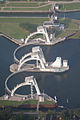
 Prinses Irenesluizen in het Amsterdam-Rijnkanaal.jpg 10,362 × 5,910; 40.99 MB
-
 PrinsesIrenesluizen.WijkBijDuurstede.jpg 3,072 × 2,304; 1.53 MB
-

-
 Slagenlandschap.JPG 1,817 × 1,158; 523 KB
-
 Steenfabriek IJsseloord 1936 luchtfoto.jpg 659 × 439; 56 KB
-
-
 Teckop-jul2017.jpg 5,276 × 3,043; 2.43 MB
-
 UFO air strip (29646824180).jpg 3,888 × 2,592; 6.13 MB
-
 Utrecht-AmsterdamrijnkanaalJul2017.jpg 5,472 × 3,080; 3.37 MB
-
 Utrecht-jul2017-1.jpg 5,075 × 2,653; 2.37 MB
-
 Vinkeveense Plassen aerial photograph.jpg 3,600 × 2,835; 5.92 MB
-
 Vinkeveense plassen luchtfoto 2018.jpg 3,548 × 1,832; 1.98 MB
-
 Vleuten-JUL2017.jpg 5,058 × 2,533; 2.52 MB
-

-

-
-

-

-

-

-

-
 Voorgevel. Luchtfoto Holland nr. 2048-26. - Renswoude - 20481234 - RCE.jpg 1,200 × 900; 165 KB
-
 VreelandSEP2017.jpg 2,184 × 1,686; 837 KB
-
 Wickenburgh Estate, 't Goy, NL.jpg 4,659 × 3,105; 1.52 MB
-
 Woning 2050-3 LUCHTFOTO HOLLAND - Achterveld - 20481284 - RCE.jpg 1,200 × 900; 207 KB
-

-

-

-
-
-


.jpg)


.jpg)


._Luchtfoto_Holland_nr._2048-28._-_Renswoude_-_20481235_-_RCE.jpg)
._Luchtfoto_Holland_nr._2048-30._-_Renswoude_-_20481237_-_RCE.jpg)


._Luchtfoto_Holland_nr._2048-37._-_Renswoude_-_20481240_-_RCE.jpg)


