Category:Aerial photographs of Utrecht (city)
Jump to navigation
Jump to search
Subcategories
This category has the following 5 subcategories, out of 5 total.
Media in category "Aerial photographs of Utrecht (city)"
The following 168 files are in this category, out of 168 total.
-
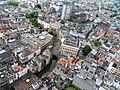 DomtorenUitzichtIn2009.jpg 2,816 × 2,112; 2.01 MB
-
 Domuitzicht1.jpg 2,592 × 1,944; 1.27 MB
-
 Domuitzicht10.jpg 2,592 × 1,944; 1.23 MB
-
 Domuitzicht11.jpg 2,592 × 1,944; 1.27 MB
-
 Domuitzicht3.jpg 2,592 × 1,944; 1.36 MB
-
 Domuitzicht6.jpg 2,592 × 1,944; 1.41 MB
-
 Domuitzicht7.jpg 2,592 × 1,944; 979 KB
-
 Domuitzicht8.jpg 2,592 × 1,944; 1.16 MB
-
 ETH-BIB-Utrecht-Inlandflüge-LBS MH01-006277.tif 6,757 × 4,520; 87.53 MB
-
 FCUtrechtstadion.jpg 700 × 524; 65 KB
-
 Galgenwaard vanuit de lucht.jpg 2,760 × 1,887; 2.82 MB
-
 Gemeentelijke Gasfabriek in Utrecht.jpg 540 × 371; 57 KB
-
 Holland Casino & Parking at Jaarbeurs, Utrecht (10759014354).jpg 3,590 × 5,385; 2.05 MB
-
 Hoogcatharijne-eo-jul2017.jpg 5,048 × 2,808; 3.34 MB
-
 KnOudenrijn1997.jpg 600 × 450; 49 KB
-
 Luchtfoto haven Utrecht 1990 X36669 - L4436.jpg 3,915 × 3,237; 8.5 MB
-
 Luchtfoto Noordzijde 1e Daalsebuurt 1980.jpg 1,032 × 581; 396 KB
-
 Luchtfoto van Buiten Wittevrouwen Utrecht HUA-85349.jpg 1,979 × 1,554; 835 KB
-
 Luchtfoto van De Inktpot in Utrecht.jpg 539 × 371; 67 KB
-
 Luchtfoto van de jaarbeurs, met lokaties, park en rivier, SFA022807788.jpg 3,542 × 2,397; 1.4 MB
-
 Luchtfoto van de jaarbeursgebouwen, SFA022807789.jpg 3,542 × 2,397; 1.3 MB
-
 Luchtfoto van de jaarbeurslokaties, SFA022807786.jpg 3,543 × 2,385; 1.4 MB
-

-
 Luchtfoto van de paviljoens van de jaarbeurs aan de Maliebaan, SFA022807790.jpg 3,515 × 2,370; 1.47 MB
-
 Luchtfoto van de wijk Buiten Wittevrouwen te Utrecht - HUA-44133.jpg 3,934 × 3,925; 4.13 MB
-
 Luchtfoto van de wijk Wittevrouwen te Utrecht - HUA-85341.jpg 3,588 × 2,935; 6.68 MB
-
 Luchtfoto van een gedeelte van de wijk Wittevrouwen te Utrecht - HUA-85339.jpg 3,579 × 2,957; 6.34 MB
-
 Luchtfoto van het 24 Oktoberplein, Utrecht, 1983.jpg 3,666 × 3,042; 5.86 MB
-
 Luchtfoto van het Lucasbolwerk en omgeving te Utrecht - HUA-26352.jpg 1,762 × 1,063; 325 KB
-
 Luchtfoto veemarkthallen Utrecht 25-06-1999.jpg 5,334 × 4,403; 2.75 MB
-
 Luchtfoto Wittevrouwen Utrecht HUA-118163.jpg 3,574 × 2,937; 6.71 MB
-
 NIMH - 2011 - 0515 - Aerial photograph of Utrecht, The Netherlands - 1920 - 1940.jpg 3,500 × 2,537; 2.76 MB
-
 NIMH - 2011 - 0516 - Aerial photograph of Utrecht, The Netherlands - 1920 - 1940.jpg 3,500 × 2,528; 2.42 MB
-
 NIMH - 2011 - 0517 - Aerial photograph of Utrecht, The Netherlands - 1920 - 1940.jpg 3,500 × 2,528; 2.41 MB
-
 NIMH - 2011 - 0518 - Aerial photograph of Utrecht, The Netherlands - 1920 - 1940.jpg 3,500 × 2,528; 2.22 MB
-
 NIMH - 2011 - 0519 - Aerial photograph of Utrecht, The Netherlands - 1920 - 1940.jpg 3,500 × 2,545; 2.25 MB
-
 NIMH - 2011 - 0520 - Aerial photograph of Utrecht, The Netherlands - 1920 - 1940.jpg 3,500 × 2,541; 2.58 MB
-
 NIMH - 2011 - 0521 - Aerial photograph of Utrecht, The Netherlands - 1920 - 1940.jpg 3,500 × 2,511; 2.81 MB
-
 NIMH - 2011 - 0522 - Aerial photograph of Utrecht, The Netherlands - 1920 - 1940.jpg 3,500 × 2,501; 2.77 MB
-
 NIMH - 2011 - 0523 - Aerial photograph of Utrecht, The Netherlands - 1920 - 1940.jpg 3,500 × 2,558; 2.18 MB
-
 NIMH - 2011 - 0524 - Aerial photograph of Utrecht, The Netherlands - 1920 - 1940.jpg 3,500 × 2,576; 2.13 MB
-
 NIMH - 2011 - 0525 - Aerial photograph of Utrecht, The Netherlands - 1920 - 1940.jpg 3,500 × 2,548; 2.22 MB
-
 NIMH - 2011 - 0526 - Aerial photograph of Utrecht, The Netherlands - 1920 - 1940.jpg 3,500 × 2,531; 2.83 MB
-
 NIMH - 2011 - 0527 - Aerial photograph of Utrecht, The Netherlands - 1920 - 1940.jpg 3,500 × 2,541; 2.37 MB
-
 NIMH - 2011 - 0528 - Aerial photograph of Utrecht, The Netherlands - 1920 - 1940.jpg 3,500 × 2,540; 1.88 MB
-
 NIMH - 2011 - 0529 - Aerial photograph of Utrecht, The Netherlands - 1920 - 1940.jpg 3,500 × 2,535; 2.45 MB
-
 NIMH - 2011 - 0530 - Aerial photograph of Utrecht, The Netherlands - 1920 - 1940.jpg 3,500 × 2,547; 2.81 MB
-
 NIMH - 2011 - 0531 - Aerial photograph of Utrecht, The Netherlands - 1920 - 1940.jpg 3,500 × 2,515; 2.74 MB
-
 NIMH - 2011 - 0532 - Aerial photograph of Utrecht, The Netherlands - 1920 - 1940.jpg 3,500 × 2,521; 2.55 MB
-
 NIMH - 2011 - 0786 - Aerial photograph of Utrecht, The Netherlands - 1920 - 1940.jpg 3,500 × 2,593; 1.84 MB
-
 NIMH - 2011 - 0787 - Aerial photograph of Utrecht, The Netherlands - 1920 - 1940.jpg 3,500 × 2,576; 1.96 MB
-
 NIMH - 2011 - 0788 - Aerial photograph of Utrecht, The Netherlands - 1920 - 1940.jpg 3,500 × 2,598; 2.53 MB
-
 NIMH - 2011 - 0789 - Aerial photograph of Utrecht, The Netherlands - 1920 - 1940.jpg 3,500 × 2,563; 2.03 MB
-
 NIMH - 2011 - 0790 - Aerial photograph of Utrecht, The Netherlands - 1920 - 1940.jpg 3,500 × 2,564; 2.38 MB
-
 NIMH - 2011 - 3666 - Aerial photograph of Utrecht, The Netherlands.jpg 3,500 × 2,540; 2.02 MB
-
 NIMH - 2011 - 3677 - Aerial photograph of Utrecht, The Netherlands.jpg 3,500 × 2,657; 2.45 MB
-
 NIMH - 2011 - 3690 - Aerial photograph of Utrecht, The Netherlands.jpg 3,500 × 2,509; 1.77 MB
-
 NIMH - 2011 - 3732 - Aerial photograph of Fort Vossegat, The Netherlands.jpg 3,500 × 2,775; 2.28 MB
-
 NIMH - 2011 - 4994 - Aerial photograph of Utrecht, The Netherlands.jpg 3,500 × 2,428; 2.21 MB
-
 NIMH - 2011 - 4995 - Aerial photograph of Utrecht, The Netherlands.jpg 3,500 × 3,480; 2.44 MB
-
 NIMH - 2011 - 5250 - Aerial photograph of Utrecht, The Netherlands.jpg 4,000 × 2,894; 3.03 MB
-
 NIMH - 2011 - 5251 - Aerial photograph of Utrecht, The Netherlands.jpg 4,000 × 2,656; 2.44 MB
-
 NIMH - 2011 - 5252 - Aerial photograph of Utrecht, The Netherlands.jpg 4,000 × 2,889; 2 MB
-
 NIMH - 2011 - 5253 - Aerial photograph of Utrecht, The Netherlands.jpg 4,000 × 2,735; 2.03 MB
-
 NIMH - 2011 - 5254 - Aerial photograph of Utrecht, The Netherlands.jpg 4,000 × 2,863; 2.9 MB
-
 NIMH - 2011 - 5255 - Aerial photograph of Utrecht, The Netherlands.jpg 4,000 × 2,745; 2.91 MB
-
 NIMH - 2011 - 5256 - Aerial photograph of Utrecht, The Netherlands.jpg 4,000 × 2,818; 2.25 MB
-
 NIMH - 2011 - 5257 - Aerial photograph of Utrecht, The Netherlands.jpg 4,000 × 2,643; 1.88 MB
-
 NIMH - 2011 - 5400 - Aerial photograph of Utrecht, The Netherlands.jpg 4,000 × 2,755; 2.18 MB
-
 NIMH - 2011 - 9015 - Aerial photograph of Utrecht, The Netherlands.jpg 4,000 × 3,211; 3.66 MB
-
 NIMH - 2011 - 9051 - Aerial photograph of Utrecht, The Netherlands.jpg 4,000 × 3,147; 4.38 MB
-
 NIMH - 2011 - 9052 - Aerial photograph of Utrecht, The Netherlands.jpg 4,000 × 3,173; 3.72 MB
-
 NIMH - 2011 - 9053 - Aerial photograph of Utrecht, The Netherlands.jpg 4,000 × 3,212; 4.81 MB
-
 NIMH - 2011 - 9054 - Aerial photograph of Utrecht, The Netherlands.jpg 4,000 × 3,212; 4.04 MB
-
 NIMH - 2011 - 9055 - Aerial photograph of Utrecht, The Netherlands.jpg 4,000 × 3,124; 3.59 MB
-
 NIMH - 2011 - 9056 - Aerial photograph of Utrecht, The Netherlands.jpg 4,000 × 3,166; 3.74 MB
-
 NIMH - 2011 - 9057 - Aerial photograph of Utrecht, The Netherlands.jpg 4,000 × 3,232; 3.43 MB
-
 NIMH - 2011 - 9901-008 - Aerial photograph of Utrecht, The Netherlands.jpg 4,000 × 2,724; 3.5 MB
-
 NIMH - 2011 - 9902-07-02 - Aerial photograph of Utrecht, The Netherlands.jpg 4,000 × 2,868; 2.29 MB
-
 NIMH - 2011 - 9903-02-04 - Aerial photograph of Utrecht, The Netherlands.jpg 4,000 × 2,849; 1.97 MB
-
 NIMH - 2011 - 9903-11-03 - Aerial photograph of Utrecht, The Netherlands.jpg 4,000 × 2,736; 1.88 MB
-
 NIMH - 2011 - 9903-11-04 - Aerial photograph of Utrecht, The Netherlands.jpg 4,000 × 2,694; 2.06 MB
-
 NIMH - 2011 - 9903-13-02 - Aerial photograph of Utrecht, The Netherlands.jpg 4,000 × 2,688; 2.76 MB
-
 NIMH - 2011 - 9903-19-01 - Aerial photograph of Utrecht, The Netherlands.jpg 4,000 × 2,767; 2 MB
-
 NIMH - 2011 - 9903-20-01 - Aerial photograph of Utrecht, The Netherlands.jpg 4,000 × 2,732; 2.04 MB
-
 NIMH - 2155 005261 - Aerial photograph of Utrecht, Fort 't Hemeltje, The Netherlands.jpg 2,454 × 3,520; 2.24 MB
-

-
 NIMH - 2155 005290 - Aerial photograph of Utrecht, Fort Ruigenhoek, The Netherlands.jpg 3,520 × 2,493; 2.54 MB
-
 NIMH - 2155 005291 - Aerial photograph of Utrecht, Fort Voordorp, The Netherlands.jpg 3,520 × 2,411; 2.39 MB
-

-
 NIMH - 2155 005295 - Aerial photograph of Utrecht, Fort Blauwkapel, The Netherlands.jpg 3,520 × 2,396; 2.32 MB
-
 NIMH - 2155 005297 - Aerial photograph of Utrecht, Fort de Klop, The Netherlands.jpg 3,520 × 2,359; 2.04 MB
-
 NIMH - 2155 005298 - Aerial photograph of Utrecht, Fort de Gagel, The Netherlands.jpg 3,520 × 2,537; 2.3 MB
-
 NIMH - 2155 005302 - Aerial photograph of Utrecht, Fort de Gagel, The Netherlands.jpg 3,520 × 2,210; 1.99 MB
-
 NIMH - 2155 005324 - Aerial photograph of Utrecht, Lunetten, The Netherlands.jpg 3,520 × 2,381; 2.05 MB
-
 NIMH - 2155 005348 - Aerial photograph of Utrecht, Fort Blauwkapel, The Netherlands.jpg 3,520 × 2,419; 2.19 MB
-

-
-
-

-

-

-

-
 NIMH - 2155 005356 - Aerial photograph of Utrecht, The Netherlands.jpg 3,520 × 3,500; 3.04 MB
-
 NIMH - 2155 005357 - Aerial photograph of Utrecht, The Netherlands.jpg 3,520 × 3,224; 2.69 MB
-
 NIMH - 2155 005358 - Aerial photograph of Utrecht, The Netherlands.jpg 3,520 × 2,402; 1.93 MB
-
 NIMH - 2155 005359 - Aerial photograph of Utrecht, Fort Vossegat, The Netherlands.jpg 3,520 × 2,408; 2.31 MB
-
 NIMH - 2155 005374 - Aerial photograph of Utrecht, Fort Blauwkapel, The Netherlands.jpg 3,520 × 2,520; 2.73 MB
-
 NIMH - 2155 005392 - Aerial photograph of Utrecht, Fort Blauwkapel, The Netherlands.jpg 3,520 × 2,373; 2.39 MB
-
 NIMH - 2155 005399 - Aerial photograph of Utrecht, Fort Vossegat, The Netherlands.jpg 3,520 × 2,439; 1.95 MB
-
 NIMH - 2155 005400 - Aerial photograph of Utrecht, Fort Vossegat, The Netherlands.jpg 3,520 × 2,407; 2.47 MB
-
 NIMH - 2155 005401 - Aerial photograph of Utrecht, Fort Vossegat, The Netherlands.jpg 3,520 × 2,532; 2.18 MB
-
 NIMH - 2155 005402 - Aerial photograph of Utrecht, Fort Vossegat, The Netherlands.jpg 3,520 × 2,428; 2.52 MB
-
 NIMH - 2155 005403 - Aerial photograph of Utrecht, Fort Vossegat, The Netherlands.jpg 3,520 × 2,480; 1.97 MB
-
 NIMH - 2155 011969 - Aerial photograph of Fort Vossegat, The Netherlands.jpg 3,520 × 2,397; 1.74 MB
-
 NIMH - 2155 011970 - Aerial photograph of Kromhoutkazerne, Utrecht, The Netherlands.jpg 3,520 × 2,407; 1.81 MB
-
 NIMH - 2155 011971 - Aerial photograph of Fort Vossegat, Utrecht, The Netherlands.jpg 3,520 × 2,439; 1.94 MB
-
 NIMH - 2155 011972 - Aerial photograph of Fort Vossegat, The Netherlands.jpg 3,520 × 2,456; 1.76 MB
-
 NIMH - 2155 013877 - Aerial photograph of Utrecht, The Netherlands.jpg 3,520 × 2,460; 2.1 MB
-
 NIMH - 2155 042900 - Aerial photograph of Utrecht, The Netherlands.jpg 4,919 × 3,532; 3.91 MB
-
 NIMH - 2155 042901 - Aerial photograph of Utrecht, The Netherlands.jpg 4,919 × 3,571; 3.44 MB
-
 NIMH - 2155 042902 - Aerial photograph of Utrecht, The Netherlands.jpg 4,899 × 3,571; 3.4 MB
-
 NIMH - 2155 042903 - Aerial photograph of Utrecht, The Netherlands.jpg 5,368 × 3,591; 4.96 MB
-
 NIMH - 2155 042904 - Aerial photograph of Utrecht, The Netherlands.jpg 5,153 × 3,532; 4.32 MB
-
 NIMH - 2155 042905 - Aerial photograph of Utrecht, The Netherlands.jpg 5,192 × 3,571; 4.57 MB
-
 NIMH - 2155 042906 - Aerial photograph of Utrecht, The Netherlands.jpg 5,368 × 3,688; 6.06 MB
-
 NIMH - 2155 042909 - Aerial photograph of Utrecht, The Netherlands.jpg 5,133 × 3,571; 4.08 MB
-
 NIMH - 2155 042911 - Aerial photograph of Utrecht, The Netherlands.jpg 5,036 × 3,591; 3.54 MB
-
 NIMH - 2155 042912 - Aerial photograph of Utrecht, The Netherlands.jpg 4,762 × 3,669; 4.22 MB
-
 NIMH - 2155 042913 - Aerial photograph of Utrecht, The Netherlands.jpg 5,192 × 3,552; 4.22 MB
-
 NIMH - 2155 042914 - Aerial photograph of Utrecht, The Netherlands.jpg 5,231 × 3,630; 3.88 MB
-
 NIMH - 2155 042915 - Aerial photograph of Utrecht, The Netherlands.jpg 4,762 × 3,669; 4.27 MB
-

-

-

-
 NIMH - 2155 079892 - Aerial photograph of Utrecht, The Netherlands.jpg 3,467 × 4,000; 3.62 MB
-
 Oudegracht (Dom).jpg 1,024 × 768; 556 KB
-
 Overzicht van af de Watertoren naar het zuid-westen - Utrecht - 20212221 - RCE.jpg 1,196 × 1,200; 392 KB
-
 Overzicht van af de Watertoren naar het zuiden - Utrecht - 20212225 - RCE.jpg 1,200 × 1,189; 306 KB
-
 Overzicht van af de Watertoren naar het zuiden - Utrecht - 20212226 - RCE.jpg 1,200 × 1,198; 442 KB
-

-
 Protonhaven Utrecht 1961 X151957 - 44476.jpg 5,669 × 4,181; 1.92 MB
-
 Rondvlucht02.jpg 1,257 × 989; 374 KB
-
 RondvluchtVoordorp00.jpg 1,525 × 1,161; 472 KB
-
 RondvluchtVoordorp01.jpg 1,505 × 1,165; 437 KB
-
 RondvluchtVoordorp03.jpg 1,713 × 1,173; 635 KB
-
 Roundabout Utrecht Lunetten, Holland. I drive here almost every day. (10759200233).jpg 5,616 × 3,744; 2.66 MB
-
 Utrecht - deel Oudegracht vanaf Domtoren gezien.jpg 700 × 524; 160 KB
-
 Utrecht at night.jpg 2,492 × 1,661; 1.04 MB
-
 Utrecht binnenstad.jpg 2,048 × 1,536; 618 KB
-
 Utrecht Canals Aerial View - July 2006.jpg 4,172 × 5,553; 7.61 MB
-
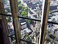
 Utrecht Domuitzicht A.jpg 2,636 × 2,628; 1.28 MB
-
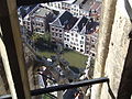
 Utrecht Domuitzicht B.jpg 2,630 × 2,589; 1.37 MB
-
 Utrecht University.jpg 4,000 × 2,209; 1.43 MB
-
 Utrecht, centrum met de Dom RM35973 RM36075 RM36077 foto1 2014-03-09 11.41.jpg 3,571 × 2,647; 8.39 MB
-
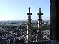
 View from the Dom Utrecht 03May14 1.jpg 1,900 × 2,539; 1.15 MB
-
 View from the Dom Utrecht 03May14 2.jpg 1,944 × 2,592; 1.9 MB
-
 Watching FC-Utrecht (10654329614) (cropped).jpg 806 × 1,026; 172 KB
-
 Watching FC-Utrecht (10654329614).jpg 1,977 × 1,318; 296 KB
-
 WW17-105 (33556254630).jpg 3,744 × 5,616; 12.47 MB
-
 WW17-106 (33097991984).jpg 3,744 × 5,616; 13.33 MB
-
 WW17-107 (33097993694).jpg 5,291 × 3,527; 10.62 MB
-
 WW17-109 (33097995604).jpg 4,801 × 3,201; 11.97 MB
-
 WW17-112 (33097998564).jpg 3,648 × 5,472; 15.53 MB
-
 WW17-113 (33098000594).jpg 2,071 × 1,381; 2.11 MB
-
 WW17-114 (33098002064).jpg 5,616 × 3,744; 14.72 MB
-
 WW17-114-2 (33098003184).jpg 1,092 × 729; 745 KB
-
 WW17-123 (33098004194).jpg 2,946 × 1,964; 4.03 MB


.jpg)


.jpg)


.jpg)


_(cropped).jpg)
.jpg)
.jpg)
.jpg)
.jpg)
.jpg)
.jpg)
.jpg)
.jpg)
.jpg)
.jpg)