Category:Aerial photographs of Falkirk council area
Jump to navigation
Jump to search
Council areas (municipalities) of Scotland: Aberdeen · Aberdeenshire · Angus · Argyll and Bute · Clackmannanshire · Dumfries and Galloway · Dundee · East Ayrshire · East Dunbartonshire · East Lothian · East Renfrewshire · Edinburgh · Falkirk · Fife · Glasgow · Highland · Inverclyde · Midlothian · Moray · North Ayrshire · North Lanarkshire · Outer Hebrides · Orkney Islands · Perth and Kinross · Renfrewshire · Scottish Borders · Shetland Islands · South Ayrshire · South Lanarkshire · Stirling · West Dunbartonshire · West Lothian
Subcategories
This category has only the following subcategory.
Media in category "Aerial photographs of Falkirk council area"
The following 12 files are in this category, out of 12 total.
-
 Avon Aqueduct alt1.jpg 4,000 × 2,250; 8.43 MB
-
 Avon Aqueduct alt2.jpg 4,000 × 2,250; 8.55 MB
-
 Avon Aqueduct alt3.jpg 4,000 × 2,250; 8.95 MB
-
 Avon Aqueduct.jpg 4,000 × 2,250; 6.04 MB
-
 Falkirk Wheel from the air - geograph.org.uk - 282517.jpg 640 × 479; 78 KB
-
 Grangemouth from the air (geograph 5222112).jpg 640 × 302; 118 KB
-
 Grangemouth from the air (geograph 6401853).jpg 1,024 × 456; 225 KB
-
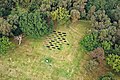 Lilia at Rough Castle.jpg 2,111 × 1,407; 3.43 MB
-
 Rough Castle Falkirk Aerial.jpg 4,000 × 2,250; 6.36 MB
-
 Scotland-2016-Aerial-Stirlingshire-Dunmore House.jpg 5,238 × 3,492; 15.71 MB
-
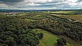
 The Forth Valley near Alloa - geograph.org.uk - 723980.jpg 640 × 433; 48 KB
-
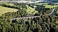
 Westfield and viaduct over the River Avon - geograph.org.uk - 2105946.jpg 2,048 × 1,536; 1.35 MB


.jpg)
.jpg)


