Category:Aerial photographs of Dumfries and Galloway
Jump to navigation
Jump to search
Council areas (municipalities) of Scotland: Aberdeen · Aberdeenshire · Angus · Argyll and Bute · Clackmannanshire · Dumfries and Galloway · Dundee · East Ayrshire · East Dunbartonshire · East Lothian · East Renfrewshire · Edinburgh · Falkirk · Fife · Glasgow · Highland · Inverclyde · Midlothian · Moray · North Ayrshire · North Lanarkshire · Outer Hebrides · Orkney Islands · Perth and Kinross · Renfrewshire · Scottish Borders · Shetland Islands · South Ayrshire · South Lanarkshire · Stirling · West Dunbartonshire · West Lothian
Media in category "Aerial photographs of Dumfries and Galloway"
The following 12 files are in this category, out of 12 total.
-
 0715 Solway Firth Wind Farm - geograph.org.uk - 1832458.jpg 1,024 × 768; 22 KB
-
 Caerlaverock Castle from the air 1.jpeg 640 × 550; 121 KB
-
 Caerlaverock Castle from the air.jpg 1,100 × 840; 166 KB
-
 Corehead Farm below the Devils Beeftub - geograph.org.uk - 194598.jpg 640 × 480; 106 KB
-
 Drumlanrig Castle 2017.jpg 4,000 × 2,250; 2.91 MB
-
 Dumfries and Galloway - Balmaghie Parish Church And Churchyard - 20220908105717.jpg 4,000 × 3,000; 6.92 MB
-
 Loch Ryan..jpg 3,264 × 2,448; 2.07 MB
-
 North Glen (mid sixties) - geograph.org.uk - 1285752.jpg 640 × 435; 374 KB
-
 North Glen from the air - geograph.org.uk - 1274012.jpg 640 × 435; 155 KB
-
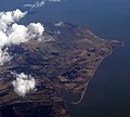
 River Nith estuary.jpg 3,504 × 2,336; 8.68 MB
-
 Southerness Point - geograph.org.uk - 1766111.jpg 2,879 × 2,592; 1.51 MB
-
 Aerial View of Moffat - geograph.org.uk - 193218.jpg 640 × 480; 124 KB


_-_geograph.org.uk_-_1285752.jpg)


