Category:Aerial photographs of Alabama
Jump to navigation
Jump to search
States of the United States: Alabama · Alaska · Arizona · Arkansas · California · Colorado · Connecticut · Delaware · Florida · Georgia · Hawaii · Idaho · Illinois · Indiana · Iowa · Kansas · Kentucky · Louisiana · Maine · Maryland · Massachusetts · Michigan · Minnesota · Mississippi · Missouri · Montana · Nebraska · Nevada · New Hampshire · New Jersey · New Mexico · New York · North Carolina · North Dakota · Ohio · Oklahoma · Oregon · Pennsylvania · Rhode Island · South Carolina · South Dakota · Tennessee · Texas · Utah · Vermont · Virginia · Washington · West Virginia · Wisconsin · Wyoming – District of Columbia: Washington, D.C.
insular area of the United States: American Samoa · Guam · Northern Mariana Islands · Puerto Rico · United States Virgin Islands – United States Minor Outlying Islands: Baker Island · Midway Atoll · Wake Island
insular area of the United States: American Samoa · Guam · Northern Mariana Islands · Puerto Rico · United States Virgin Islands – United States Minor Outlying Islands: Baker Island · Midway Atoll · Wake Island
Subcategories
This category has the following 8 subcategories, out of 8 total.
A
B
Media in category "Aerial photographs of Alabama"
The following 105 files are in this category, out of 105 total.
-

-

-

-
 Aerial photo, US-31 bridge, Birmingham Hwy.jpg 640 × 480; 20 KB
-

-

-
-

-

-

-

-

-

-
-

-

-

-
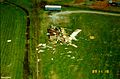
 Aerial view 1 after the 1989 Huntsville Tornado.jpg 808 × 554; 79 KB
-
 Aerial view 2 after the 1989 Huntsville Tornado.jpg 808 × 532; 78 KB
-
 Aerial view 3 after the 1989 Huntsville Tornado.jpg 532 × 808; 74 KB
-
 Aerial view 4 after the 1989 Huntsville Tornado.jpg 778 × 548; 69 KB
-
 Aerial view 5 after the 1989 Huntsville Tornado.jpg 820 × 536; 61 KB
-
 Aerial view 6 after the 1989 Huntsville Tornado.jpg 820 × 536; 78 KB
-
 Aerial view of the Crescent in Birmingham, August 2018.jpg 3,992 × 2,242; 2.67 MB
-
 Aerial view of the Crescent in Birmingham, May 2018.jpg 3,982 × 2,006; 2.09 MB
-

-

-
 Air University.jpg 501 × 340; 62 KB
-
 AL255 Aerial Facing South - US72 Bradford I-565 Exits - August 2014 (27145111767).jpg 1,600 × 2,400; 1.56 MB
-
 AL53 Facing North - AL255 Aerial (43874789702).jpg 2,400 × 1,600; 2.09 MB
-
 AL53JordanLaneAerial-Aug2014 (38642848416).jpg 1,600 × 2,400; 1.96 MB
-
 Albertville Galaxy (14933436956).jpg 1,200 × 800; 304 KB
-
 Auburn 2013 Campus Aerial CM.jpg 1,510 × 1,078; 771 KB
-
 Auburn High School satellite.jpg 735 × 490; 136 KB
-
 Birmingham Aerial (17020168105).jpg 2,400 × 1,600; 3.13 MB
-
 BSCC-AL-FayetteCampus.jpg 670 × 540; 183 KB
-
 BSCC-AL-HamiltonCampus.jpg 398 × 432; 94 KB
-
 BSCC-AL-JasperCampus.jpg 413 × 309; 76 KB
-
 BSCC-AL-SumitonCampus.jpg 730 × 722; 329 KB
-
-

-

-
 CACC-AL-2-USGA.jpg 410 × 360; 100 KB
-
 CACC-AL-USGA.jpg 490 × 708; 235 KB
-
 City of Uniontown, Alabama.png 1,500 × 1,000; 2.37 MB
-

-
 Colbert fossil plant.jpg 1,458 × 972; 1.99 MB
-
 Columbus Georgia - Phenix City Alabama Aerial (49055053181).jpg 3,600 × 2,400; 4.4 MB
-
 Downtown Huntsville - January 2015 (30174228988).jpg 1,600 × 2,400; 2.05 MB
-
 Downtown Tuscaloosa, Alabama.jpg 2,592 × 2,108; 1.27 MB
-
 Drake Field.jpg 221 × 126; 10 KB
-
 Elton B. Stephens Expressway - Red Mountain Expressway.jpg 1,100 × 1,100; 273 KB
-
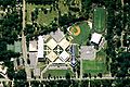
 Enterprise High School, Alabama 2007March03.jpg 515 × 335; 102 KB
-
 Finley Roundhouse South Aerial.jpg 921 × 651; 170 KB
-
 Gadsden Alabama Aerial - January 2015 (29144693107).jpg 2,400 × 1,600; 1.68 MB
-
 Geiger, Alabama tornado damage.jpg 640 × 480; 75 KB
-
 Guntersville City and Lake (35108179154).jpg 1,600 × 2,400; 1.5 MB
-
 Guntersville Lock and Dam (35816044661).jpg 1,600 × 2,400; 1.49 MB
-
 Gurley Alabama Aerial - Aug2014 (40207555000).jpg 2,400 × 1,600; 1.79 MB
-
 HSV - Facing South (29078182651).jpg 1,200 × 800; 544 KB
-
 Huntsville Downtown - Memorial and I-565 Aerial - May 2015 (30378943958).jpg 1,600 × 2,400; 2.14 MB
-
 Huntsville Downtown - Memorial and I-565 Aerial Angle - May 2015 (29310302827).jpg 2,400 × 1,600; 2.42 MB
-
 Huntsville Downtown Aerial (16603258252).jpg 1,200 × 800; 920 KB
-
 Huntsville Hospital Complex Aerial - Aug2014 (24825876938).jpg 2,400 × 1,600; 2.44 MB
-
 Huntsville International Airport - January 2016 (47959255856).jpg 3,600 × 2,400; 2.84 MB
-
 Huntsville Morning Aerial - January 2016 (31286422855).jpg 1,200 × 800; 551 KB
-
 HuntsvilleDowntownAerial565b-Aug2014 (26922618539).jpg 2,400 × 1,600; 2.7 MB
-
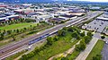
 I-20 59 at US 280 Ramps (34381655093).jpg 2,400 × 1,600; 2.84 MB
-
 I-565 at US431 Aerial - Huntsville - January 2015 (29105175807).jpg 1,600 × 2,400; 2.03 MB
-
 Int565eRoadAerial-Exit8-MountainsBackground-LandingHSV (40326523212).jpg 2,400 × 1,600; 2.13 MB
-
 Interstate 565 Facing West (28537077153).jpg 1,600 × 2,400; 1.18 MB
-
 Interstate565Aerial-DowntownHuntsville (24825878098).jpg 1,600 × 2,400; 1.88 MB
-
 Iss068e014755 (52678096018).jpg 5,568 × 3,712; 23.21 MB
-
 James Clemens High School Aerial - January 2015 (44042092321).jpg 2,400 × 1,600; 1.46 MB
-

-

-

-

-

-

-

-

-

-

-

-

-
 AERIAL VIEW. - Concord Mine, Bessemer, Jefferson County, AL HAER ALA,37-BES.V,4-1.tif 5,000 × 4,038; 19.26 MB
-
 Little-lagoon-aerial.jpg 1,280 × 823; 156 KB
-
 Misty Ridge (35108178094).jpg 2,400 × 1,600; 1.06 MB
-
 Mobile88.04321W 30.69415N.png 992 × 654; 1.18 MB
-
 Norfolk Southern Line - County Line Road Madison AL - August 2014 (28141882918).jpg 1,600 × 2,400; 2.79 MB
-
 Over I-565 under County Line Road (15100794106).jpg 1,200 × 800; 430 KB
-
 Piedmont Alabama Aerial - January 2015 (44082240931).jpg 2,400 × 1,600; 1.42 MB
-
 Salamander of Tennesee River (41463904381).jpg 2,400 × 1,600; 1.82 MB
-
 Sharp Ford Road (35816043011).jpg 2,400 × 1,600; 1.55 MB
-
 TalladegaSuperspeedway2-2.jpg 2,576 × 1,512; 832 KB
-
 TalladegaSuperspeedway2.jpg 2,576 × 1,932; 804 KB
-
 Tennessee River in Spring (28172583180).jpg 1,200 × 800; 680 KB
-
 Transmitters on Burritt and Monte Sano - Huntsville - January 2015 (42233118480).jpg 1,600 × 2,400; 2.01 MB
-
 U.S. Space and Rocket Center (33832309686) (cropped).jpg 1,600 × 1,199; 921 KB
-
 U.S. Space and Rocket Center (33832309686).jpg 1,600 × 2,400; 1.65 MB
-
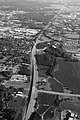
 US 72 West - Near Athens, AL (36749887566).jpg 1,600 × 2,400; 1.05 MB
-
 US Route 72 Athens-Capshaw (20435810135).jpg 800 × 1,200; 480 KB
-
 US231-AL53GovernorsDrAerialHSV-May2014 (38561510980).jpg 2,400 × 1,600; 2.39 MB
-
 US231fns-BobWallaceAerialHSV-May2014 (39474998135).jpg 2,400 × 1,600; 2.4 MB


.jpg)
.jpg)
.jpg)
.jpg)


.jpg)


.jpg)
.jpg)


.jpg)

.jpg)
.jpg)
.jpg)
.jpg)
.jpg)
.jpg)
.jpg)
.jpg)
.jpg)
.jpg)
.jpg)
.jpg)
.jpg)
.jpg)
.jpg)
.jpg)
.jpg)
.jpg)

.jpg)

.jpg)
.jpg)
.jpg)
.jpg)
.jpg)


.jpg)
_(cropped).jpg)
.jpg)
.jpg)
.jpg)
.jpg)
.jpg)
.jpg)