Category:2008 in the London Borough of Hillingdon
Jump to navigation
Jump to search
Boroughs of London: City of London · City of Westminster · Barking and Dagenham · Barnet · Bexley · Brent · Bromley · Camden · Croydon · Ealing · Enfield · Greenwich · Hackney · Hammersmith and Fulham · Haringey · Harrow · Havering · Hillingdon · Hounslow · Islington · Kensington and Chelsea · Kingston · Lambeth · Lewisham · Merton · Newham · Redbridge · Richmond · Southwark · Sutton · Tower Hamlets · Waltham Forest · Wandsworth
Subcategories
This category has only the following subcategory.
H
Media in category "2008 in the London Borough of Hillingdon"
The following 109 files are in this category, out of 109 total.
-
 "BLOCKBUSTER" video shop, Northwood - geograph.org.uk - 976027.jpg 640 × 480; 145 KB
-

-
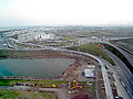
 Heathrow T5 station AB.JPG 3,888 × 2,592; 2.86 MB
-
 Hugh llewelyn 360 204 (6347601762).jpg 2,592 × 1,944; 1.21 MB
-
 Hugh llewelyn 360 201 (6341449982).jpg 2,592 × 1,944; 1.25 MB
-
 Hugh llewelyn 360 204 (6341454910).jpg 2,592 × 1,944; 1.23 MB
-
 Hugh llewelyn 165 111 (6340702409).jpg 2,592 × 1,944; 1.25 MB
-
 Hugh llewelyn 166 209 (6340699109).jpg 2,592 × 1,944; 1.1 MB
-
 Hugh llewelyn 360 203 (6340704391).jpg 2,592 × 1,944; 1.28 MB
-
 Mad Bess arrives at Ruislip Lido Station cropped.jpg 1,551 × 1,622; 880 KB
-
 Mad Bess arrives at Ruislip Lido Station.jpg 3,072 × 2,304; 3 MB
-
 423H5.jpg 3,488 × 2,616; 2.19 MB
-
 A Stock at Ickenham.JPG 1,600 × 1,200; 483 KB
-
 B472 Joel Street - geograph.org.uk - 976106.jpg 640 × 480; 84 KB
-
 Back o' Langley Crescent - geograph.org.uk - 726149.jpg 640 × 427; 75 KB
-
 Bempton Drive, Ruislip Manor - geograph.org.uk - 1096366.jpg 640 × 480; 75 KB
-
-

-
 Bridge to Slough Arm, Grand Union Canal - geograph.org.uk - 815712.jpg 640 × 480; 198 KB
-
 Bus stop on Green Lane - geograph.org.uk - 976054.jpg 640 × 480; 79 KB
-
 Clayton Road, Hayes - geograph.org.uk - 815260.jpg 640 × 479; 86 KB
-
 Cowley recreation ground - geograph.org.uk - 809129.jpg 640 × 479; 246 KB
-

-

-
 Cowley, Little Britain Lake - geograph.org.uk - 941452.jpg 640 × 480; 86 KB
-
 Cowley, Peachey Lane (1) - geograph.org.uk - 801322.jpg 640 × 480; 91 KB
-
 Cowley, The Malt Shovel public house - geograph.org.uk - 943372.jpg 640 × 480; 74 KB
-
 Cranford Park, Cranford - geograph.org.uk - 1013357.jpg 640 × 426; 108 KB
-
 Derelict building at Cranford Park - geograph.org.uk - 1012710.jpg 640 × 426; 139 KB
-
 Dot2dot 1017.jpg 3,648 × 2,736; 4.26 MB
-
 Eastcote station roundel.JPG 1,600 × 1,200; 603 KB
-
 Eastcote tube station 1.jpg 3,648 × 2,736; 4.53 MB
-
 Electricity sub-station at Hayes - geograph.org.uk - 814639.jpg 640 × 480; 74 KB
-
 Esso petrol station, Northwood Hills - geograph.org.uk - 976080.jpg 640 × 480; 56 KB
-
 Field End Road - geograph.org.uk - 1002390.jpg 640 × 480; 71 KB
-
 Field End Road, Eastcote - geograph.org.uk - 935459.jpg 640 × 480; 69 KB
-

-

-
 Footbridge over the River Colne - geograph.org.uk - 664035.jpg 480 × 640; 140 KB
-
 Fray's River, Former GWR railway bridge - geograph.org.uk - 856755.jpg 640 × 480; 138 KB
-

-
 Ha-ha in Cranford Park - geograph.org.uk - 1012673.jpg 640 × 426; 117 KB
-

-
 The Five Bells Pub, Harmondsworth.jpg 3,500 × 2,134; 1.4 MB
-
 Hatton Cross stn eastbound look west.JPG 1,600 × 1,200; 504 KB
-
 Hatton Cross stn northern entrance close.JPG 1,600 × 1,200; 451 KB
-
 Hatton Cross stn roundel backlit.JPG 1,200 × 1,600; 586 KB
-
 Hatton Cross stn roundel.JPG 1,200 × 1,600; 411 KB
-
 Hatton Cross stn southern entrance.JPG 1,600 × 1,200; 352 KB
-
 Hatton Cross stn westbound look east.JPG 1,600 × 1,200; 502 KB
-
 Hayes & Harlington stn building2.JPG 1,600 × 1,200; 422 KB
-
 Heathrow T5 staff shuttle bus.jpg 3,648 × 2,736; 4.18 MB
-
 Heathrow Terminal 5 tube stn roundel.JPG 1,600 × 1,200; 627 KB
-
 Horse riders turn into Mad Bess Wood - geograph.org.uk - 827723.jpg 640 × 479; 138 KB
-
 Houses in Nestle's Avenue - geograph.org.uk - 814145.jpg 640 × 480; 89 KB
-
 Ickenham station - geograph.org.uk - 2208331.jpg 1,600 × 1,200; 569 KB
-
 Ickenham stn roundel.JPG 1,200 × 1,600; 329 KB
-
 Ickenham tube station 1.jpg 3,574 × 2,680; 1.55 MB
-

-
 Knowles Close, Yiewsley - geograph.org.uk - 815650.jpg 640 × 480; 87 KB
-
 London Bus route 482.jpg 3,648 × 2,736; 4.42 MB
-

-
 Marriott Hotel - geograph.org.uk - 726124.jpg 640 × 427; 67 KB
-

-
 Northwood Hills tube roundel.jpg 2,736 × 3,648; 3.7 MB
-
 Northwood station look east2.JPG 1,600 × 1,200; 476 KB
-
 Northwood station look west.JPG 1,600 × 1,200; 486 KB
-
 Northwood tube roundel.jpg 3,648 × 2,736; 4.19 MB
-
 Pasture with buttercups by Bayhurst Wood - geograph.org.uk - 827717.jpg 640 × 480; 204 KB
-
 Pipe bridge over Grand Union Canal - geograph.org.uk - 664712.jpg 640 × 480; 87 KB
-
 Premier Inn Heathrow - geograph.org.uk - 753184.jpg 640 × 480; 56 KB
-
 PRT Heathrow.jpg 640 × 480; 135 KB
-

-
 Ruislip station look east.JPG 1,600 × 1,200; 465 KB
-
 Ruislip station roundel.JPG 1,600 × 1,200; 616 KB
-
 Sipson Lane - geograph.org.uk - 1149863.jpg 640 × 528; 49 KB
-
 Site of Cranford House, Cranford Park - geograph.org.uk - 1012634.jpg 640 × 411; 142 KB
-
 South Ruislip stn tube roundel.JPG 1,200 × 1,600; 600 KB
-

-
 Station Approach, Northwood - geograph.org.uk - 976035.jpg 640 × 480; 81 KB
-
 Stockley Country Park - geograph.org.uk - 815486.jpg 640 × 480; 202 KB
-
 Stockley Park.jpg 2,816 × 2,112; 1.53 MB
-
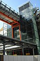 T5 Walkway.jpg 1,501 × 2,246; 386 KB
-
 The Nestlé factory at Hayes - geograph.org.uk - 1018952.jpg 640 × 480; 97 KB
-
 The Northwood Hills - geograph.org.uk - 976075.jpg 640 × 480; 71 KB
-
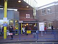 The rear entrance to Uxbridge Tube station.jpg 1,600 × 1,200; 546 KB
-
 The Riverside Hotel West Drayton - geograph.org.uk - 753213.jpg 640 × 480; 73 KB
-

-
 Unit 360203 at Hayes & Harlington.JPG 1,600 × 1,200; 498 KB
-
 Uxbridge Central Library - geograph.org.uk - 798550.jpg 640 × 480; 105 KB
-
 Uxbridge station roundel.JPG 1,600 × 1,200; 592 KB
-
 Uxbridge Underground station (1) - geograph.org.uk - 797072.jpg 640 × 480; 92 KB
-
 Uxbridge Underground station (2) - geograph.org.uk - 798601.jpg 640 × 480; 83 KB
-
 Uxbridge, Brunel University - geograph.org.uk - 800408.jpg 640 × 480; 76 KB
-
 Uxbridge, Brunel University chimney - geograph.org.uk - 800462.jpg 480 × 640; 124 KB
-
 Uxbridge, Harman House - geograph.org.uk - 797109.jpg 640 × 480; 86 KB
-
 Uxbridge, High Street (1) - geograph.org.uk - 798505.jpg 640 × 480; 86 KB
-
 Uxbridge, High Street (2) - geograph.org.uk - 800336.jpg 640 × 480; 80 KB
-
 Uxbridge, Metropolitan Line sidings - geograph.org.uk - 796991.jpg 640 × 480; 85 KB
-
 Uxbridge, Quakers' Meeting House - geograph.org.uk - 797341.jpg 640 × 480; 98 KB
-
 Uxbridge, The Market House - geograph.org.uk - 798869.jpg 640 × 480; 81 KB
-
 Uxbridge, Unisys UK Head Office - geograph.org.uk - 797018.jpg 640 × 480; 82 KB
-
 Uxbridge, Windsor Street (2) - geograph.org.uk - 800047.jpg 640 × 480; 76 KB
-
 Uxbridge, Windsor Street (3) - geograph.org.uk - 800064.jpg 640 × 480; 81 KB
-

-
 Weir on the Colne at Denham - geograph.org.uk - 663809.jpg 640 × 480; 105 KB
-
 West Drayton, The Gatehouse - geograph.org.uk - 1079473.jpg 640 × 480; 69 KB
-
 Whitby Road, Ruislip Manor - geograph.org.uk - 1096369.jpg 640 × 480; 60 KB
-
 Woody Bay - Ruislip Lido - geograph.org.uk - 947989.jpg 640 × 480; 51 KB


.jpg)
.jpg)
.jpg)
.jpg)
.jpg)
.jpg)


_by_bridge_199_-_geograph.org.uk_-_815435.jpg)


_-_geograph.org.uk_-_801322.jpg)


_-_geograph.org.uk_-_797072.jpg)
_-_geograph.org.uk_-_798601.jpg)


_-_geograph.org.uk_-_798505.jpg)
_-_geograph.org.uk_-_800336.jpg)


_-_geograph.org.uk_-_800047.jpg)
_-_geograph.org.uk_-_800064.jpg)


