Category:2008 in the City of London
Jump to navigation
Jump to search

Subcategories
This category has the following 6 subcategories, out of 6 total.
C
L
- 2008 at Liverpool Street station (27 F)
- Lord Mayor's Show 2008 (242 F)
S
- St. Paul's Cathedral in 2008 (45 F)
Media in category "2008 in the City of London"
The following 200 files are in this category, out of 551 total.
(previous page) (next page)-
 "Mustard" in Distaff Lane - geograph.org.uk - 967972.jpg 640 × 480; 65 KB
-
 "Wigwams" in New Fetter Lane - geograph.org.uk - 766456.jpg 640 × 480; 71 KB
-
 16 St Clare Street - geograph.org.uk - 1007104.jpg 640 × 480; 73 KB
-
 2008 02 London - Suppressive Teddy.jpg 650 × 1,024; 287 KB
-
 St. Paul's Cathedral, London, England 2008-01-19 (2280106372).jpg 1,280 × 853; 181 KB
-
 St. Paul's Cathedral, London, England 2008-01-19 (2279316379).jpg 1,280 × 853; 187 KB
-
 319376-Thameslink-20080513.JPG 3,872 × 2,592; 2.53 MB
-
 City Thameslink stn northbound.JPG 1,600 × 1,200; 605 KB
-
 City Thameslink stn signage.JPG 1,600 × 1,200; 622 KB
-
 City Thameslink stn southbound.JPG 1,600 × 1,200; 1.33 MB
-
 City Thameslink stn Ludgate Hill entrance.JPG 1,600 × 1,200; 638 KB
-
 The Bell in Bush Lane - geograph.org.uk - 883046.jpg 480 × 640; 69 KB
-
 Moorgate station Thameslink bays looking west.JPG 1,600 × 1,200; 624 KB
-
 Fine Line, City, EC4 (2871526545).jpg 1,280 × 960; 336 KB
-
-

-
 Tower42 Oct2008.jpg 2,376 × 4,224; 3.68 MB
-
 Fine Line, Monument, EC3 (3781446186).jpg 2,848 × 2,136; 2.27 MB
-
 Sign for The Bell, Bush Lane, EC4 - geograph.org.uk - 1094385.jpg 480 × 640; 70 KB
-
 The Bell, Bush Lane, EC4 - geograph.org.uk - 1094377.jpg 480 × 640; 79 KB
-
 30 St Mary Axe - geograph.org.uk - 863454.jpg 414 × 640; 72 KB
-
 37–38 Threadneedle Street, London.jpg 692 × 922; 132 KB
-
 5 Essex Court - geograph.org.uk - 765075.jpg 640 × 480; 124 KB
-
 500px photo (140471633).jpeg 1,365 × 2,048; 402 KB
-
 8 and a half Dowgate Hill - geograph.org.uk - 883096.jpg 640 × 480; 85 KB
-

-
-
 A golden scene in Goodman's yard - geograph.org.uk - 1015545.jpg 640 × 480; 77 KB
-
 A new New Change - geograph.org.uk - 922079.jpg 640 × 480; 83 KB
-

-
 A possibly unique address - geograph.org.uk - 886979.jpg 480 × 640; 48 KB
-
 A puzzling offer in Cheapside - geograph.org.uk - 890497.jpg 640 × 480; 71 KB
-

-
 A wet Sunday at The Temple - geograph.org.uk - 765122.jpg 640 × 480; 109 KB
-

-
 Aldersgate Street - geograph.org.uk - 723858.jpg 640 × 480; 87 KB
-
 Aldgate station anticlockwise Circle platform 4 look south.JPG 1,600 × 1,200; 500 KB
-
 Aldgate station building.JPG 1,600 × 1,200; 474 KB
-
 Aldgate station clockwise Circle platform 1 look north.JPG 1,600 × 1,200; 476 KB
-
 Aldgate station Metropolitan platform 2 look north.JPG 1,600 × 1,200; 475 KB
-
 Aldgate station Metropolitan platform 2 look south buffers.JPG 1,600 × 1,200; 494 KB
-
 Aldgate station Metropolitan platform 2 look south.JPG 1,600 × 1,200; 489 KB
-
 Aldgate station Metropolitan platform 3 look south.JPG 1,600 × 1,200; 482 KB
-
 Aldgate station platforms 1 and 2 high southbound.JPG 1,600 × 1,200; 416 KB
-
 Aldgate station platforms 3 and 4 high northbound.JPG 1,600 × 1,200; 512 KB
-
 Aldgate station roundel.JPG 1,600 × 1,200; 440 KB
-
 Alibi, Holborn, EC4 (2493488332).jpg 1,280 × 960; 278 KB
-
 All Bar One, Houndsditch, EC3 (2580390659).jpg 1,280 × 960; 299 KB
-
 Alx200andalx400.JPG 640 × 480; 147 KB
-
-

-
 An upholsterer explains his craft - geograph.org.uk - 890489.jpg 480 × 640; 70 KB
-

-
-
 Angel Court, London - geograph.org.uk - 1139515.jpg 640 × 480; 84 KB
-
 Angel Street - geograph.org.uk - 700852.jpg 350 × 543; 75 KB
-
 Angel Street - geograph.org.uk - 767101.jpg 557 × 444; 83 KB
-
 Angel Street, London EC1 - geograph.org.uk - 1086519.jpg 640 × 481; 114 KB
-
 Any Spare? (2789510894).jpg 2,848 × 2,136; 2.78 MB
-
 Apostle, St Pauls, EC4 (2872355504).jpg 960 × 1,280; 339 KB
-

-
 Appold Street, EC2 (2) - geograph.org.uk - 1099523.jpg 480 × 640; 87 KB
-
 APStNA.JPG 3,264 × 2,448; 2.39 MB
-
 Archway in Crutched Friars - geograph.org.uk - 976198.jpg 640 × 480; 52 KB
-
 Are you really surprised^ - geograph.org.uk - 1021581.jpg 480 × 640; 78 KB
-
 Arms of the United Kingdom Temple Bar.jpg 495 × 1,069; 355 KB
-
 Artillery Lane - geograph.org.uk - 1021601.jpg 640 × 480; 78 KB
-
 Artillery Lane, London EC2M - geograph.org.uk - 691220.jpg 640 × 480; 82 KB
-
 Austin FX4 at St Pauls cathedral.jpg 1,680 × 1,260; 583 KB
-
 Autumn colours in Finsbury Circus - geograph.org.uk - 1072449.jpg 640 × 430; 102 KB
-
 Bakery by Priest's Court, Foster Lane - geograph.org.uk - 921982.jpg 480 × 640; 78 KB
-
 Bank station (Central Line), EC3 - geograph.org.uk - 896375.jpg 640 × 480; 52 KB
-
 Bank station entrance look to Bank.JPG 1,600 × 1,200; 463 KB
-
 Banker, Cannon Street, London (2795349373).jpg 2,560 × 1,920; 913 KB
-
 Barbican , Shakespeare Tower - geograph.org.uk - 723869.jpg 434 × 640; 30 KB
-
 Barbican Skyline - geograph.org.uk - 1099393.jpg 640 × 480; 57 KB
-
 Barbican station 1.jpg 2,736 × 3,648; 3.76 MB
-
 Barbican, Mendelssohn's Tree - geograph.org.uk - 723863.jpg 640 × 480; 94 KB
-
 Barbican, the YMCA tower - geograph.org.uk - 721965.jpg 449 × 640; 34 KB
-
 Barley Mow Passage - geograph.org.uk - 721713.jpg 480 × 640; 43 KB
-
 Bayer House Golden Lane Estate.jpg 3,008 × 2,000; 2.87 MB
-
 Bear Alley off Farringdon Street - geograph.org.uk - 886903.jpg 640 × 480; 49 KB
-
 Beech Street, Barbican - geograph.org.uk - 1099372.jpg 480 × 640; 76 KB
-

-
 Benches and bushes in Watling Street - geograph.org.uk - 881917.jpg 480 × 640; 76 KB
-
 Bend in Catherine Wheel Alley - geograph.org.uk - 1021563.jpg 480 × 640; 74 KB
-
 Betjemans, Farringdon, EC1 (2835985470).jpg 1,280 × 960; 329 KB
-
 Bevis Marks Synagogue P6110041.JPG 2,288 × 1,712; 721 KB
-
 Bevis Marks Synagogue P6110042.JPG 1,712 × 2,288; 796 KB
-
 Blackfriars House - geograph.org.uk - 923472.jpg 480 × 640; 85 KB
-
 Blackfriars Lane, EC4 - geograph.org.uk - 701844.jpg 640 × 480; 81 KB
-
 Blackfriars Underground Station - geograph.org.uk - 1113373.jpg 640 × 480; 84 KB
-
 Blackfriars Underground Station - geograph.org.uk - 1113377.jpg 640 × 480; 72 KB
-
 Blackfriars Underground Station - geograph.org.uk - 1113391.jpg 640 × 480; 76 KB
-
 Bouverie Street - geograph.org.uk - 765053.jpg 640 × 480; 82 KB
-
 Bow Wine Vaults, City, EC4 (2871526085).jpg 960 × 1,280; 364 KB
-
 Brabant Court off Philpot Lane - geograph.org.uk - 924418.jpg 480 × 640; 61 KB
-
 Bride Lane - geograph.org.uk - 698453.jpg 419 × 640; 178 KB
-
 Broadgate Circle - geograph.org.uk - 667989.jpg 640 × 480; 115 KB
-
 BT Centre, Newgate Street - geograph.org.uk - 699720.jpg 640 × 480; 78 KB
-

-
-
 Calico - geograph.org.uk - 764308.jpg 480 × 640; 48 KB
-
 Cameras, Cranes and Church Tower - geograph.org.uk - 852120.jpg 640 × 427; 177 KB
-
 Canopy near St Paul's cathedral - geograph.org.uk - 764663.jpg 480 × 640; 45 KB
-

-
 Car park in St Clare Street - geograph.org.uk - 1007102.jpg 640 × 480; 70 KB
-
 Carphone Warehouse in New Street - geograph.org.uk - 1021560.jpg 640 × 480; 81 KB
-
 Carthusian Street - geograph.org.uk - 721961.jpg 473 × 640; 39 KB
-
 Carved head in Change Alley, EC3 - geograph.org.uk - 1114565.jpg 480 × 640; 48 KB
-
 Central Criminal Court - geograph.org.uk - 650721.jpg 480 × 640; 73 KB
-
 Chancery Lane stn roundel.JPG 1,600 × 1,200; 636 KB
-
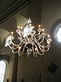 Chandelier at St James Garlickhythe - geograph.org.uk - 964280.jpg 480 × 640; 54 KB
-
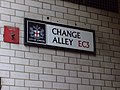
 Change Alley eastward (3164408560).jpg 762 × 600; 70 KB
-
 Change Alley, EC3 - geograph.org.uk - 1114560.jpg 480 × 640; 55 KB
-

-

-
 Circular stairwell in Broadgate - geograph.org.uk - 1021793.jpg 640 × 480; 63 KB
-
 Ciro's Pizza Pomodoro - geograph.org.uk - 1099567.jpg 480 × 640; 90 KB
-
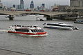 City Cruises Thames.jpg 1,936 × 1,288; 1.09 MB
-

-
-

-
 City of London School, London EC4 - geograph.org.uk - 1094938.jpg 640 × 401; 94 KB
-
 City of London skyline from London City Hall - Oct 2008 - Aligned.jpg 8,442 × 4,668; 14.8 MB
-
 City of London skyline from London City Hall - Oct 2008.jpg 8,441 × 4,427; 10.81 MB
-
 City of London, 2 Dorset Rise - geograph.org.uk - 865073.jpg 640 × 480; 89 KB
-

-
 City of London, Crown Office Row - geograph.org.uk - 865082.jpg 640 × 480; 70 KB
-
 City of London, entranceway to St. Bart's - geograph.org.uk - 865209.jpg 480 × 640; 106 KB
-
 City of London, Kings Bench Walk - geograph.org.uk - 865106.jpg 640 × 480; 107 KB
-

-
 City of London, Pump Court - geograph.org.uk - 865090.jpg 480 × 640; 82 KB
-
-
 City of London, Serjeant's Inn - geograph.org.uk - 865117.jpg 640 × 480; 82 KB
-
 City of London, St. Ann's Vestry Hall - geograph.org.uk - 865030.jpg 480 × 640; 69 KB
-

-
 City of London, Temple Bar - geograph.org.uk - 865147.jpg 480 × 640; 95 KB
-

-
 City Thameslink station geograph-3306678-by-Ben-Brooksbank.jpg 2,394 × 1,533; 4.66 MB
-

-
 CityofLondonSchoolforGirls.jpg 2,048 × 1,536; 751 KB
-
 Cloak Lane, EC4 - geograph.org.uk - 764281.jpg 640 × 480; 77 KB
-
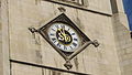 Clock of St Dunstan In The West Church (2326804117).jpg 2,816 × 1,584; 1.94 MB
-
 Clock of St Dunstan In The West Church (2327621634).jpg 2,112 × 2,816; 2.62 MB
-

-
 Cloth Fair - geograph.org.uk - 721720.jpg 480 × 640; 47 KB
-
 Club Gascon, Farringdon, EC1.jpg 1,200 × 1,600; 488 KB
-

-

-
-
 Coleman Street - geograph.org.uk - 767143.jpg 640 × 480; 74 KB
-

-
 Compter Passage - geograph.org.uk - 921887.jpg 480 × 640; 46 KB
-

-
 Corner Queen street - panoramio.jpg 2,448 × 3,264; 3.21 MB
-
 Cory Environmental - geograph.org.uk - 1085872.jpg 640 × 427; 78 KB
-
 Crane in Fetter Lane - geograph.org.uk - 766470.jpg 640 × 480; 68 KB
-
 Crane in Watling Street - geograph.org.uk - 764644.jpg 480 × 640; 71 KB
-
 Crescent House corridor.jpg 3,008 × 2,000; 2.57 MB
-
 Crescent House Golden Lane Estate.jpg 3,008 × 2,000; 2.15 MB
-
-
 Cripplegate Free Library (2946960115).jpg 2,304 × 3,456; 4.89 MB
-
 Cross Lane - geograph.org.uk - 965696.jpg 480 × 640; 88 KB
-
 Crosse Keys, Bank, EC3 (2551337165).jpg 1,280 × 960; 323 KB
-

-
 Cunard Passage - geograph.org.uk - 921476.jpg 480 × 640; 65 KB
-

-
 Cutlers exchange - geograph.org.uk - 1015691.jpg 640 × 480; 67 KB
-
 Dangling legs (2477220013).jpg 3,072 × 2,304; 2.32 MB
-
 Dead end near The Monument - geograph.org.uk - 882847.jpg 480 × 640; 70 KB
-

-

-
 Derelict toilet block Smithfield Street 1.jpg 3,648 × 2,736; 4.26 MB
-
 Derelict toilet block Smithfield Street 2.jpg 3,648 × 2,736; 4.76 MB
-

-
 Devonshire Row - geograph.org.uk - 1021454.jpg 480 × 640; 55 KB
-
 Devonshire Square, EC2 - geograph.org.uk - 1101059.jpg 640 × 480; 74 KB
-
 Dirty Dicks - Bishopsgate - EC2.jpg 960 × 1,280; 309 KB
-
 Distaff Lane - geograph.org.uk - 777739.jpg 640 × 480; 103 KB
-
 Dyer's Buildings - geograph.org.uk - 766602.jpg 640 × 480; 92 KB
-
 East Harding Street - geograph.org.uk - 886780.jpg 640 × 480; 76 KB
-
 Eastern end of Snow Hill - geograph.org.uk - 966817.jpg 640 × 480; 87 KB
-
 Eastern entrance to St Paul's Churchyard - geograph.org.uk - 881689.jpg 480 × 640; 110 KB
-
 Eastern side of Wardrobe Place - geograph.org.uk - 922693.jpg 480 × 640; 99 KB
-
 Eat-drink-chat near Steelyard Passage - geograph.org.uk - 975837.jpg 640 × 480; 69 KB
-

-

-

-
 Entrance to 62 Threadneedle Street - geograph.org.uk - 924018.jpg 480 × 640; 65 KB
-
-
 Entrance to Pump Court - geograph.org.uk - 765085.jpg 640 × 480; 91 KB
-

-

-
 F Flittner, gentlemen's hairdressing. Broadgate (2887309695).jpg 1,194 × 1,651; 246 KB
-
 Faraday Building - geograph.org.uk - 921388.jpg 640 × 487; 169 KB
-
 Faraday Building - geograph.org.uk - 921415.jpg 416 × 640; 132 KB
-
 Fenchurch Buildings - geograph.org.uk - 921464.jpg 480 × 640; 51 KB
-
 Fenchurch Buildings - geograph.org.uk - 976770.jpg 480 × 640; 65 KB
-
 Fenchurch Place - geograph.org.uk - 913108.jpg 425 × 640; 143 KB


.jpg)
.jpg)


.jpg)


.jpg)


.jpeg)


.jpg)
.jpg)


.jpg)
.jpg)

_-_geograph.org.uk_-_1099523.jpg)


,_EC3_-_geograph.org.uk_-_896375.jpg)

.jpg)


.jpg)


.jpg)


.jpg)


.jpg)
.jpg)


.jpg)

.jpg)


.jpg)


.jpg)


