Category:1981 maps of Virginia
Jump to navigation
Jump to search
States of the United States: Alabama · Arkansas · California · Connecticut · Delaware · Florida · Georgia · Kentucky · Maine · Massachusetts · New York · Ohio · Pennsylvania · South Carolina · Tennessee · Vermont · Virginia
| ← 1980 1981 1982 1985 1989 → |
Media in category "1981 maps of Virginia"
The following 28 files are in this category, out of 28 total.
-
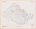
 Charlotte County, Virginia LOC 82696192.jpg 7,807 × 11,417; 5.56 MB
-
 Charlotte County, Virginia LOC 82696192.tif 7,807 × 11,417; 255.01 MB
-
 Chesterfield County, Virginia LOC 82693332.jpg 10,188 × 8,219; 5.66 MB
-
 Chesterfield County, Virginia LOC 82693332.tif 10,188 × 8,219; 239.57 MB
-
 Culpeper County, Virginia LOC 82693328.jpg 9,823 × 9,021; 4.67 MB
-
 Culpeper County, Virginia LOC 82693328.tif 9,823 × 9,021; 253.52 MB
-
 Fairfax County, Virginia LOC 82693331.jpg 8,250 × 9,853; 6.3 MB
-
 Fairfax County, Virginia LOC 82693331.tif 8,250 × 9,853; 232.56 MB
-
 Flood insurance studies status map, Virginia - October 1, 1981 LOC 82690883.jpg 6,400 × 3,180; 2.01 MB
-
 Flood insurance studies status map, Virginia - October 1, 1981 LOC 82690883.tif 6,400 × 3,180; 58.23 MB
-
 Flood plain management studies status map, Virginia - October 1, 1981 LOC 82690886.jpg 6,509 × 3,243; 2.16 MB
-
 Flood plain management studies status map, Virginia - October 1, 1981 LOC 82690886.tif 6,509 × 3,243; 60.39 MB
-
 General forest land productivity map, Virginia - April 1981 LOC 81693347.jpg 9,243 × 4,463; 5.36 MB
-
 General forest land productivity map, Virginia - April 1981 LOC 81693347.tif 9,243 × 4,463; 118.02 MB
-
 Great Falls Park, Virginia LOC 83693765.jpg 6,877 × 6,403; 7.8 MB
-
 Great Falls Park, Virginia LOC 83693765.tif 6,877 × 6,403; 125.98 MB
-
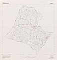
 King George County, Virginia LOC 82696193.jpg 6,339 × 7,190; 3 MB
-
 King George County, Virginia LOC 82696193.tif 6,339 × 7,190; 130.4 MB
-
 Loudoun County, Virginia LOC 82696191.jpg 9,960 × 10,423; 6.17 MB
-
 Loudoun County, Virginia LOC 82696191.tif 9,960 × 10,423; 297.01 MB
-
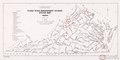
 Resource conservation and development status map, Virginia - November 1981 LOC 82690688.jpg 8,575 × 4,213; 2.64 MB
-
 Resource conservation and development status map, Virginia - November 1981 LOC 82690688.tif 8,575 × 4,213; 103.36 MB
-
 River basin studies status map, Virginia - October 1, 1981 LOC 82690885.jpg 6,359 × 3,139; 2.39 MB
-
 River basin studies status map, Virginia - October 1, 1981 LOC 82690885.tif 6,359 × 3,139; 57.11 MB
-
 Status of soil surveys, Virginia. LOC 81692880.jpg 6,389 × 4,354; 2.2 MB
-
 Status of soil surveys, Virginia. LOC 81692880.tif 6,389 × 4,354; 79.59 MB
-
 Watershed status map, Virginia - October 1, 1981 LOC 82690884.jpg 6,334 × 3,149; 2.21 MB
-
 Watershed status map, Virginia - October 1, 1981 LOC 82690884.tif 6,334 × 3,149; 57.07 MB


