Category:1981 maps of Georgia (U.S. state)
Jump to navigation
Jump to search
States of the United States: Alabama · Arkansas · California · Connecticut · Delaware · Florida · Georgia · Kentucky · Maine · Massachusetts · New York · Ohio · Pennsylvania · South Carolina · Tennessee · Vermont · Virginia
| ← 1980 1981 1983 1985 1986 1988 1989 → |
Media in category "1981 maps of Georgia (U.S. state)"
The following 17 files are in this category, out of 17 total.
-

-

-

-
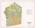
 General soil map, Jasper County, Georgia LOC 82693769.jpg 7,124 × 5,685; 5.03 MB
-
 General soil map, Jasper County, Georgia LOC 82693769.tif 7,124 × 5,685; 115.87 MB
-
 General soil map, Newton County, Georgia LOC 82693767.jpg 7,379 × 5,665; 4.7 MB
-
 General soil map, Newton County, Georgia LOC 82693767.tif 7,379 × 5,665; 119.6 MB
-
 General soil map, Rockdale County, Georgia LOC 82693768.jpg 7,291 × 5,669; 4.54 MB
-
 General soil map, Rockdale County, Georgia LOC 82693768.tif 7,291 × 5,669; 118.25 MB
-

-

-

-
 Prime farmland map, southwest Georgia land and water resource cooperative study LOC 82693781.tif 4,577 × 3,358; 43.97 MB
-
 Prime farmlands of the State of Georgia. LOC 82693719.jpg 2,615 × 3,376; 1.13 MB
-
 Prime farmlands of the State of Georgia. LOC 82693719.tif 2,615 × 3,376; 25.26 MB
-

-


