Category:1980s maps of England
Jump to navigation
Jump to search
Constituent countries of the United Kingdom: England
Media in category "1980s maps of England"
The following 9 files are in this category, out of 9 total.
-
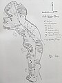 EK Quarry 1983.jpg 3,024 × 4,032; 1.94 MB
-
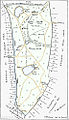 Great Culverden Park map.jpg 572 × 992; 177 KB
-
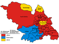 Sheffield UK local election 1980 map.png 520 × 384; 72 KB
-
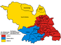
 Sheffield UK local election 1982 map.png 520 × 384; 66 KB
-
 Sheffield UK local election 1983 map.png 520 × 384; 66 KB
-
 Sheffield UK local election 1984 map.png 520 × 384; 66 KB
-
 Sheffield UK local election 1986 map.png 520 × 384; 66 KB
-
 Sheffield UK local election 1987 map.png 520 × 384; 75 KB
-
 Sheffield UK local election 1988 map.png 520 × 384; 68 KB


