Category:1878 maps
Jump to navigation
Jump to search
| ← · 1870 · 1871 · 1872 · 1873 · 1874 · 1875 · 1876 · 1877 · 1878 · 1879 · → |
Deutsch: Karten mit Bezug zum Jahr 1878
English: Maps related to the year 1878
Español: Mapas relativos al año 1878
Français : Cartes concernant l’an 1878
Русский: Карты 1878 года
Subcategories
This category has the following 13 subcategories, out of 13 total.
*
- 1878 maps of the world (4 F)
A
- A system of geography (1878) (18 F)
E
G
N
O
- 1878 maps of Oceania (2 F)
S
- 1878 maps of South America (1 F)
Media in category "1878 maps"
The following 158 files are in this category, out of 158 total.
-
 FONSECA(1878) p024 MAP OF GOA.jpg 3,782 × 5,763; 8.19 MB
-
 FONSECA(1878) p136 PLAN OF THE CITY OF GOA.jpg 3,231 × 3,005; 4.52 MB
-
 Álþíng við Öxará.jpg 4,888 × 2,693; 6.91 MB
-
 LANG(1878) p010 AGRICULTURAL MAP.jpg 1,405 × 911; 680 KB
-
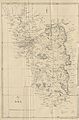
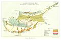
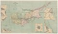 (1878) MAP OF CYPRUS.jpg 4,731 × 2,773; 6.86 MB
-
 (1878) MAP OF FAMAGOUSTA.jpg 1,124 × 1,147; 538 KB
-
 (1878) MAP OF KYRENIA.jpg 853 × 653; 254 KB
-
 (1878) MAP OF LARNAKA.jpg 744 × 927; 329 KB
-
 (1878) MAP OF LIMASOL.jpg 759 × 767; 243 KB
-
 (1878) MAP OF NICOSIA.jpg 696 × 823; 235 KB
-
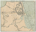 (1878) MAP OF RUINS OF SALAMIS.jpg 1,120 × 999; 485 KB
-
 LANG(1878) p215 THE RELATIONS OF CYPRUS AND THE ADJACENT COASTS.jpg 1,441 × 1,151; 848 KB
-
 LANG(1878) p281 GEOLOGICAL MAP OF CYPRUS.jpg 1,595 × 913; 845 KB
-
 MAP OF THE AUTHOR'S ROUTE.jpg 3,847 × 3,871; 5.58 MB
-
 Bodhgaya(1878) p283 T01.jpg 1,940 × 2,911; 1.7 MB
-
 Bodhgaya(1878) p289 T03.jpg 1,963 × 2,987; 1.72 MB
-
 Bodhgaya(1878) p291 T04.jpg 2,851 × 2,060; 2.24 MB
-
 Bodhgaya(1878) p293 T05.jpg 1,931 × 2,980; 2.52 MB
-
 SETON(1878) - (1) GEOGRAPHICAL POSITION OF ST. KILDA.jpg 1,961 × 1,541; 1.64 MB
-
 SETON(1878) - (2) MAPS OF ST. KILDA.jpg 1,389 × 2,131; 1.73 MB
-
 SETON(1878) - p95 Map of Macculoch Island.jpg 2,698 × 1,368; 1.64 MB
-
 SETON(1878) - p95 Map of Martin Island.jpg 2,718 × 1,366; 1.6 MB
-
 SETON(1878) - p95 Map of Wilson Island.jpg 2,699 × 1,374; 1.77 MB
-
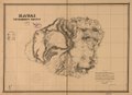
 1878 Government Land Office Map of Lanai, Hawaii - Geographicus - LanaiHawaii-lo-1878.jpg 4,000 × 3,029; 1.47 MB
-
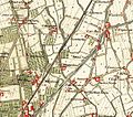
 1878 Manhattan Beach Railway.jpg 557 × 951; 111 KB
-

-

-
 5 of 'Guide to the Transvaal. (With plates and maps.)' (11124466004).jpg 4,905 × 3,291; 3 MB
-
 Alderney Harbour, plan of breakwater and Admiralty property. RMG F0258.tiff 7,211 × 6,175; 127.4 MB
-

-
 Archives des missions scientifiques et littéraires (1879) (19727108756).jpg 2,548 × 1,976; 909 KB
-
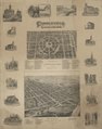
 Bird's eye view of Gardiner and Pittston, Kennebec Co., Maine, 1878 LOC 80693968.jpg 8,608 × 5,904; 11.44 MB
-
 Bird's eye view of Gardiner and Pittston, Kennebec Co., Maine, 1878 LOC 80693968.tif 8,608 × 5,904; 145.4 MB
-
 Bird's eye view of Mechanic Falls, Maine, 1878 - looking east LOC 2015588522.jpg 5,766 × 4,145; 3.81 MB
-
 Bird's eye view of Mechanic Falls, Maine, 1878 - looking east LOC 2015588522.tif 5,766 × 4,145; 68.38 MB
-
 Bird's eye view of Port Townsend, Puget Sound, Washington Territory 1878. LOC 75696659.jpg 8,384 × 5,648; 8.02 MB
-
 Bird's eye view of Port Townsend, Puget Sound, Washington Territory 1878. LOC 75696659.tif 8,384 × 5,648; 135.48 MB
-

-
 Bird's Eye View of the Holy Land (FL37110503 3893124).jpg 7,067 × 5,431; 57.98 MB
-
 Birds-eye view of the Bethlehems, Pa. LOC 2015585060.jpg 8,321 × 6,436; 9.21 MB
-
 Britannica Baden (Germany) - Ground-Plan.jpg 2,412 × 1,665; 696 KB
-
 Carta Archeologica do Algarve 1878.svg 6,816 × 4,946; 7.14 MB
-

-

-
 Circleville illustrated LOC 2011592044.jpg 7,370 × 9,354; 9.97 MB
-
 Circleville illustrated LOC 2011592044.tif 7,370 × 9,354; 197.24 MB
-

-
 Cours d'aménagement des forêts enseigné a l'École forestìere (IA coursdamnageme00broiuoft).pdf 762 × 1,285, 380 pages; 16.81 MB
-
 Cram's railroad & township map of Mississippi LOC 2005625321.jpg 5,091 × 6,609; 4.96 MB
-
 Cram's railroad & township map of Mississippi LOC 2005625321.tif 5,091 × 6,609; 96.26 MB
-
 Das Heilige Land aus der Vogelperspective (FL37663338 3915237).jpg 7,258 × 4,725; 34.87 MB
-
 Die Bauten von Dresden (1878) Illustrationsseite 241.jpg 9,555 × 2,865; 3.9 MB
-
 Dover & Foxcroft (2675894532).jpg 2,000 × 1,255; 1.96 MB
-
 EB9 Aleutian Islands.jpg 1,619 × 560; 270 KB
-
 EB9 Cincinnati.jpg 2,538 × 1,616; 882 KB
-
 EB9 Dublin Plan.png 4,000 × 2,571; 11.21 MB
-
 Flammarion - La planète Mars, Tome 1-f152.jpg 706 × 446; 133 KB
-
 France, Ile Amsterdam.png 1,880 × 2,480; 5.34 MB
-
 Heinrich Theodor Menke, Syrien zur Zeit der Kreuzzuge (FL33144813 3881566).jpg 11,464 × 9,691; 138.76 MB
-
 Holbrook's map of the city of Newark, New Jersey. LOC 2011593696.jpg 7,154 × 5,751; 7.01 MB
-
 Holbrook's map of the city of Newark, New Jersey. LOC 2011593696.tif 7,154 × 5,751; 117.71 MB
-

-
 J.K. Gill & Cos. map of Washingtonter. LOC 98687150.jpg 8,798 × 6,370; 9.61 MB
-
 Jan-mayen-1878.jpg 1,276 × 1,037; 458 KB
-
 Jerusalem aus der Vogelschau 01 (FL37663333 3915227).jpg 6,630 × 5,860; 51.03 MB
-
 Jerusalem aus der Vogelschau 02-list-inner-binding (FL37663339 3915227).jpg 3,525 × 5,140; 19.71 MB
-
 Jerusalem und Seine umgebung (FL45602927 3939219).jpg 2,188 × 1,536; 1.01 MB
-
 John Bartholomew, Palestine ancient and Modern (FL37128312 3904542).jpg 3,499 × 5,008; 6.61 MB
-
 Jules Verne. Plan de Jérusalem. Reproduite. 1878.jpg 1,459 × 2,138; 632 KB
-
-

-
 Kauai government survey, 1878 LOC 2005625315.jpg 7,989 × 5,861; 6.32 MB
-
 Kauai government survey, 1878 LOC 2005625315.tif 7,989 × 5,861; 133.96 MB
-

-

-
 Lockstreammap.jpg 622 × 462; 97 KB
-

-

-

-

-

-

-

-

-

-

-

-

-
 Map of Bedford County, Tenn. LOC 2006626023.jpg 8,827 × 12,471; 18.27 MB
-
 Map of Bedford County, Tenn. LOC 2006626023.tif 8,827 × 12,471; 314.95 MB
-
 Map of Christian County, Ky. LOC 2012593102.jpg 14,441 × 14,744; 25.98 MB
-
 Map of Christian County, Ky. LOC 2012593102.tif 14,441 × 14,744; 609.16 MB
-
 Map of Eau Claire County, Wisconsin LOC 2012593194.jpg 14,277 × 10,539; 23.06 MB
-
 Map of Eau Claire County, Wisconsin LOC 2012593194.tif 14,277 × 10,539; 430.48 MB
-
 Map of Freeborn County, Minnesota - drawn from actual surveys and the county records. LOC 2012593029.jpg 16,205 × 15,785; 30.79 MB
-
 Map of Great Moulton from 1878.PNG 343 × 316; 192 KB
-
 Map of Maury Co., Tennessee - from new and actual surveys LOC 2009579455.jpg 11,705 × 17,474; 29.77 MB
-
 Map of Maury Co., Tennessee - from new and actual surveys LOC 2009579455.tif 11,705 × 17,474; 585.17 MB
-
 Map of Rutherford County, Tenn. - from actual surveys LOC 2012586255.jpg 11,913 × 16,611; 25.45 MB
-
 Map of Rutherford County, Tenn. - from actual surveys LOC 2012586255.tif 11,913 × 16,611; 566.16 MB
-
 Map of Sumner Co., Tennessee - from new and actual surveys LOC 2012593685.jpg 11,295 × 15,868; 25.17 MB
-
 Map of Sumner Co., Tennessee - from new and actual surveys LOC 2012593685.tif 11,295 × 15,868; 512.78 MB
-

-
 Map of the lands of the Memphis & Little Rock Railroad Company (as reorganized) 1878. LOC 98688708.tif 14,467 × 5,977; 247.39 MB
-

-

-

-
 Mapa Timbuí 1878.jpg 1,328 × 900; 485 KB
-
 Milano - IGM, carta di manovra (1878), dettaglio 02.JPG 859 × 752; 200 KB
-
 Milano - IGM, carta di manovra (1878), dettaglio 03.JPG 646 × 549; 123 KB
-
 Milano - IGM, carta di manovra (1878), dettaglio 04.JPG 759 × 637; 180 KB
-
 Milano - IGM, carta di manovra (1878), dettaglio 05.JPG 489 × 646; 116 KB
-
 Milano - IGM, carta di manovra (1878), dettaglio 06.JPG 611 × 542; 130 KB
-
 Newport, R.I. 1878. LOC 75696563.jpg 10,164 × 8,328; 8.92 MB
-
 Newport, R.I. 1878. LOC 75696563.tif 10,164 × 8,328; 242.17 MB
-
 Originalkarte von Kauai Niihau &c.png 2,390 × 1,859; 3.91 MB
-
 Palaestina von der Rückkehr der Juden aus der babylon (FL37663324 3915233).jpg 4,828 × 6,211; 35.83 MB
-
 Palestine (FL37821421 3923159).jpg 8,535 × 10,735; 128.54 MB
-
 Pinguente, Senosech, Laas 1878.jpg 3,784 × 2,596; 9.56 MB
-
 Plan de la ville de Clamecy - 1878.jpg 12,772 × 8,925; 16.9 MB
-
 Plan der Stadt Hoechst 1878.jpg 2,238 × 1,582; 2.82 MB
-

-
 Plan of land in Newton, 6th ward ... (5120535793).jpg 2,000 × 1,156; 1.67 MB
-
 Plattegrond van de vesting Maastricht (Wyck), 1868 (crop2).jpg 5,052 × 3,255; 3.99 MB
-
 Preliminary geological map of the Yellowstone National Park. LOC 97683605.jpg 9,040 × 10,432; 14.18 MB
-
 Preliminary geological map of the Yellowstone National Park. LOC 97683605.tif 9,040 × 10,432; 269.81 MB
-
 PSM V13 D679 Hudson river and the old littoral plain.jpg 1,658 × 995; 234 KB
-
 Putai.png 800 × 598; 875 KB
-
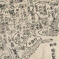 Quan Tai qian hou shan yu tu LOC gm71005160 (三塊厝).jpg 800 × 800; 119 KB
-
 Quan Tai qian hou shan yu tu LOC gm71005160.jpg 14,829 × 9,484; 15.39 MB
-
 Quan Tai qian hou shan yu tu LOC gm71005160.tif 14,829 × 9,484; 402.37 MB
-
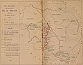
 Results of the Treaty of Berlin 1878..jpg 5,120 × 7,352; 11.92 MB
-
 Richmond, Sagadahoc Co., Maine 1878. LOC 73694688.jpg 6,736 × 4,656; 6.45 MB
-
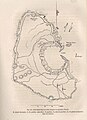
 Saint Paul island geological map 1878.jpg 1,120 × 1,280; 120 KB
-
 Saint-Paul map 1878.jpg 927 × 1,280; 143 KB
-
 Sandnes Parish 1878.jpg 1,487 × 1,032; 774 KB
-
 Sanon.png 649 × 530; 758 KB
-
 Seat of the war in Asia, map of Afghanistan. LOC 2003627034.jpg 9,408 × 7,105; 14.62 MB
-
 Seat of the war in Asia, map of Afghanistan. LOC 2003627034.tif 9,408 × 7,105; 191.24 MB
-
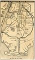
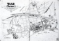
 Seattle map, 1878 (SEATTLE 445).jpg 768 × 477; 66 KB
-
 T.C. Strickland's new sectional map of Webster Co., Missouri. LOC 2012593049.jpg 3,456 × 5,306; 1.76 MB
-
 T.C. Strickland's new sectional map of Webster Co., Missouri. LOC 2012593049.tif 3,456 × 5,306; 52.46 MB
-
 Tavola Schiavoni 19 Quartiere Granili progetto01.jpg 1,024 × 717; 642 KB
-
 Tavola Schiavoni 19 Quartiere Granili progetto02.jpg 1,024 × 718; 656 KB
-
 Tavola Schiavoni 21 Piedigrotta progetto01.jpg 1,024 × 709; 757 KB
-
 Tavola Schiavoni 21 Piedigrotta progetto02.jpg 1,024 × 711; 713 KB
-
 Tavola Schiavoni 22 Villa Nazionale progetto01.jpg 1,024 × 716; 655 KB
-
 Tavola Schiavoni 22 Villa Nazionale progetto02.jpg 1,024 × 713; 693 KB
-
 Tavola Schiavoni Incrocio 3 4 7 8.jpg 1,024 × 715; 668 KB
-
 The Potomac River from Great Falls to Point Lookout LOC 90684587.jpg 5,946 × 2,435; 1.45 MB
-
 The Potomac River from Great Falls to Point Lookout LOC 90684587.tif 5,946 × 2,435; 41.42 MB
-
 Toms River 1878.jpg 2,137 × 3,600; 643 KB
-

-

-
 Transitville, Indiana 1878.png 1,600 × 1,440; 434 KB
-
 View of new Tacoma and Mount Rainier, Puget Sound, Washington Territory. LOC 75696667.jpg 7,744 × 5,216; 7.12 MB
-
 View of new Tacoma and Mount Rainier, Puget Sound, Washington Territory. LOC 75696667.tif 7,744 × 5,216; 115.56 MB
-
 Wippach, Planina, Laibach 1878.jpg 3,788 × 2,580; 11.13 MB
_p024_MAP_OF_GOA.jpg)
_p136_PLAN_OF_THE_CITY_OF_GOA.jpg)

_p010_AGRICULTURAL_MAP.jpg)
_MAP_OF_CYPRUS.jpg)
_MAP_OF_FAMAGOUSTA.jpg)
_MAP_OF_KYRENIA.jpg)
_MAP_OF_LARNAKA.jpg)
_MAP_OF_LIMASOL.jpg)
_MAP_OF_NICOSIA.jpg)
_MAP_OF_RUINS_OF_SALAMIS.jpg)
_p215_THE_RELATIONS_OF_CYPRUS_AND_THE_ADJACENT_COASTS.jpg)
_p281_GEOLOGICAL_MAP_OF_CYPRUS.jpg)

_p283_T01.jpg)
_p289_T03.jpg)
_p291_T04.jpg)
_p293_T05.jpg)
_-_(1)_GEOGRAPHICAL_POSITION_OF_ST._KILDA.jpg)
_-_(2)_MAPS_OF_ST._KILDA.jpg)
_-_p95_Map_of_Macculoch_Island.jpg)
_-_p95_Map_of_Martin_Island.jpg)
_-_p95_Map_of_Wilson_Island.jpg)


_-_Geographicus_-_BritishIsles-migeon-1878.jpg)
.jpg)
_(19727108756).jpg)


.jpg)

_-_Ground-Plan.jpg)


.jpg)

.jpg)
.jpg)


.jpg)


.jpg)
.jpg)
.jpg)
.jpg)

,_RP-P-OB-89.263.jpg)


.jpg)
_(cropped).jpg)


_1878._LOC_98688708.jpg)


,_dettaglio_02.JPG)
,_dettaglio_03.JPG)
,_dettaglio_04.JPG)
,_dettaglio_05.JPG)
,_dettaglio_06.JPG)


.jpg)
.jpg)


_(cropped).jpg)
.jpg)
,_1868_(crop2).jpg)


.jpg)


.jpg)


%27_(11124466004).jpg)
_Illustrationsseite_241.jpg)
_by_%C3%89mile_Prisse_d%27Avennes._Original_from_The_New_York_Public_Library._Digitally_enhanced_by_rawpixel._(50623605481).jpg)
_by_%C3%89mile_Prisse_d%27Avennes._Original_from_The_New_York_Public_Library._Digitally_enhanced_by_rawpixel._(50623605536).jpg)