Category:1868 maps of Massachusetts
Jump to navigation
Jump to search
States of the United States: California · Georgia · Illinois · Iowa · Massachusetts · Michigan · Missouri · New York · Utah
| ← 1860 1861 1862 1863 1864 1865 1866 1867 1868 1869 → |
Media in category "1868 maps of Massachusetts"
The following 16 files are in this category, out of 16 total.
-
 1868 BeachSt Boston map byMitchell detail BPL10531.png 809 × 714; 1.01 MB
-
 1868 BeachSt Boston map detail BPL11019.png 809 × 711; 1.11 MB
-
 A new & complete map of the city of Boston... (2675351454).jpg 1,707 × 2,000; 3.29 MB
-

-

-

-
 Map of Boston and the country adjacent, from actual surveys (2675354830).jpg 1,556 × 2,000; 2.97 MB
-
 Map of Boston from the latest surveys (2674530581).jpg 2,000 × 1,348; 2.49 MB
-
 Maps of Dorchester and Quincy (2674684255).jpg 2,000 × 1,293; 1.74 MB
-
 Plan of Boston (2674545337).jpg 2,000 × 1,351; 2.69 MB
-
 Plan of Boston and its vicinity (2675345800).jpg 1,614 × 2,000; 2.62 MB
-
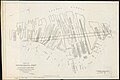
 Plan of Church St. district, showing estates and buildings (2674534915).jpg 2,000 × 1,327; 2.09 MB
-
 Plan of estates on High Street belonging to the City of Boston (2675347120).jpg 2,000 × 1,545; 2.17 MB
-

-
-
 Russells map of Boston from the latest surveys (9136378731).jpg 800 × 545; 116 KB


.jpg)
.jpg)
.jpg)
.jpg)
.jpg)
.jpg)
.jpg)
.jpg)
.jpg)
.jpg)
.jpg)
.jpg)
.jpg)
.jpg)