Category:1860s maps of Switzerland
Jump to navigation
Jump to search
Countries of Europe: Albania · Armenia‡ · Austria · Azerbaijan‡ · Belarus · Belgium · Bosnia and Herzegovina · Bulgaria · Croatia · Cyprus‡ · Czech Republic · Denmark · Estonia · Finland · France‡ · Georgia‡ · Germany · Greece · Hungary · Republic of Ireland · Italy · Latvia · Lithuania · Moldova · Montenegro · Netherlands‡ · Norway · Poland · Portugal‡ · Romania · Russia‡ · Serbia · Slovenia · Spain‡ · Sweden · Switzerland · Turkey‡ · Ukraine · United Kingdom
Limited recognition: Abkhazia‡
‡: partly located in Europe
Limited recognition: Abkhazia‡
‡: partly located in Europe
Subcategories
This category has the following 7 subcategories, out of 7 total.
- 1860 maps of Switzerland (3 F)
- 1862 maps of Switzerland (10 F)
- 1864 maps of Switzerland (2 F)
- 1868 maps of Switzerland (3 F)
- 1869 maps of Switzerland (3 F)
Media in category "1860s maps of Switzerland"
The following 13 files are in this category, out of 13 total.
-

-

-
-
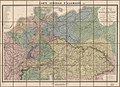
 Carte générale de l'Allemagne comprenant l'ensemble des etats de l'Europe centrale LOC 2015591062.tif 11,512 × 8,309; 273.67 MB
-

-

-

-

-
 Johnson, A.J. Europe. 1864.G.Switzerland.jpg 579 × 444; 89 KB
-

-
 The Quarterly journal of the Geological Society of London (1862) (14577808939).jpg 2,196 × 3,954; 1.63 MB
-
 The Quarterly journal of the Geological Society of London (1862) (14577996917).jpg 3,181 × 2,300; 1.48 MB
-
 La terre atlas historique et universel de Geographie ancienne 1864 (139050463).jpg 10,237 × 6,783; 67.44 MB
._1866_(-74)%27_(11074742233).jpg)


.jpg)
.jpg)
.jpg)

;_Island_of_Corsica_(inset)_(NYPL_b13663520-1510829).jpg)
_(14577808939).jpg)
_(14577996917).jpg)
.jpg)