Category:1860s maps of Sweden
Jump to navigation
Jump to search
Countries of Europe: Albania · Armenia‡ · Austria · Azerbaijan‡ · Belarus · Belgium · Bosnia and Herzegovina · Bulgaria · Croatia · Cyprus‡ · Czech Republic · Denmark · Estonia · Finland · France‡ · Georgia‡ · Germany · Greece · Hungary · Republic of Ireland · Italy · Latvia · Lithuania · Moldova · Montenegro · Netherlands‡ · Norway · Poland · Portugal‡ · Romania · Russia‡ · Serbia · Slovenia · Spain‡ · Sweden · Switzerland · Turkey‡ · Ukraine · United Kingdom
Limited recognition: Abkhazia‡
‡: partly located in Europe
Limited recognition: Abkhazia‡
‡: partly located in Europe
Media in category "1860s maps of Sweden"
The following 4 files are in this category, out of 4 total.
-
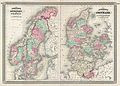
 1865 Johnson Map of Sweden, Norway and Denmark - Geographicus - SwedenDenmark-j-65.jpg 4,000 × 2,958; 3.19 MB
-
-

-
 Johnson, A.J. Europe. 1864.M.Norway.jpg 1,799 × 2,037; 1,018 KB


.jpg)
