Category:1857 maps of Vermont
Jump to navigation
Jump to search
States of the United States: California · Florida · Illinois · Massachusetts · New Mexico · New York · Ohio · Pennsylvania · Texas · Utah · Vermont
| 1855 1856 1857 |
Media in category "1857 maps of Vermont"
The following 8 files are in this category, out of 8 total.
-

-
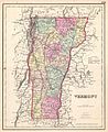 1857 Colton Map of Vermont - Geographicus - Vermont-colton-1857.jpg 2,869 × 3,500; 2.53 MB
-
 Map of Addison County, Vermont LOC 2012586232.tif 16,328 × 16,369; 764.67 MB
-
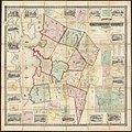 Map of Chittenden County, Vermont (13389343854).jpg 2,000 × 1,998; 3.45 MB
-
 Map of Chittenden County, Vermont - from actual surveys LOC 2005625313.jpg 16,596 × 16,373; 40.65 MB
-

-
 Map of the counties of Franklin and Grand Isle, Vermont - from actual surveys LOC 2005625354.jpg 17,262 × 16,795; 46.13 MB
-
 Map of the counties of Franklin and Grand Isle, Vermont - from actual surveys LOC 2005625354.tif 17,262 × 16,795; 829.45 MB


.jpg)

.jpg)
