Category:1830s maps of Georgia
Jump to navigation
Jump to search
Countries of Europe: Albania · Armenia‡ · Azerbaijan‡ · Belgium · Bulgaria · Cyprus‡ · Czech Republic · Denmark · Estonia · Finland · France‡ · Georgia‡ · Germany · Greece · Hungary · Republic of Ireland · Italy · Latvia · Lithuania · Netherlands‡ · Norway · Poland · Portugal‡ · Romania · Russia‡ · Slovenia · Spain‡ · Sweden · Switzerland · Turkey‡ · Ukraine · United Kingdom
Limited recognition: Abkhazia‡
‡: partly located in Europe
Limited recognition: Abkhazia‡
‡: partly located in Europe
Media in category "1830s maps of Georgia"
The following 9 files are in this category, out of 9 total.
-
 Akhaltsikhe fort.jpg 2,718 × 2,373; 8.39 MB
-
 Daniel Lizars. Turkey in Asia. 1831 (O).JPG 1,010 × 605; 171 KB
-
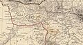
 Map of Caucasus in Russian imperia 1833.jpg 1,200 × 903; 252 KB
-
 View to Tbilisi from a book by Montpereux, 1833.jpg 2,270 × 1,336; 1.58 MB
-

-

-

-

-

.JPG)


._Russia_in_Europe_Part_IX_and_Georgia.1835.B.jpg)
._Russia_in_Europe_Part_IX_and_Georgia.1835.BA.jpg)
._Russia_in_Europe_Part_IX_and_Georgia.1835.BB.jpg)
._Russia_in_Europe_Part_IX_and_Georgia.1835.BC.jpg)
._Russia_in_Europe_Part_IX_and_Georgia.1835.G.jpg)