Category:1830s maps of Denmark
Jump to navigation
Jump to search
Countries of Europe: Albania · Armenia‡ · Azerbaijan‡ · Belgium · Bulgaria · Cyprus‡ · Czech Republic · Denmark · Estonia · Finland · France‡ · Georgia‡ · Germany · Greece · Hungary · Republic of Ireland · Italy · Latvia · Lithuania · Netherlands‡ · Norway · Poland · Portugal‡ · Romania · Russia‡ · Slovenia · Spain‡ · Sweden · Switzerland · Turkey‡ · Ukraine · United Kingdom
Limited recognition: Abkhazia‡
‡: partly located in Europe
Limited recognition: Abkhazia‡
‡: partly located in Europe
Media in category "1830s maps of Denmark"
The following 11 files are in this category, out of 11 total.
-
 SidneyHall Denmark 1830-Longman.jpg 3,568 × 2,465; 5.79 MB
-
 Denmark 1831.jpg 4,928 × 6,209; 3.94 MB
-
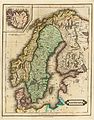 Norway and Sweden 1831.jpg 4,813 × 6,155; 3.64 MB
-

-

-
 1837 Malte-Brun Denmark Iceland.jpg 1,250 × 1,717; 1.74 MB
-
 Islande. 1837 Malte-Brun Denmark Iceland (cropped).jpg 414 × 355; 153 KB
-
 Dänemark Karte 1838 Friedrich Wilhelm Streit.tif 5,184 × 6,032; 63.85 MB
-
 Dänemark Karte 1841 Friedrich Wilhelm Streit.jpg 3,248 × 3,807; 2.54 MB
-
 Dänemark Karte 1841 Friedrich Wilhelm Streit.tif 3,262 × 3,807; 34.73 MB
-
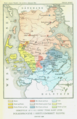 Folkesprogene i Hertugdømmet Slesvig.png 865 × 1,341; 1.91 MB


_-_Geographicus_-_Denmark-mb-1837.jpg)
)%27_(11010547994).jpg)

.jpg)

