Category:17th-century maps of Moravia
Jump to navigation
Jump to search
Media in category "17th-century maps of Moravia"
The following 9 files are in this category, out of 9 total.
-
 Blaeu 1645 - Hungaria Regnum.jpg 3,661 × 3,029; 1.48 MB
-

-
 Atlante Veneto Volume 2 093.jpg 10,565 × 7,078; 8.31 MB
-
 Blaeu 1645 - Moravia Marchionatus.jpg 3,720 × 3,120; 1.4 MB
-
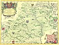
 Bohemiae Moraviae et Silesiae (Merian) 148.jpg 5,408 × 4,196; 3.57 MB
-
 Coronelliova mapa Moravy.jpg 12,120 × 9,223; 20.58 MB
-
 Kaeriova mapa Moravy.jpg 9,970 × 7,765; 14.03 MB
-
 Map of Moravia by Abraham Ortelius.jpeg 3,006 × 2,357; 2.18 MB
-
 Mapa Moravy 1627.jpg 2,352 × 1,948; 1,018 KB

.jpg)


_148.jpg)


