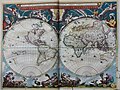
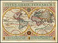
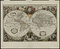
Category:17th-century double hemisphere world maps
Jump to navigation
Jump to search
Subcategories
This category has the following 5 subcategories, out of 5 total.
1
- Kunyu quantu - Nan huairen (10 F)
Media in category "17th-century double hemisphere world maps"
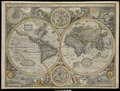
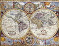
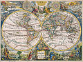
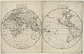
The following 142 files are in this category, out of 142 total.
-
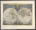
 "Nova et accuratíssima totíus Terrarum Orbis tabula" (22270602751).jpg 4,033 × 3,024; 1.94 MB
-
 "Nova Totius Terrarum Orbis". Amsterdam, Henricus Hondius, 1630.jpg 2,385 × 1,700; 3.62 MB
-
 (Nova et accuratissima totius terrarum orbis tabula). LOC 98687202.jpg 6,782 × 5,130; 8.36 MB
-
 (Nova et accuratissima totius terrarum orbis tabula). LOC 98687202.tif 6,782 × 5,130; 99.54 MB
-

-
 Universale Descrittione Di Tutto Il Mondo Del Eccte. Giuseppe Rosaccio.jpg 7,904 × 6,630; 10.41 MB
-
 1611 Novissima &c. Hondius.jpg 2,887 × 2,254; 6.14 MB
-

-

-

-

-
 Kepler-world.jpg 3,433 × 2,000; 9.16 MB
-
 1628 map - Typus Orbis Terrarum.jpg 5,106 × 3,854; 4.88 MB
-
 1628 Typus Orbis Terrarum.jpg 5,243 × 3,915; 5.19 MB
-

-
-
 Nova totius terrarum orbis 1.jpg 5,248 × 3,688; 6.83 MB
-

-
 1631 map - Typus Orbis Terrarum.jpg 5,120 × 3,802; 4.84 MB
-

-
 Atlas ou Representation du Monde Universel t. 1. 1633 (109103115).jpg 16,481 × 11,767; 36.26 MB
-
 Nova Totius Terrarum Orbis Geographica Ac Hydrographica Tabula auc.t Iud Hondio . . . 1636.jpg 14,070 × 9,710; 37.23 MB
-
 Cavallini. Atlas nautique de la Mer Méditerranée et d'une partie de la Mer Noire. 1639.jpg 10,231 × 6,446; 10.82 MB
-
 Globes - Societatis Missiones Indicae (cropped).jpg 3,360 × 2,563; 2.79 MB
-
 Societatis Missiones Indicae.jpg 4,529 × 7,451; 6.26 MB
-
 1646 New Speed Kaerius.jpg 1,687 × 1,224; 1.88 MB
-
-

-
 A-3-37-01-World-Hemispheres.jpg 3,000 × 2,240; 979 KB
-
 A-3-37-02-World-Hemispheres.jpg 3,000 × 2,234; 890 KB
-
 A-3-37-03-World-Hemispheres.jpg 3,000 × 2,277; 873 KB
-
 A-3-37-35-Hemisphere-Arctic-Antarctic.jpg 3,000 × 2,282; 828 KB
-
 A-3-37-36-World-Hemisphere.jpg 3,000 × 2,219; 912 KB
-
 Orbis Terrarum Tipus de Integro Multis in Locis Emendatus.jpg 8,500 × 5,096; 14.45 MB
-

-

-

-

-
-
 Gulf1..JPG 3,072 × 2,304; 3.12 MB
-
 Orbis Terrarum Nova et Accuratissima Tabula by Nicolaes Visscher, 1658.jpg 2,950 × 2,478; 1.64 MB
-
-
 1660 Nova Totius de Wit 12 bladige wandkaart.jpg 3,584 × 2,752; 2.09 MB
-

-
 Nova totius terrarum orbis tabula auctore F. de Wit RMG F8117.tiff 4,800 × 3,722; 51.11 MB
-
 Nova Orbis Tabula in Lucem Edita.jpg 2,172 × 1,820; 888 KB
-
 Johannes Blaeu - World map 1664.jpg 877 × 650; 197 KB
-
 Nova et Accuratissima Terrarum Orbis Tabula (J.Blaeu, 1664).jpg 7,686 × 6,751; 15.76 MB
-
 Nuevo Atlas o Teatro Mundo - Nova et Accuratissima Totius.jpg 6,480 × 5,144; 5.43 MB
-
 Nova totius terrarum orbis tabula (8429816765).jpg 800 × 678; 170 KB
-
 1666 Orbis Terrarum Goos.jpg 4,782 × 3,702; 9.92 MB
-
-
 Pierre Duval, Planisphere ou carte generale du monde (FL13730376 2718552).jpg 9,800 × 7,156; 102.68 MB
-
 1669 map of the world by Pieter Goos.tif 6,927 × 5,900; 233.88 MB
-

-
 1674 map of the world by Giacomo Giovanni Rossi.jpg 14,772 × 10,375; 23.07 MB
-
 Kunyu Quantu of Ferdinand Verbiest 1674.jpg 1,908 × 800; 497 KB
-
 17th century world map - Nova Totius Terrarum Orbis Tabula.jpg 11,665 × 10,270; 30.36 MB
-
 Nova Orbis Tabula in Lucem edita A F de Wit 1680.jpg 2,685 × 2,290; 6.89 MB
-
 The world in planisphere (NYPL b14428893-1503411).jpg 5,197 × 4,188; 5.26 MB
-
 Nova totius terrarum orbis geographica.jpg 1,280 × 1,100; 481 KB
-
 1682 map of the world by Hans Georg Bodenehr.jpg 33,033 × 16,475; 99.57 MB
-

-
 1685 Bormeester Map of the World - Geographicus - TerrarumOrbis-bormeester-1685.jpg 5,000 × 4,251; 4.48 MB
-
 Orbis nulla plaga est quam sol non ditet Iesus.jpg 4,026 × 2,933; 3.13 MB
-
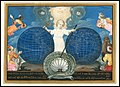
 View of an armillary sphere admired by a cherub, 1685.jpg 600 × 900; 384 KB
-
 Novissima totius tarrarum orbis tabula, Auctore Hugonis Allardi.jpg 6,000 × 4,826; 9.56 MB
-
 Blome Geography 1686 Cornell CUL PJM 1013 01.jpg 4,534 × 7,215; 5.32 MB
-
 A new mapp of the world (8342125193).jpg 800 × 659; 156 KB
-
 Kartenarbeit.png 3,000 × 1,776; 1.28 MB
-
 World Map 1689-smaller.jpg 2,280 × 1,968; 1.01 MB
-
 World Map 1689.JPG 4,560 × 3,936; 8.59 MB
-
 Ca. 1690 world map - Orbis Terrarum Nova et Accurata Tabula.jpg 7,225 × 6,225; 13.64 MB
-
 New and Accurate Map of the World WDL179.png 1,212 × 1,024; 2.79 MB
-
 Nova orbis tabula, ad usum serenissimi Burgundiae Ducis LOC 2006627251.jpg 7,774 × 6,252; 9.48 MB
-
 Nova orbis tabula, ad usum serenissimi Burgundiae Ducis LOC 2006627251.tif 7,774 × 6,252; 139.05 MB
-
 1695 Armenian map of the world.jpg 14,002 × 11,207; 31.5 MB
-
 Askharhatsuits.jpg 1,420 × 1,139; 932 KB
-
 Matenadaran (021).jpg 7,152 × 5,368; 5.01 MB
-
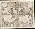
 1672 95 Novus Planiglobii Valck'.jpg 8,500 × 6,487; 17.74 MB
-
 Hamadaradz Asharhatsuyts = Extensive world map (8540503506).jpg 800 × 569; 123 KB
-
 1696 map of the world by Carolus Allard.jpg 14,267 × 12,499; 44.11 MB
-
 1696 Zahn Map of the World in Two Hemispheres - Geographicus - World-zahn-1696.jpg 6,000 × 2,433; 4.98 MB
-
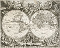
 Le Globe Terrestre Represente En Deux Plans-Hemispheres et en Diverses Autres Figures.jpg 15,314 × 11,841; 37.97 MB
-
 1700 map of the world by Paolo Petrini.jpg 12,878 × 10,246; 37.96 MB
-
 1907 facsimile of the Hondius' 1610s world map.jpg 46,498 × 30,000; 301.6 MB
-
 A map of the world c. 1600 Wellcome L0034555.jpg 3,426 × 2,655; 3.74 MB
-

-

-

-
 A new and accurat map of the world (8642021329).jpg 5,227 × 3,776; 21.23 MB
-
 A new and accurat map of the world - Norman B. Leventhal Map Center at the BPL.jpg 2,000 × 1,576; 3.5 MB
-

-
-
-

-
 A New And Accvrat Map Of The World.png 3,491 × 2,694; 25.48 MB
-
 1664 Nova et Accvrat Blaeu.jpg 874 × 659; 575 KB
-
 Charles Inselin - Mape-monde.jpg 800 × 599; 249 KB
-
-
 Continentem Dudum Notam Componebat (with) Continentem Noviter Detectam, 1660.jpg 5,087 × 3,164; 4.53 MB
-
 Fotothek df tg 0007189 Geographie ^ Karte.jpg 6,002 × 4,284; 13.03 MB
-

-
 Hendrik Hondius, Nova Totius Terrarum orbis Geographica ac Hydrographica Tabula 1641.jpg 4,800 × 3,400; 24.62 MB
-
 Hondius - Nova totius terrarum 1625.jpg 1,701 × 1,221; 1.03 MB
-
 Map - Special Collections University of Amsterdam - OTM- HB-KZL 31-01-09.tif 6,536 × 4,552; 85.12 MB
-
 Map - Special Collections University of Amsterdam - OTM- HB-KZL 31-01-10.tif 6,768 × 5,477; 106.05 MB
-
 Map - Special Collections University of Amsterdam - OTM- HB-KZL 31-01-11.tif 7,088 × 5,955; 120.76 MB
-
 Map - Special Collections University of Amsterdam - OTM- HB-KZL 31-01-12.tif 6,140 × 3,458; 60.75 MB
-
 Map - Special Collections University of Amsterdam - OTM- HB-KZL 31-01-19.tif 6,784 × 5,530; 107.33 MB
-
 Map - Special Collections University of Amsterdam - OTM- HB-KZL 31-01-20.tif 6,480 × 5,256; 97.44 MB
-
 Map - Special Collections University of Amsterdam - OTM- HB-KZL 31-01-21.tif 7,135 × 5,892; 120.28 MB
-
 Map of the world. Wellcome L0051173.jpg 6,557 × 5,060; 12.44 MB
-
-

-
 Mappemonde 1683.JPG 5,500 × 4,421; 16.13 MB
-

-

-
-
 Nova delineatio totius orbis terrarum RMG F8090.tiff 4,741 × 4,168; 56.54 MB
-

-
-
-
 Nova totius terrarium orbis (De Wit, Luyken, De Hooghe).jpg 3,316 × 2,845; 10.23 MB
-
 Nova Totius Terrarum orbis Geographica ac Hydrographica Tabula - no-nb krt 00678.jpg 8,867 × 6,354; 22.59 MB
-
 Nova totius terrarum orbis tabula RMG F8175.tiff 4,800 × 3,973; 54.56 MB
-
 Novissima totius terrarum orbis tabula RMG F8055.tiff 4,824 × 3,634; 50.16 MB
-
 Nieuwe Werelt kaert (NYPL b13647135-ps map cd7 081).jpg 4,072 × 4,072; 6.54 MB
-
 Nova et accuratissima totius terrarum orbis tabula (NYPL b13963883-psnypl map 233).jpg 4,708 × 3,672; 4.43 MB
-

-

-
 Pieter Goos - Nieuwe werelt kaert (New Map of the World).jpg 5,573 × 4,648; 8.75 MB
-
 Planisphaerium terrestre sive terrarum orbis RMG F0431.tiff 6,571 × 5,561; 104.55 MB
-
 Puzzle z mapą siedemnastowiecznego świata firmy Trefl - lipiec 2018.jpg 2,592 × 1,944; 2.59 MB
-

-
 UBBasel Map 1630 Kartenslg Mappe 1-6.tif 12,161 × 8,276, 2 pages; 287.97 MB
-
 Weltkarte 1674.jpg 2,000 × 827; 734 KB
-
 Weltkarte Atlas Blaeuw.jpg 11,220 × 8,524; 42.03 MB
-
 1670 Nova Orbis de Wit.JPG 4,566 × 3,880; 15.01 MB
-

-
 World Map (Nova orbis tabula in lucem edita A.F. de Wit) (CBL Wep 4181).jpg 10,244 × 8,351; 64.36 MB
-
 Cartes generales de toutes les parties du monde 1681 (127470372).jpg 12,539 × 9,493; 15.12 MB
.jpg)

._LOC_98687202.jpg)


.jpg)
s_Planis_Hemisphaerii_(s_com)_prehes._Nic._Geilekerck,_fecit_-_btv1b53069786t_(1_of_2).jpg)
.jpg)


.jpg)

.jpg)
.jpg)


.jpg)


.jpg)
.jpg)
.jpg)
.jpg)
.jpg)


_-_btv1b52511195b_(09_of_85).jpg)


.jpg)

.jpg)

.1.(1).jpg)
.jpg)
.jpg)


.jpg)


.jpg)


.jpg)

.jpg)


.jpg)

.jpg)


_-_componebat_Joa._Baptista_Nicolosius..._-_btv1b53093265h.jpg)
_Continentem_Noviter_Detectam,_1660.jpg)


.jpg)
_Amsterdam_Gedruckt_by_Iustus_Danckers_consien_caert_vercoper_inde_Calverstaet_nule_Danckbaenheyt._RMG_RP6726.jpg)
.jpg)

.jpg)
.jpg)

.jpg)


,_RP-P-1891-A-16621.jpg)
_(CBL_Wep_4181).jpg)
.jpg)
_by_John_Playford._Original_From_The_New_York_Public_Library._Digitally_enhanced_by_rawpixel._(50623610066).jpg)