Category:1760s maps of Chile
Jump to navigation
Jump to search
Countries of the Americas: Argentina · The Bahamas · Brazil · Canada · Chile · Colombia · Cuba · Ecuador · Mexico · Paraguay · Peru · United States of America · Uruguay · Venezuela
Other areas: Puerto Rico
Other areas: Puerto Rico
Media in category "1760s maps of Chile"
The following 19 files are in this category, out of 19 total.
-
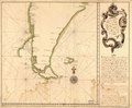
 Carte du Chili - (par J.N. Bellin) - btv1b8596585g.jpg 3,652 × 4,800; 2.86 MB
-

-
-

-
-

-

-

-
 La Terre et les Isles (...)Sanson Guillaume btv1b8493487s.jpg 1,329 × 1,054; 338 KB
-
 Pianta della citta di Santiago, capitale del regno del Chili - btv1b8441146t.jpg 3,537 × 4,332; 2.63 MB
-
 Plan de la ville de Santiago Capitale du Chili - (par J.N.Bellin) - btv1b85966066.jpg 3,370 × 3,996; 2.3 MB
-
 Plan du port de Coquimbo a la coste du Chili - (par J.N. Bellin) - btv1b8596592m.jpg 3,741 × 4,429; 2.54 MB
-
 Plano de la Isla Mocha.jpg 852 × 1,024; 256 KB
-
 Plano del Balparayso LOC 90682627.jpg 6,062 × 4,562; 2.48 MB
-
 Plano del Balparayso LOC 90682627.tif 6,062 × 4,562; 79.12 MB
-
 Plano del pto. de Balparayso LOC 90682625.jpg 5,739 × 3,592; 1.97 MB
-
 Plano del pto. de Balparayso LOC 90682625.tif 5,739 × 3,592; 58.98 MB
-

-

_-_btv1b8596585g.jpg)


_(8443730393).jpg)
Sanson_Guillaume_btv1b8493487s.jpg)

_-_btv1b85966066.jpg)
_-_btv1b8596592m.jpg)


