Category:1730s maps of Turkey
Jump to navigation
Jump to search
Countries of Asia: Armenia‡ · Azerbaijan‡ · People's Republic of China · Cyprus‡ · Egypt‡ · Georgia‡ · India · Indonesia‡ · Iran · Iraq · Philippines · Russia‡ · Turkey‡
Limited recognition: Abkhazia‡ · Taiwan · State of Palestine
‡: partly located in Asia
Limited recognition: Abkhazia‡ · Taiwan · State of Palestine
‡: partly located in Asia
Countries of Europe: Armenia‡ · Azerbaijan‡ · Belgium · Bosnia and Herzegovina · Bulgaria · Croatia · Cyprus‡ · Denmark · France‡ · Georgia‡ · Germany · Greece · Hungary · Republic of Ireland · Italy · Lithuania · Netherlands‡ · Norway · Poland · Portugal‡ · Russia‡ · Serbia · Slovenia · Spain‡ · Sweden · Switzerland · Turkey‡ · Ukraine · United Kingdom
Limited recognition: Abkhazia‡
‡: partly located in Europe
Limited recognition: Abkhazia‡
‡: partly located in Europe
Subcategories
This category has the following 2 subcategories, out of 2 total.
- 1736 maps of Turkey (1 F)
- 1737 maps of Turkey (empty)
Media in category "1730s maps of Turkey"
The following 6 files are in this category, out of 6 total.
-
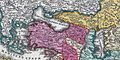 C. Homann. Map of Asia. 1730. Caucasus.jpg 1,287 × 640; 385 KB
-

-
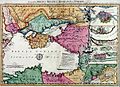
 Moll, Herman. Turkey in Asia; or Asia Minor &c. 1736 (B).jpg 1,387 × 1,411; 447 KB
-
 Moll, Herman. Turkey in Asia; or Asia Minor &c. 1736 (H).jpg 1,132 × 816; 238 KB
-
 Moll, Herman. Turkey in Asia; or Asia Minor &c. 1736 (G).jpg 1,588 × 963; 390 KB
-


.jpg)
.jpg)
.jpg)
