Category:1730s maps of Switzerland
Jump to navigation
Jump to search
Countries of Europe: Armenia‡ · Azerbaijan‡ · Belgium · Bosnia and Herzegovina · Bulgaria · Croatia · Cyprus‡ · Denmark · France‡ · Georgia‡ · Germany · Greece · Hungary · Republic of Ireland · Italy · Lithuania · Netherlands‡ · Norway · Poland · Portugal‡ · Russia‡ · Serbia · Slovenia · Spain‡ · Sweden · Switzerland · Turkey‡ · Ukraine · United Kingdom
Limited recognition: Abkhazia‡
‡: partly located in Europe
Limited recognition: Abkhazia‡
‡: partly located in Europe
Media in category "1730s maps of Switzerland"
The following 8 files are in this category, out of 8 total.
-
 Carte du Lac de Genève et des Pays Circonvoisins 1730.jpg 5,251 × 3,761; 11.09 MB
-

-

-
 UechtlandByHomann.jpg 1,188 × 837; 238 KB
-
 Le flambeau de la guerre allumee au Rhin 1735 (81480932).jpg 5,978 × 4,595; 4.46 MB
-
 Le flambeau de la guerre allumee au Rhin 1735 (81480971).jpg 5,977 × 4,580; 4.7 MB
-
 A new map of Germany, Hungary, Transilvania and the Suisse cantons, ... NYPL1630445.tiff 7,230 × 5,100; 105.5 MB
-
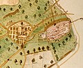 Avenches plan 1731.jpg 400 × 331; 192 KB


_-_Geographicus_-_Germaniae-covensmortier-1720.jpg)

.jpg)
.jpg)
