Category:1720s maps of North America
Jump to navigation
Jump to search
Temperate regions: North America · South America · Africa · Europe · Asia · Oceania – Polar regions: – Other regions:
Subcategories
This category has the following 14 subcategories, out of 14 total.
Media in category "1720s maps of North America"
The following 3 files are in this category, out of 3 total.
-
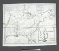 A Map of Carolana and of the River Meschacebe etc NYPL434393.tiff 4,932 × 4,272; 60.29 MB
-
 Homann Amplissimae Regionis Mississipi c. 1720 UTA.jpg 6,000 × 5,321; 16.4 MB
-


