Category:1680s maps of Turkey
Jump to navigation
Jump to search
Countries of Europe: Armenia‡ · Austria · Azerbaijan‡ · Belgium · Bosnia and Herzegovina · Bulgaria · Croatia · Cyprus‡ · Denmark · France‡ · Georgia‡ · Germany · Greece · Hungary · Republic of Ireland · Italy · Lithuania · Montenegro · Netherlands‡ · Norway · Poland · Portugal‡ · Romania · Russia‡ · Serbia · Slovakia · Slovenia · Spain‡ · Sweden · Switzerland · Turkey‡ · Ukraine
‡: partly located in Europe
‡: partly located in Europe
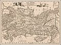
Media in category "1680s maps of Turkey"
The following 8 files are in this category, out of 8 total.
-
 Map of Armenia, Description de L'Universe (Alain Manesson Mallet, 1683).jpg 725 × 1,078; 162 KB
-
 1684 Curdistan Diarbeck map.jpg 1,090 × 1,474; 1.47 MB
-
 Partie Orientalie De Mediterraneo Del Padre Cosmografo Coronelli.jpg 5,147 × 3,723; 3.18 MB
-
 1686 map of Asia Minor by Giacomo Cantelli da Vignola.jpg 4,597 × 3,416; 2.85 MB
-
 Armenia, Georgia, Comania &c.jpg 3,560 × 3,147; 2.36 MB
-

-

-
 Nova Persiae Armeniae Natoliae et Arabiae (8342790665).jpg 800 × 652; 167 KB
.jpg)


_Maris_Aegaei_Accurata_Delinatio_autore_Imeu_(%3F)_-_Dapper_Olfert_-_1688.jpg)
.jpg)
.jpg)