Category:1680s maps of Greece
Jump to navigation
Jump to search
Countries of Europe: Armenia‡ · Austria · Azerbaijan‡ · Belgium · Bosnia and Herzegovina · Bulgaria · Croatia · Cyprus‡ · Denmark · France‡ · Georgia‡ · Germany · Greece · Hungary · Republic of Ireland · Italy · Lithuania · Montenegro · Netherlands‡ · Norway · Poland · Portugal‡ · Romania · Russia‡ · Serbia · Slovakia · Slovenia · Spain‡ · Sweden · Switzerland · Turkey‡ · Ukraine
‡: partly located in Europe
‡: partly located in Europe
Subcategories
This category has the following 2 subcategories, out of 2 total.
Media in category "1680s maps of Greece"
The following 33 files are in this category, out of 33 total.
-
 - Piacenza Francesco - 1688.jpg 1,047 × 1,500; 923 KB
-

-
 George Wheler 1682 Map-of-Achaia 01.png 1,020 × 940; 1.53 MB
-
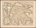
 1684 map of Thessaly and Macedonia by Giacomo Cantelli da Vignola.jpg 4,657 × 3,705; 3.66 MB
-
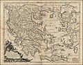
 1684 map of Macedonia and Thessaly by Giacomo Cantelli da Vignola.jpg 4,546 × 3,636; 3.53 MB
-
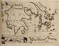
 Archipelagus - Enderlin Jacob - 1686.jpg 2,112 × 1,771; 2.04 MB
-

-

-

-

-
 Morea - Peeters Jacob - 1686.jpg 1,500 × 864; 522 KB
-
 Partie Orientalie De Mediterraneo Del Padre Cosmografo Coronelli.jpg 5,147 × 3,723; 3.18 MB
-

-

-

-

-
 Fortezze della Preuesa e Santa Maura - (par le Père Coronelli) - btv1b5962291f.jpg 6,000 × 4,104; 3.97 MB
-
 IAN 0033 Coronelli 1687 Preveza.jpg 6,208 × 3,823; 26.48 MB
-
 Map of the Peloponnese - Coronelli Vincenzo - 1687.jpg 800 × 636; 205 KB
-

-
-

-

-

-

-
 Peloponnneso hoggidí Morea - Coronelli Vincenzo - 1688.jpg 2,000 × 1,452; 1.38 MB
-
 1689 map of Greece by Giacomo Cantelli da Vignola.jpg 4,717 × 3,696; 3.34 MB
-
 Greece with a part of Anatolia - Randolph Bernard - 1689.jpg 2,000 × 1,672; 1.84 MB
-
 Zarnata - btv1b55006169n (2 of 3).jpg 6,486 × 4,958; 3.58 MB
-
 A Plan of Athens - btv1b59623281.jpg 3,376 × 2,952; 1.21 MB
-

-

-
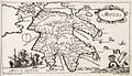
 Achaia vetus et nova - Wheler George - 1682.jpg 800 × 694; 229 KB


_-_btv1b5962291f.jpg)


.jpg)


.jpg)


