User:Dough4872/gallery/July 26, 2008
< User:Dough4872 | gallery
-
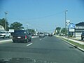
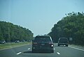
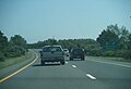
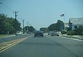
 NJ 47 northbound approaching Wildwood drawbridge
 -
 NJ 47 northbound drawbridge out of Wildwood
 -
 NJ 47 northbound past Wildwood drawbridge
 -
 NJ 47 northbound at Cape May CR 624 western segment
 -
 NJ 47 northbound leaving Wildwood
 -
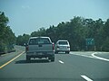
 NJ 47 northbound approaching GSP
 -
 NJ 47 northbound approaching GSP
 -
 NJ 47 northbound at GSP northbound exit
 -
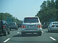
 NJ 47 southbound at GSP southbound exit
 -
 NJ 47 northbound at Fifth Street
 -
 NJ 47 northbound past Fifth Street
 -
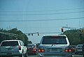
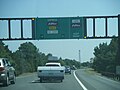
 NJ 47 northbound approaching US 9
 -
 NJ 47 northbound at US 9
 -
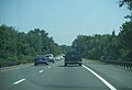
 NJ 47 northbound past US 9
 -
 US 9 northbound past NJ 47
 -
 US 9 southbound at NJ 47
 -
 US 9 southbound past NJ 47
 -
 NJ Transit bus #7998 on 552 line along US 9
 -
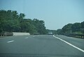 GSP northbound over NJ 47
 -
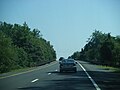
 GSP northbound past NJ 47
 -
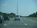
 GSP northbound at mile marker 5
 -
 GSP northbound at mile marker 6
 -
 GSP northbound over NJ 147
 -
 GSP northbound past NJ 147
 -
 GSP northbound 1 mile to Shellbay Avenue
 -
 GSP northbound between NJ 147 and Shellbay Avenue
 -
 GSP northbound ½ mile to Shellbay Avenue
 -
 GSP northbound approaching Shellbay Avenue
 -
 GSP northbound at Shellbay Avenue
 -
 GSP northbound past Shellbay Avenue
 -
 GSP northbound between Shellbay Avenue and Cape May CR 657
 -
 GSP northbound ½ mile to Cape May CR 657
 -
 GSP northbound approaching Cape May CR 657
 -
 Closer view of sign for Cape May County Route 657 eastbound
 -
 Closer view of sign for Cape May CR 657 westbound
 -
 Sign for Cape May CR 657 westbound at intersection
 -
 Sign for Cape May CR 657 eastbound at intersection
 -
 GSP northbound at Cape May CR 657
 -
 GSP northbound past Cape May CR 657
 -
 GSP northbound approaching Caoe May County Route 609 with sign for eastbound CR 609
 -
 GSP northbound approaching Cape May County Route 609 with sign for westbound CR 609
 -
 Sign for Cape May CR 609 westbound at intersection
 -
 Sign for Cape May CR 609 eastbound at intersection
 -
 GSP northbound at Cape May CR 609
 -
 GSP northbound past Cape May CR 609
 -
 GSP northbound 2 miles to Cape May CR 601
 -
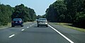
 GSP northbound between Cape May CR 609 and Cape May CR 601
 -
 Sign advising motorists to use next exit for Sea Isle City
 -
 GSP northbound 1 mile to Cape May CR 601
 -
 GSP northbound at Cape May CR 601 exit
 -
 Another view of exit
 -
 GSP northbound past Cape May CR 601
 -
 GSP northbound between Cape May CR 601 and Cape May CR 625
 -
 GSP northbound at mile marker 15.4
 -
 Advance sign with price for Lukoil gas station at Ocean View service area
 -
 GSP northbound between Cape May CR 601 and Cape May CR 625
 -
 Advance sign for Ocean View service area
 -
 GSP northbound 2 miles to Cape May Toll Plaza
 -
 GSP northbound over Cape May CR 625
 -
 GSP northbound past Cape May CR 625
 -
 VMS with “Buckle Up For Safety”
 -
 GSP northbound at Ocean View service area ramp
 -
 GSP northbound 1 mile to Cape May Toll Plaza
 -
 select toll lane sign for Cape May Toll Plaza
 -
 GSP northbound 1 ½ miles to US 9/NJ 50
 -
 GSP northbound approaching Cape May Toll Plaza
 -
 GSP northbound approaching Cape May Toll Plaza
 -
 Cape May Toll Plaza
 -
 GSP northbound ½ mile to US 9/NJ 50
 -
 GSP northbound approaching US 9/NJ 50
 -
 GSP northbound at US 9/NJ 50 exit
 -
 Another view of exit
 -
 GSP northbound past US 9/NJ 50
 -
 GSP northbound between US 9/NJ 50 and Cape May CR 623
 -
 GSP northbound 1 mile to picnic area
 -
 GSP northbound at mile marker 22.3
 -
 Sign advising of closure of Beesley Point Bridge
 -
 GSP northbound between US 9/NJ 50 and Cape May CR 623
 -
 GSP northbound 2 miles to Cape May CR 623
 -
 GSP northbound between US 9/NJ 50 and Cape May CR 623
 -
 GSP northbound 1 mile to Cape May CR 623
 -
 GSP northbound between US 9/NJ 50 and Cape May CR 623
 -
 Sign advising of NJ 52 truck detour
 -
 GSP northbound approaching Cape May CR 623
 -
 GSP northbound at Cape May CR 623 exit
 -
 Closer view of sign at exit
 -
 Another view of exit
 -
 Cape May CR 623 eastbound past GSP
 -
 Cape May CR 623 eastbound past GSP
 -
 Cape May CR 623 eastbound approaching 34th Street Bridge
 -
 Cape May CR 623 eastbound crossing onto 34th Street Bridge
 -
 34th Street Bridge into Ocean City
 -
 Cape May CR 623 eastbound past 34th Street Bridge
 -
 Cape May CR 623 eastbound approaching Cape May CR 656
 -
 Cape May CR 623 eastbound approaching Cape May CR 656
 -
 Cape May CR 623 eastbound approaching Cape May CR 656
 -
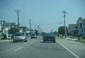
 Cape May CR 656 northbound past Cape May CR 623
 -
 Cape May CR 656 northbound at 29th Street
 -
 Cape May CR 656 northbound at 24th Street
 -
 Cape May CR 656 northbound at 20th Street
 -
 Cape May CR 656 northbound at 16th Street
 -
 Cape May CR 656 northbound at 11th Street
 -
 Cape May CR 656 northbound at 9th Street, which provides access to NJ 52
 -
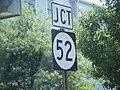 Closer view of junction NJ 52 shield
 -
 Cape May CR 656 northbound past 9th Street
 -
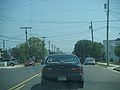
 Cape May CR 656 northbound past 6th Street
 -
 Atlantic City skyline from Ocean City
 -
 Ocean City beach at Surf Road
 -
 Absecon Island from Ocean City
 -
 Ocean City boardwalk looking south from 12th Street
 -
 Kites on Ocean City beach at 12th Street
 -
 Another view of kites


