Reykjahlíð
Jump to navigation
Jump to search
Dansk: Reykjahlíð er en islandsk bygd med ca. 200 indb. som ligger ved Mývatn (Myggesøen) i det nordøstlige Island. Reykjahlíð er administrationscenter for Skútustaðir kommune, der 2005 havde 410 indbyggere.
Deutsch: Das Dorf Reykjahlíð liegt auf dem Gebiet des Vulkansystems der Krafla im Norden Islands beim See Mývatn. In der Nähe befinden sich zahlreiche touristische Attraktionen, die mit dem Vulkan in Zusammenhang stehen. Gleichzeitig ist der Ort Verwaltungszentrum der Gemeinde Skútustaðahreppur.
English: The village of Reykjahlíð has approximately 200 inhabitants and is situated on the shores of Lake Mývatn in the north of Iceland. It is the seat of the municipality of Skútustaðahreppur. As the village is situated in the range of influence of the Krafla (volcanic system), there are a lot of connected tourist attractions in the vicinity.
Français : Le village Reykjahlíð est une commune islandaise de la municipalité de Norðurþing située au nord de l'île, dans la région de Norðurland eystra. En 2011, le village comptait 187 habitants. Il se trouve sous le site du volcan Krafla, c'est pour cela qu' on trouve de nombreuses attractions touristiques dans la région.
Íslenska: Reykjahlíð er þorp sem stendur á bökkum Mývatns. Þar búa rúmlega 200 manns. Reykjahlíð tilheyrir Skútustaðahreppi og er skrifstofa sveitarfélagsins staðsett í þorpinu. Þar er íþróttafélag sem er fyrir alla íbúa við Mývatn, það nefnist Mývetningur.
Italiano: Reykjahlíð è una piccolissima località islandese sulle sponde del lago Myvatn. L'attività è orientata molto al turismo legato alle bellezze naturalistiche del lago e suoi dintorni.
Nederlands: Reykjahlíð is een plaatsje in het noorden van IJsland met ongeveer 200 inwoners aan de noordoostelijke oever van het Mývatn meer. Reykjahlíð ligt aan de hringvegur.
Norsk bokmål: Reykjahlíð er et tettsted med rundt 200 innbyggere som ligger på bredden av innsjøen Mývatn nord på Island.
Maps[edit]
-
 Reykjahlíð is located on the northeast shores of lake Mývatn.
 -
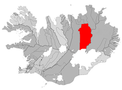 The municipality Skútustaðahreppur
 -
 COA Skútustadahreppur


Views of the village[edit]
-
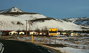 Approaching the village
 -
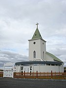 The church of Reykjahlíð
 -
 Interior of the church
 -
 The church that was engolfed by lava in the 18th century
 -
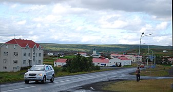 The main street
 -
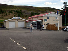 Hotel
Hotel -
 Some farms


.jpg)


Energy for the region: Geothermal power station Bjarnarflag[edit]


Bathing in hot geothermal water: Jarðböðin[edit]


The lake (almost) without midges: Mývatn[edit]
-

-
 Rootless cones in the lake
 -
 Seen from Námafjall
 -
 The lake behind the crater row of Jarðbaðshólar
 -
 Seen from Skútustaðir
 -
 Aerial view of the lake


High temperature area at the volcano Námafjall: Hverarönd[edit]
-

-
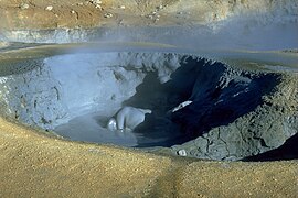 Mud pot at Námafjall
 -
 Solfatara at Hverarönd
 -
 Another mudpot
 -
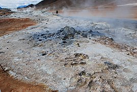
 Steaming sulfur fumarole
 -
 Mineral deposits at Hverarönd


.jpg)


Two more high temperature areas in the region: Víti and Leirhnjúkur are situated within Krafla caldera and above magma chambers[edit]
-

-
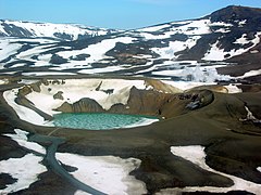 The Víti crater and the central volcano Krafla
 -

-
 Lava fields at Leirhnjúkur
 -
 Steaming lavas at Leirhnjúkur


.jpg)