Maps of Italy
Jump to navigation
Jump to search
Countries of Europe: Albania · Andorra · Armenia‡ · Austria · Azerbaijan‡ · Belarus · Belgium · Bosnia and Herzegovina · Bulgaria · Croatia · Cyprus‡ · Czech Republic · Denmark · Estonia · Finland · France‡ · Georgia‡ · Germany · Greece · Hungary · Iceland · Republic of Ireland · Italy · Kazakhstan‡ · Latvia · Liechtenstein · Lithuania · Luxembourg · Malta · Moldova · Monaco · Montenegro · Netherlands‡ · North Macedonia · Norway · Poland · Portugal‡ · Romania · Russia‡ · San Marino · Serbia · Slovakia · Slovenia · Spain‡ · Sweden · Switzerland · Turkey‡ · Ukraine · United Kingdom · Vatican City
Specific status: Akrotiri and Dhekelia‡ · Faroe Islands · Gibraltar · Bailiwick of Guernsey · Isle of Man · Jersey · Svalbard – Limited recognition: Abkhazia‡ · Gagauzia · Kosovo · South Ossetia‡ · Transnistria · Northern Cyprus‡ · United Nations Buffer Zone in Cyprus‡
‡: partly located in Europe
Specific status: Akrotiri and Dhekelia‡ · Faroe Islands · Gibraltar · Bailiwick of Guernsey · Isle of Man · Jersey · Svalbard – Limited recognition: Abkhazia‡ · Gagauzia · Kosovo · South Ossetia‡ · Transnistria · Northern Cyprus‡ · United Nations Buffer Zone in Cyprus‡
‡: partly located in Europe
- Maps are also available as part of the
 Wikimedia Atlas of the World project in the Atlas of Italy.
Maps of the country[edit]
-
 Location map for Italy
 -
 Location map for Italy in Europe
 -
 Geographic map of Italy without labels (source file)
 -
 Map of South Tyrol with labels in Cerman (source file)
 -
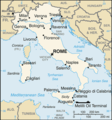 Map of Italy from CIA World Factbook (English text)
 -
 CIA World Factbook map of Italy (French text)
 -
 Network of the Italian motorways
 -
 Same, with some labels
 -
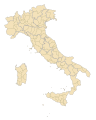 Blank vector map
 -
 Map of the main ports of Italy


.jpg)
.png)


Locator Maps of italian regions[edit]
Pink version (220x257 pixels)[edit]
-
 Map of Abruzzo
 -
 Map of Aosta Valley
 -
 Map of Apulia
 -
 Map of Basilicata
 -
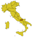
 Map of Calabria
 -
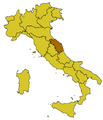
 Map of Campania
 -
 Map of Emilia-Romagna
 -
 Map of Friuli-Venezia Giulia
 -
 Map of Latium
 -
 Map of Liguria
 -
 Map of Lombardy
 -
 Map of Marche
 -
 Map of Molise
 -
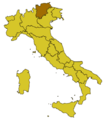
 Map of Piedmont
 -
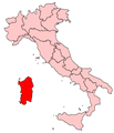 Map of Sardinia
 -
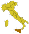
 Map of Sicily
 -
 Map of Trentino
 -
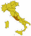
 Map of Tuscany
 -
 Map of Umbria
 -
 Map of Veneto


Yellow and brown version (300x350 pixels)[edit]
-
 Map of Abruzzo
 -
 Map of Aosta Valley
 -
 Map of Basilicata
 -
 Map of Calabria
 -
 Map of Campania Map
 -
 Map of Emilia-Romagna
 -
 Map of Friuli-Venezia Giulia
 -
 Map of Latium
 -
 Map of Liguria
 -
 Map of Lombardy
 -
 Map of Marche
 -
 Map of Molise
 -
 Map of Piedmont
 -
 Map of Sardinia
 -
 Map of Sicily
 -
 Map of Trentino
 -
 Map of Tuscany
 -
 Map of Umbria
 -
 Map of Veneto


Locator Maps of Italian provinces[edit]
-
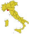
 Map of the province of Ravenna

Locator Maps of Italian Cities[edit]


.png)
Locator Maps of Italian Islands[edit]


Historical Maps[edit]
-
 Italy in 1494 (SVG map).
 -
 Map operation husky landing
 -
 Italy in 1796.
 -
 Northern and Middle Italy 1799
 -
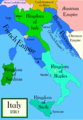 Italy in 1810.
-en.svg)


Maps of national parks[edit]
-
 Cinque Terre
 -
 Dolomiti Bellunesi
 -
 Foreste Casentinesi, Monte Falterona, Campigna
 -
 Gran Paradiso
 -
 Gran Sasso e Monti della Laga
 -
 Stelvio
 -
 Val Grande
 -
 Vesuvius


Maps of other parks in Lazio[edit]


Anthropological Maps[edit]
-
 Pigmentation eyes & hair and height
 -
 Cephalic index Sardinia

